
 |
 |
 |
| 70-mm magazine S - AS07-07-1738 to 1878 |
Photography Index | 70-mm magazine V - AS07-09-1944 to 1948 |
No copyright is asserted for NASA photographs. If a recognizable person appears in a photo, use for commercial purposes may infringe a right of privacy or publicity. Photos may not be used to state or imply the endorsement by NASA or by any NASA employee of a commercial product, process or service, or used in any other manner that might mislead. Accordingly, it is requested that if a NASA photograph is used in advertising and other commercial promotion, layout and copy be submitted to NASA prior to release. NASA photos reproduced from this archive should include photo credit to "NASA" or "National Aeronautics and Space Administration" and should include scanning credit to the appropriate individuals or agencies as noted in the captions.
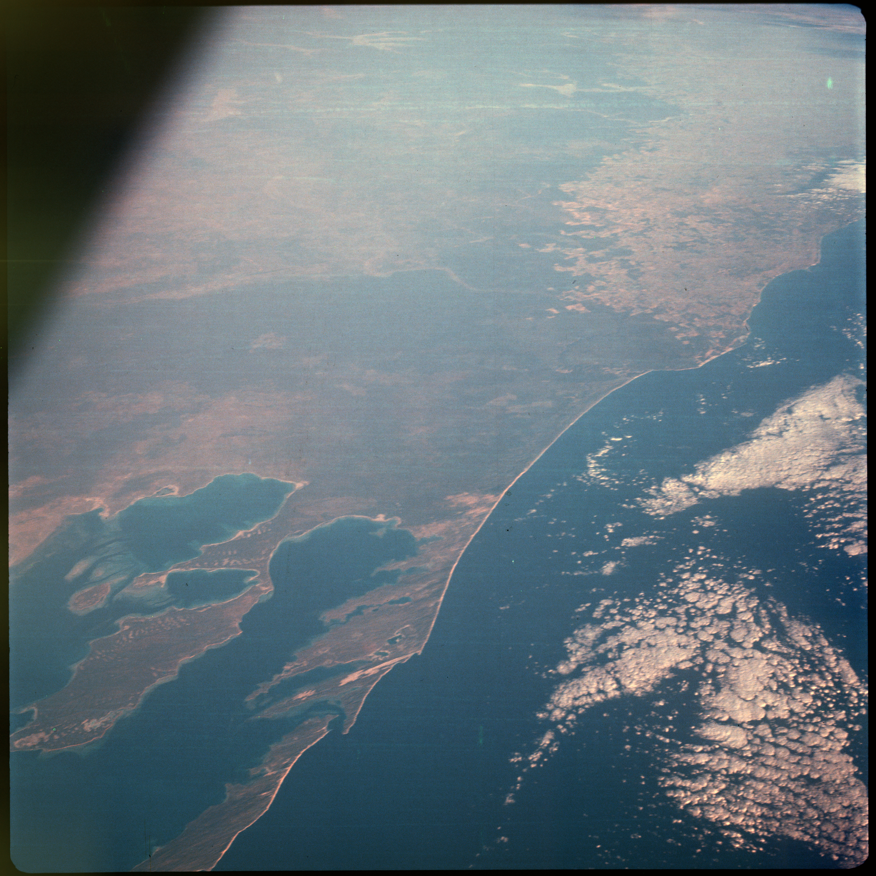 | AS07-08-1880 GEOGRAPHY/CARTOGRAPHY: Shark Bay, Western Australia. (Dark) GEOLOGY/HYDROLOGY: Coastal plain region. METEOROLOGY: Strato-cumulus. FORESTRY: Dense shrubform changing to scattered shrubform and grassland. OCEANOGRAPHY: Some wave action along coastline. Image credit: Image Science and Analysis Laboratory, NASA-Johnson Space Center. |
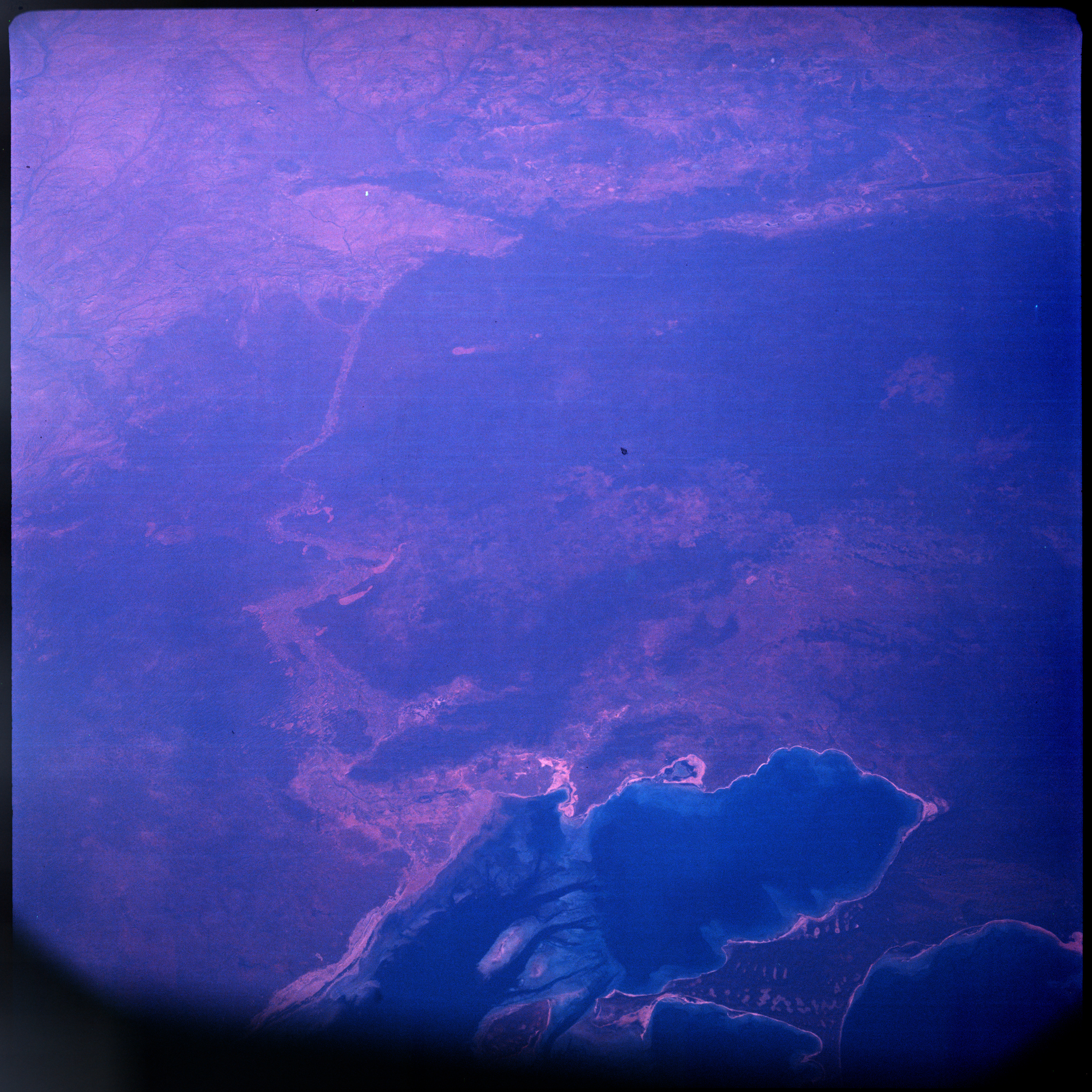 | AS07-08-1881 GEOGRAPHY/CARTOGRAPHY: Shark Bay, Western Australia. (Dark) GEOLOGY/HYDROLOGY: Coastal plain region. FORESTRY: Intermittent shrubform and coastal savanna grassland. OCEANOGRAPHY: Coastal shallows, sand bars. Image credit: Image Science and Analysis Laboratory, NASA-Johnson Space Center. |
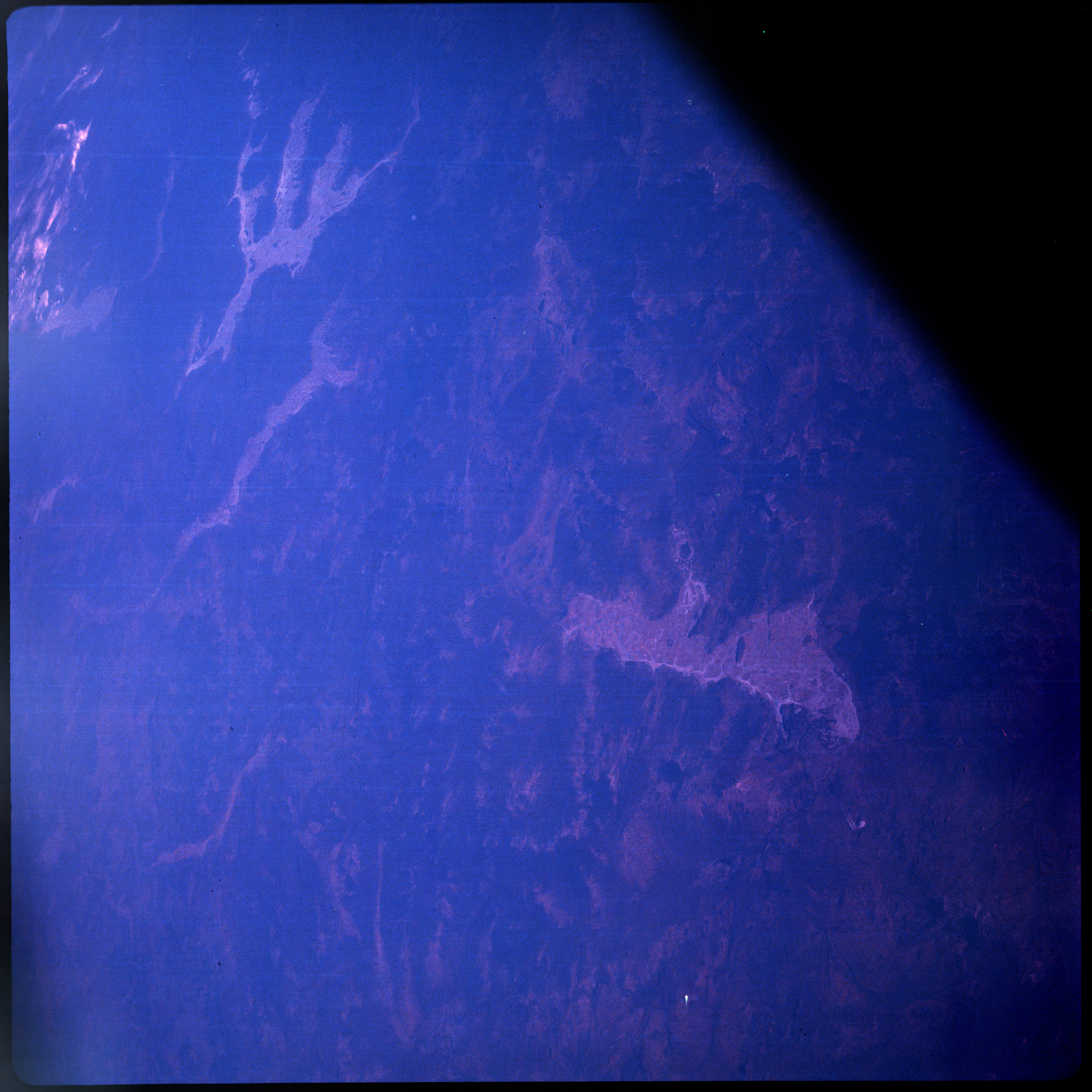 | AS07-08-1882 GEOGRAPHY/CARTOGRAPHY: Lakes Austin, Barlee, Ballard, Salt Lakes, Western Australia. (Dark) Image credit: Image Science and Analysis Laboratory, NASA-Johnson Space Center. |
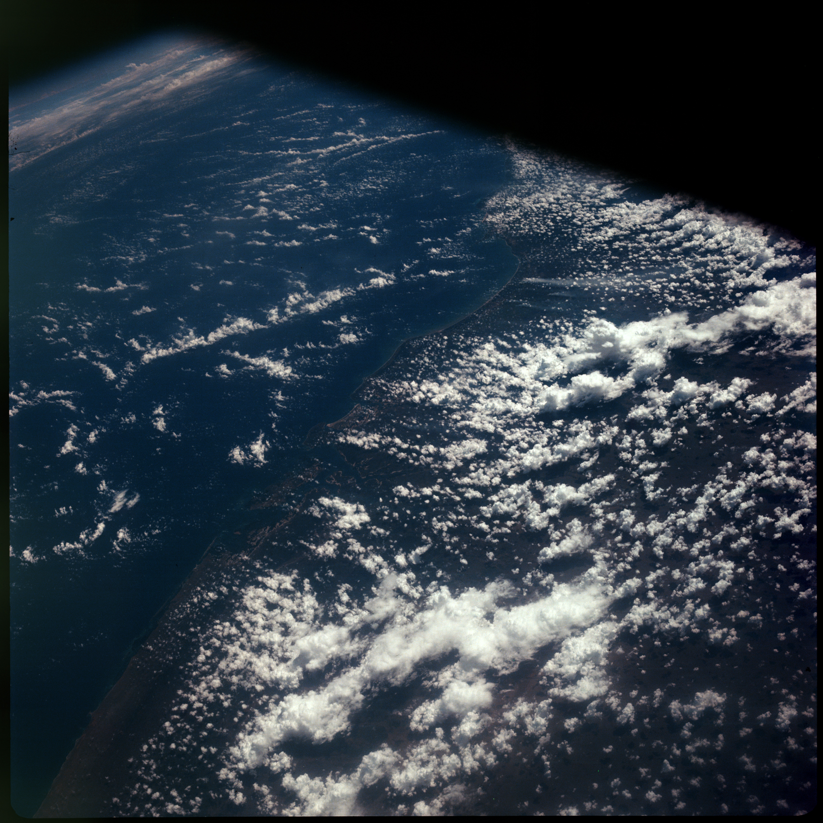 | AS07-08-1883 GEOGRAPHY/CARTOGRAPHY: Kenya Coastline, Formosa Bay, Tana River, Siyu Channel. (Dark) METEOROLOGY: Towering cumulus. Image credit: Image Science and Analysis Laboratory, NASA-Johnson Space Center. |
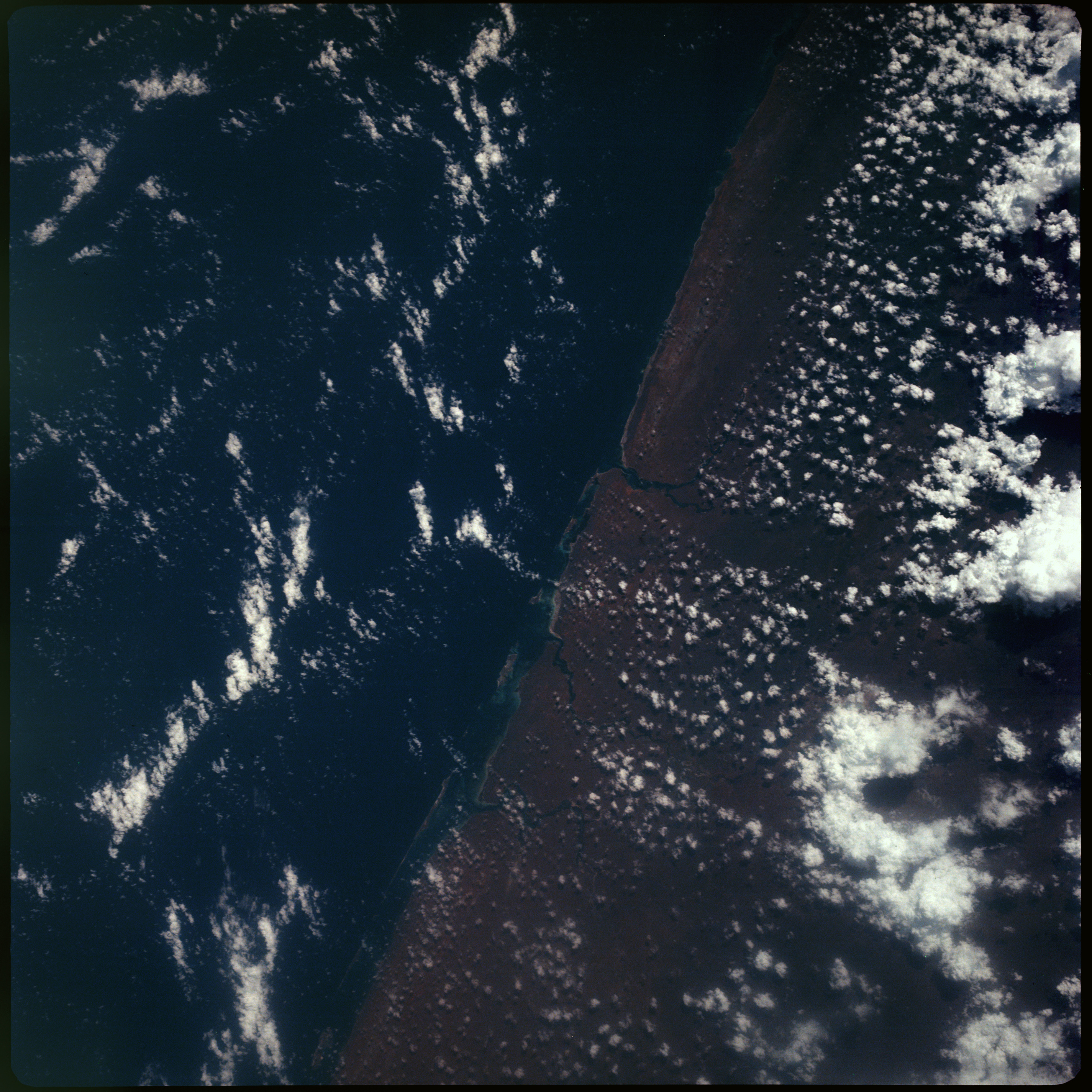 | AS07-08-1884 GEOGRAPHY/CARTOGRAPHY: Somali, Kenya Coastline, South of Chismaio. (Dark) METEOROLOGY: Small cumulus, towering cumulus. OCEANOGRAPHY: Coastline and beaches. Image credit: Image Science and Analysis Laboratory, NASA-Johnson Space Center. |
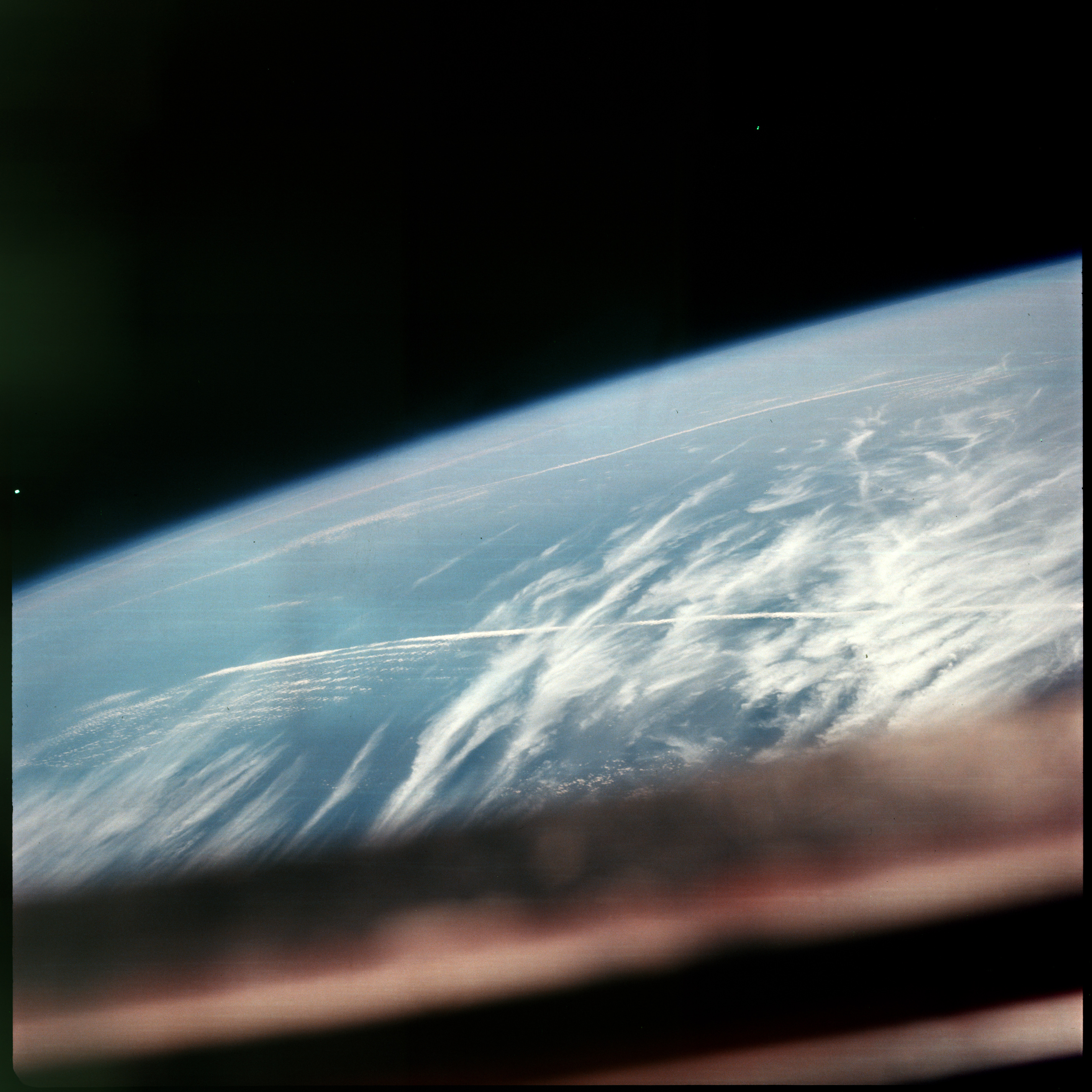 | AS07-08-1885 METEOROLOGY: Cirrus. Image credit: Image Science and Analysis Laboratory, NASA-Johnson Space Center. |
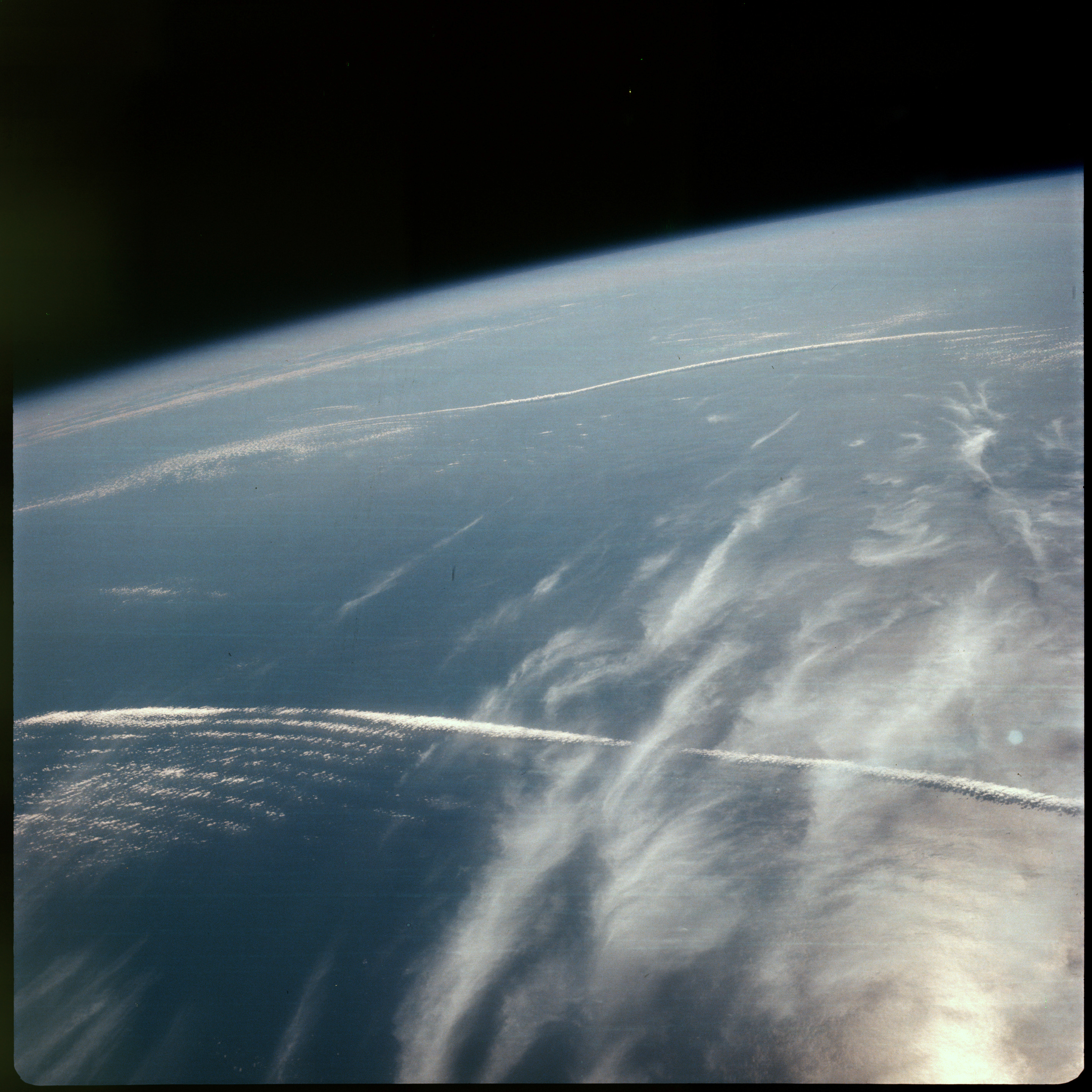 | AS07-08-1886 GEOGRAPHY/CARTOGRAPHY: Coast of N.W. Africa. (Dark) METEOROLOGY: Small cumulus, cirrus. Image credit: Image Science and Analysis Laboratory, NASA-Johnson Space Center. |
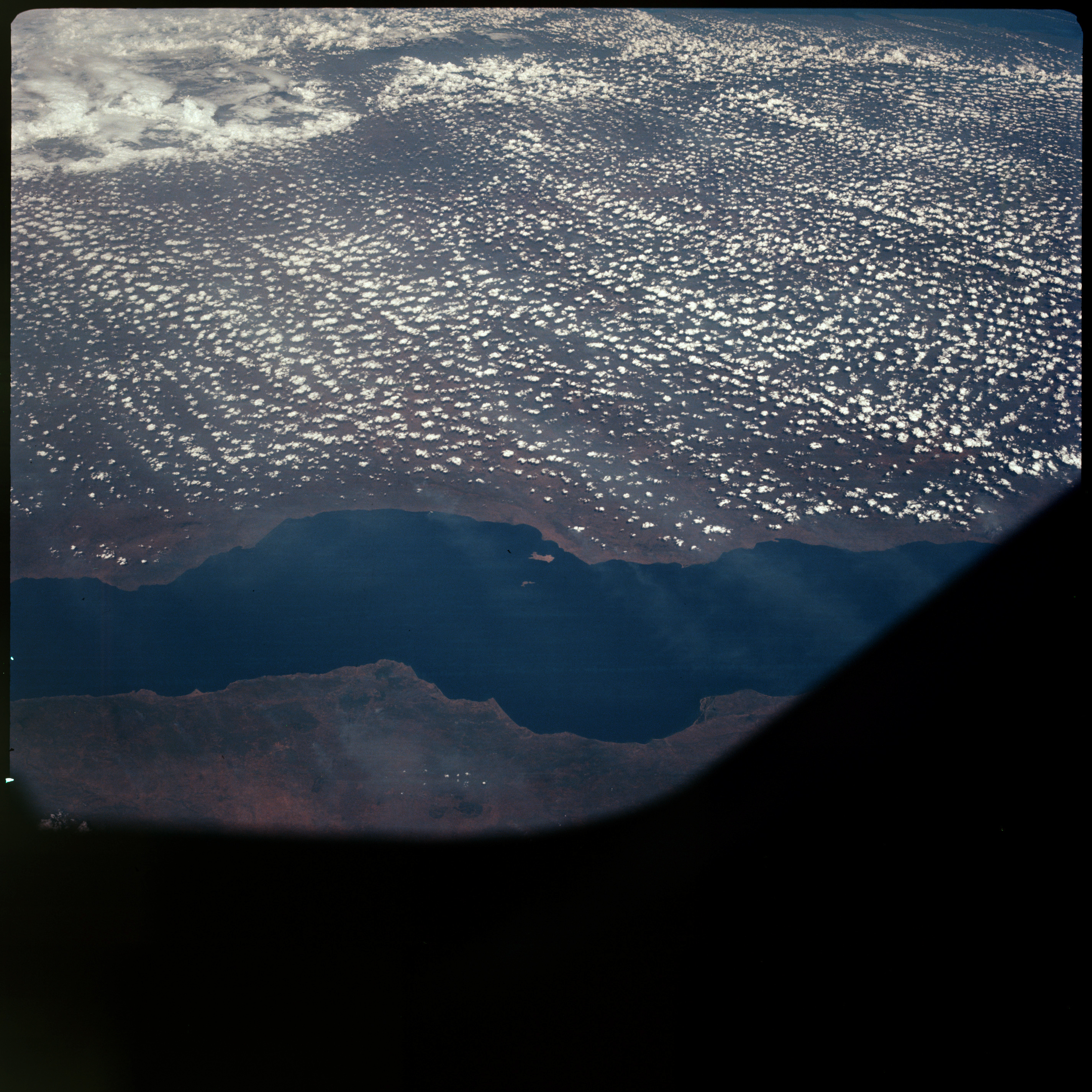 | AS07-08-1887 GEOGRAPHY/CARTOGRAPHY: Lake Nyasa, Malawi, Mozambique. (Dark) GEOLOGY/HYDROLOGY: Rift zone lake with boundary fractures and lying within the complex Vypiya mountains. METEOROLOGY: Cumulus. FORESTRY: Intermittent shrubform and savanna grassland, smoke apparent. Image credit: Image Science and Analysis Laboratory, NASA-Johnson Space Center. |
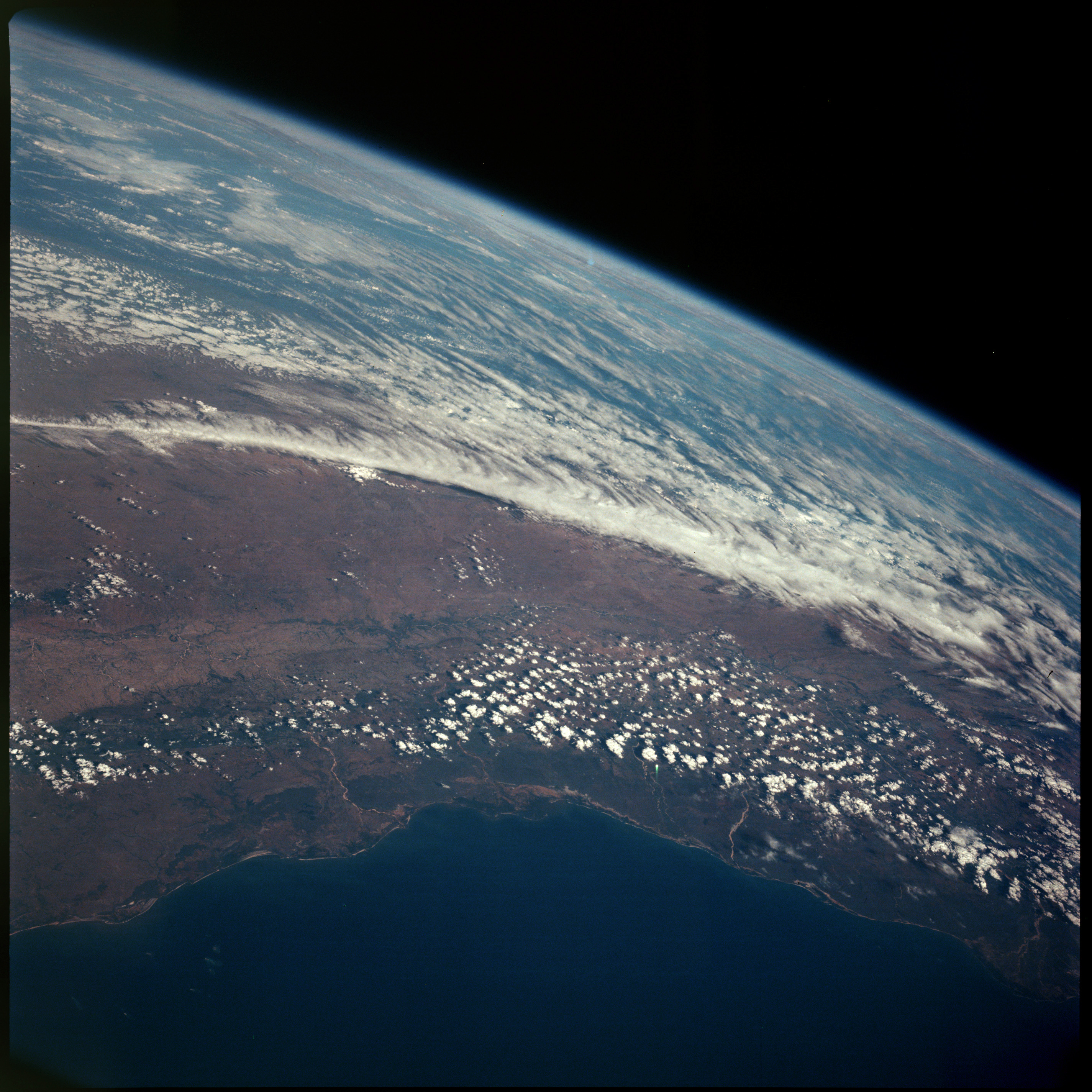 | AS07-08-1888 GEOGRAPHY/CARTOGRAPHY: Madagascar, central part of island, Morondana, Tanana River. (Dark) GEOLOGY/HYDROLOGY: Coastal plain and plateau region with perennial drainage. METEOROLOGY: Cumulus. FORESTRY: Intermittent shrubform and savanna grasslands. OCEANOGRAPHY: Coastline visible. Image credit: Image Science and Analysis Laboratory, NASA-Johnson Space Center. |
 | AS07-08-1889 Terminator. (Dark) Image credit: Image Science and Analysis Laboratory, NASA-Johnson Space Center. |
 | AS07-08-1890 Blank. Image credit: Image Science and Analysis Laboratory, NASA-Johnson Space Center. |
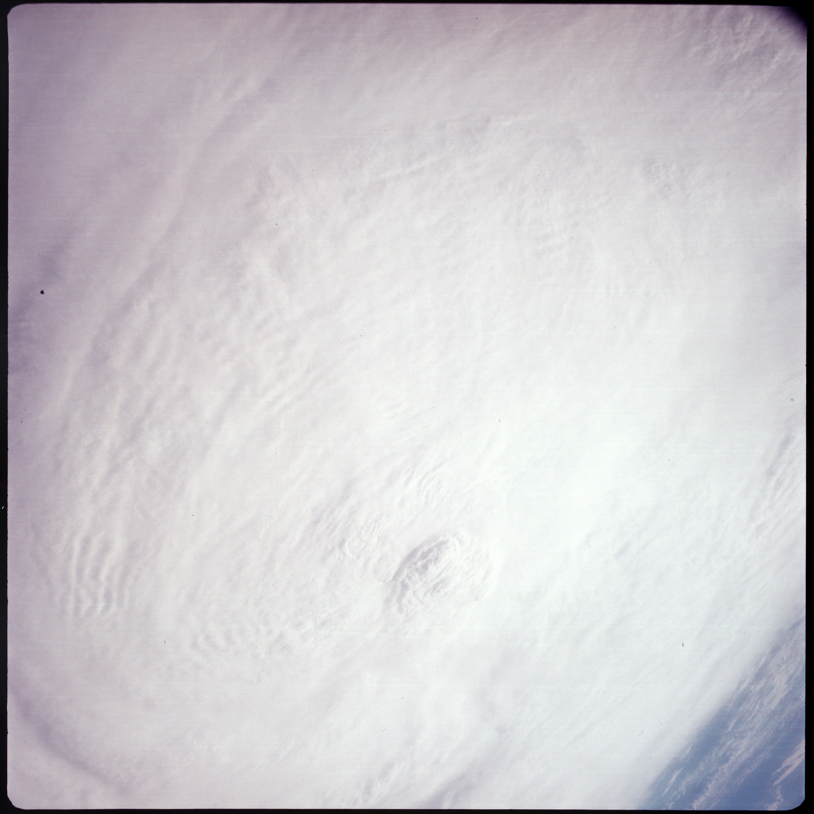 | AS07-08-1891 GEOGRAPHY/CARTOGRAPHY: Gulf of Mexico. METEOROLOGY: Hurricane Gladys. Image credit: Image Science and Analysis Laboratory, NASA-Johnson Space Center. |
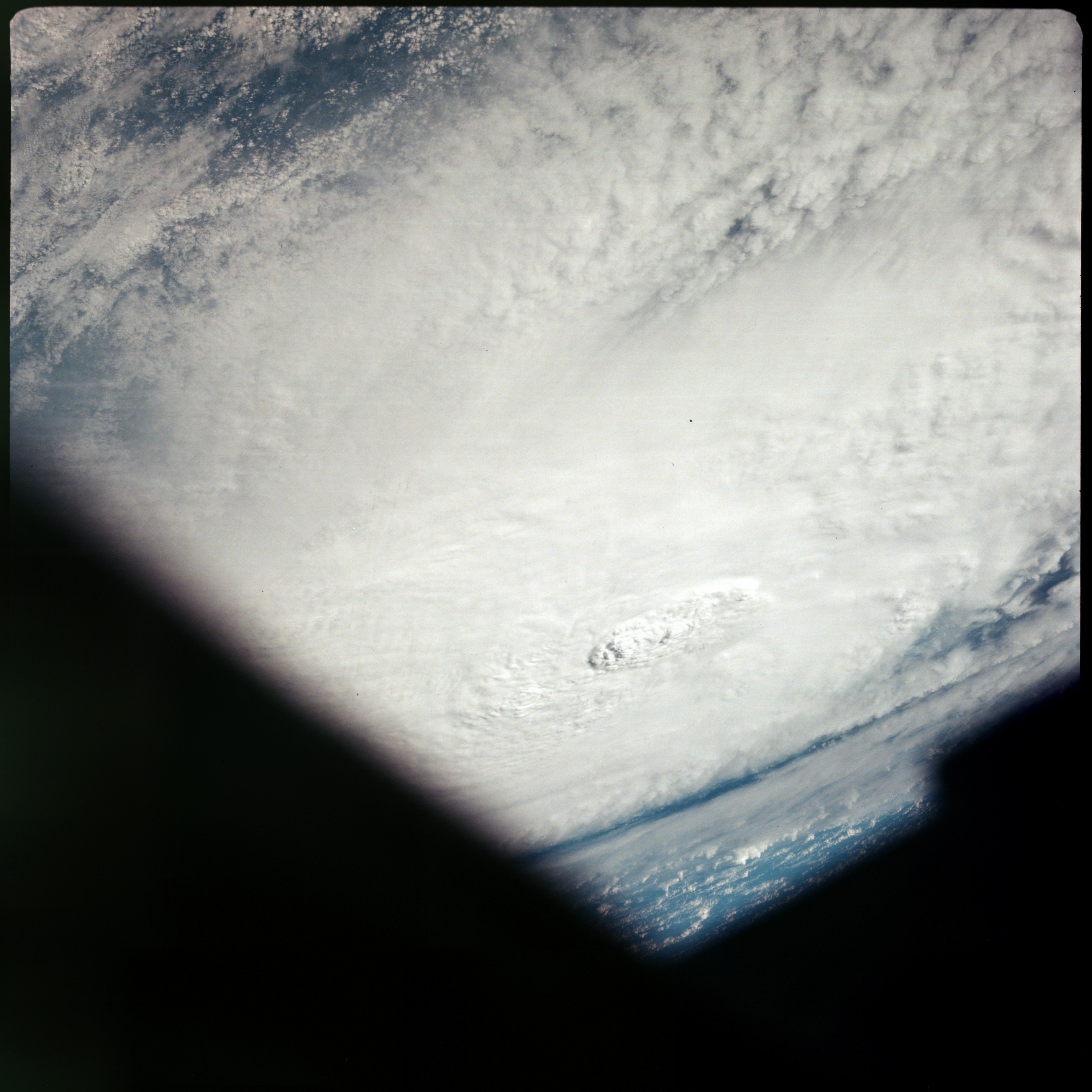 | AS07-08-1892 GEOGRAPHY/CARTOGRAPHY: Gulf of Mexico. METEOROLOGY: Hurricane Gladys. Image credit: Image Science and Analysis Laboratory, NASA-Johnson Space Center. |
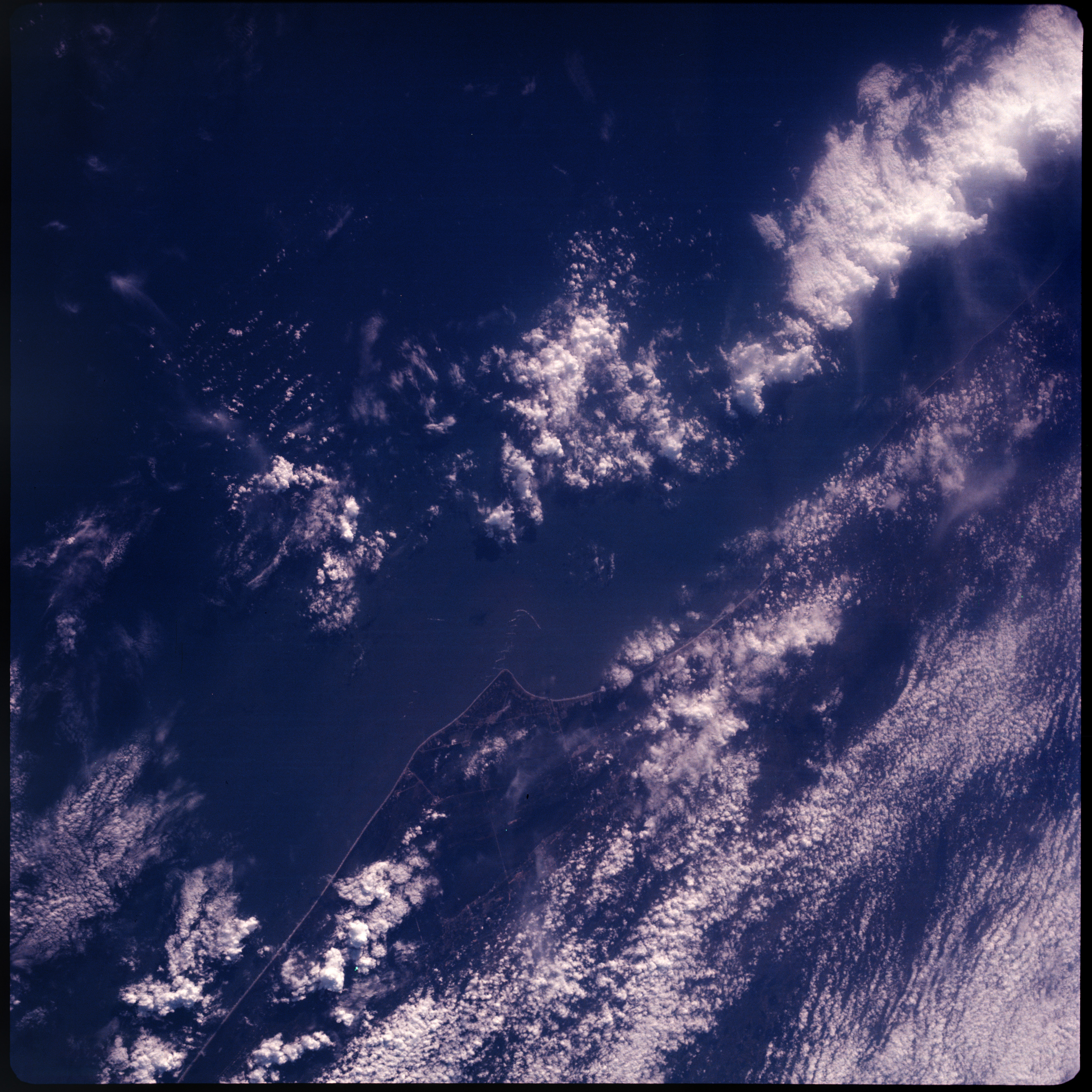 | AS07-08-1893 GEOGRAPHY/CARTOGRAPHY: KSC Florida, regional transportation network. (Dark) GEOLOGY/HYDROLOGY: Coastal plain. METEOROLOGY: Towering cumulus. Image credit: Image Science and Analysis Laboratory, NASA-Johnson Space Center. |
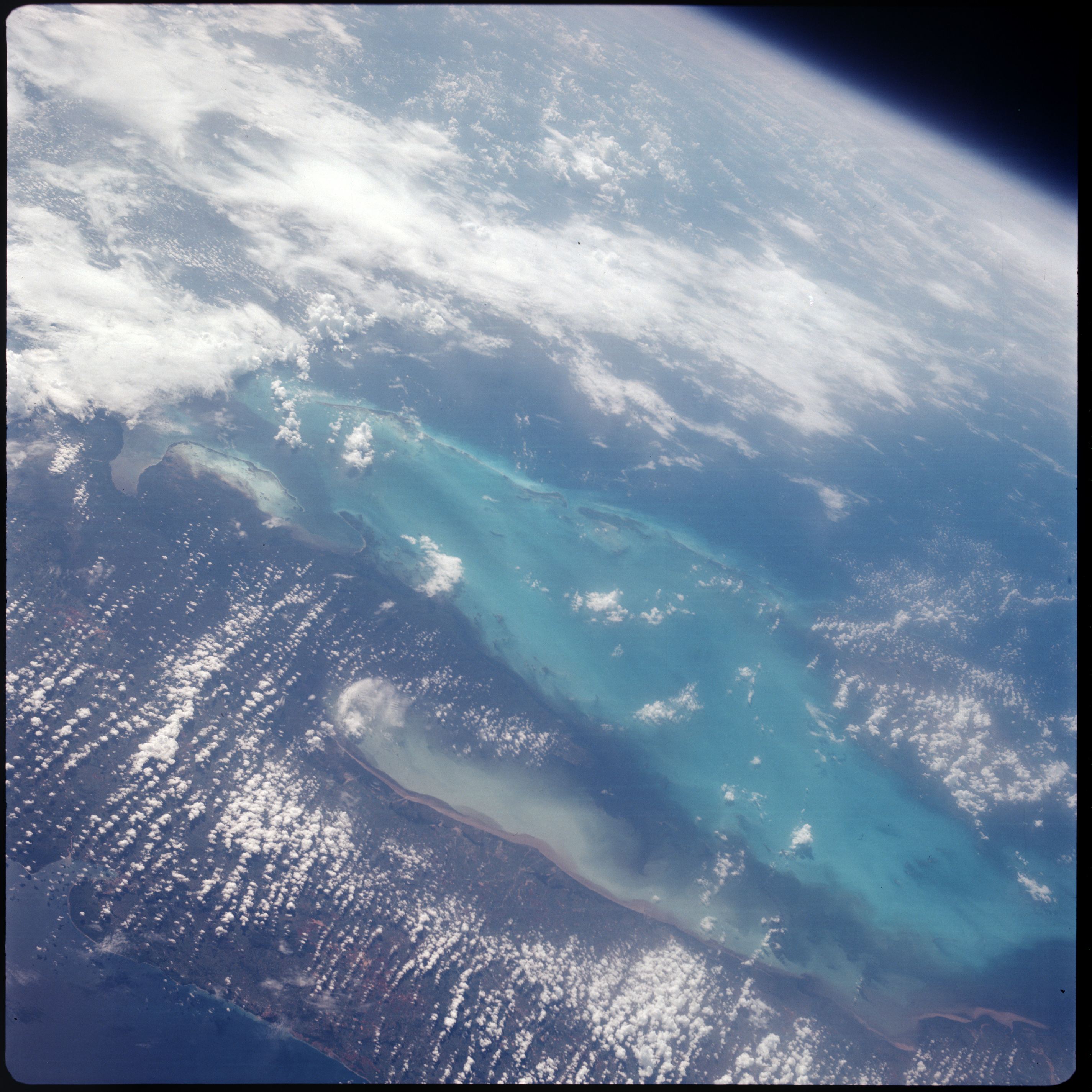 | AS07-08-1894 GEOGRAPHY/CARTOGRAPHY: Cuba, Bay of Pigs, Ensenada de Broa. (Dark) AGRICULTURE: Scattered cultivation. GEOLOGY/HYDROLOGY: Coastal plain region with sedimentation build-up and distinct shelf variation off shore. METEOROLOGY: Cumulus, alto-cumulus, cirrus. FORESTRY: Intermittent dense tropical hardwood forests. OCEANOGRAPHY: Depth changes. Image credit: Image Science and Analysis Laboratory, NASA-Johnson Space Center. |
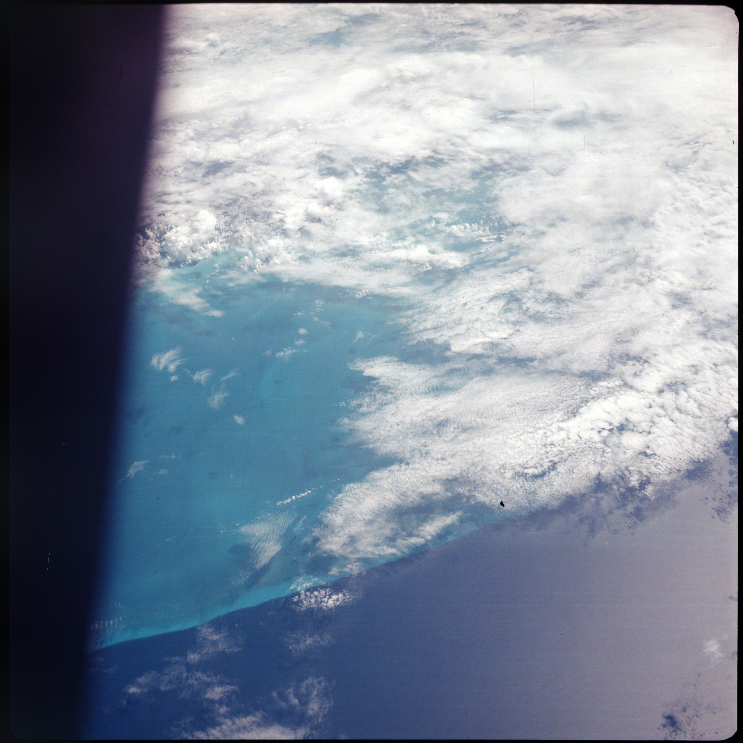 | AS07-08-1895 METEOROLOGY: Alto-cumulus, strato-cumulus. OCEANOGRAPHY: Shelf variation. Image credit: Image Science and Analysis Laboratory, NASA-Johnson Space Center. |
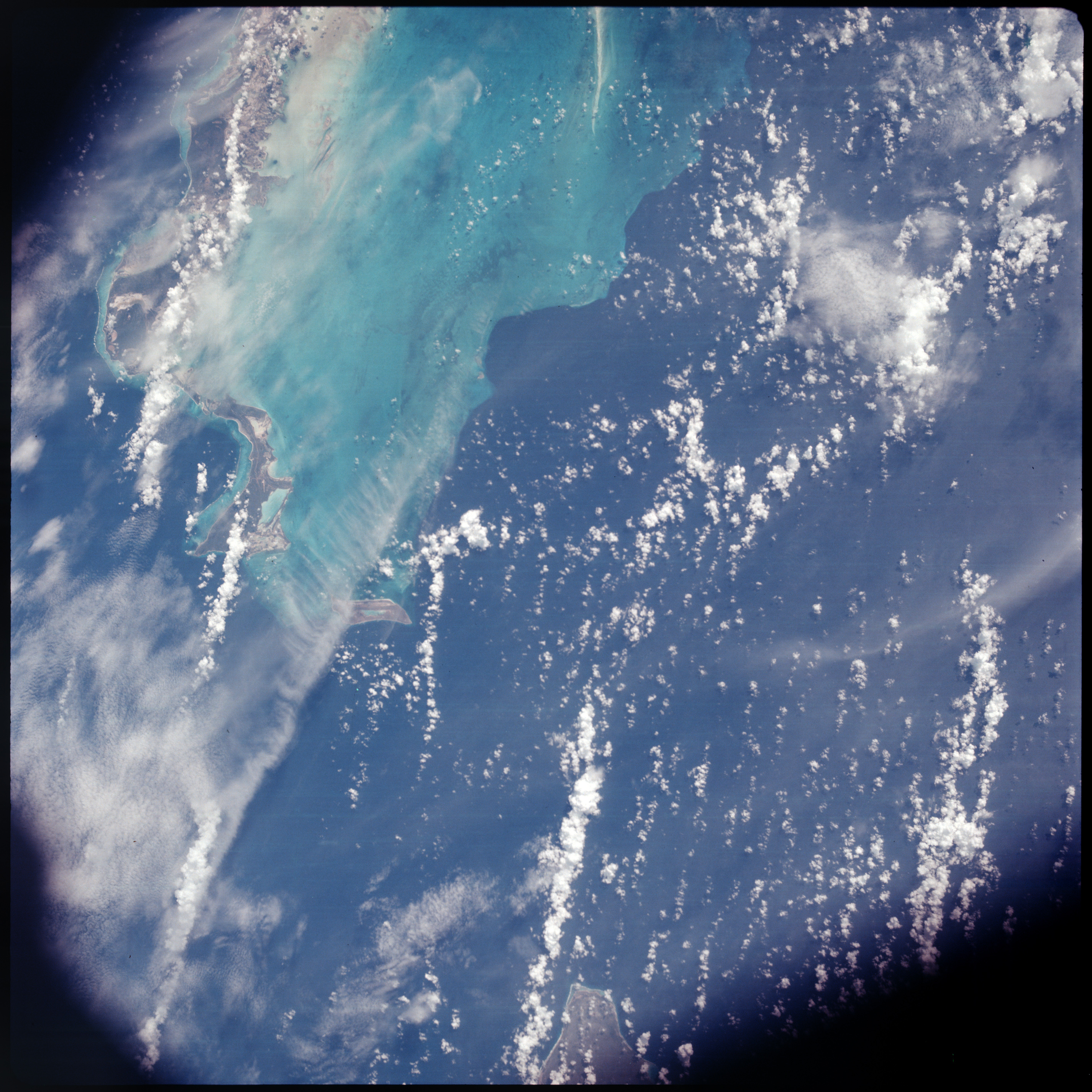 | AS07-08-1896 GEOGRAPHY/CARTOGRAPHY: Caico Islands, Great Abaco Islands, transportation network. GEOLOGY/HYDROLOGY: Quaternary marine and coastal deposits. METEOROLOGY: Cumulus, cirrus. OCEANOGRAPHY: Depth differences. Image credit: Image Science and Analysis Laboratory, NASA-Johnson Space Center. |
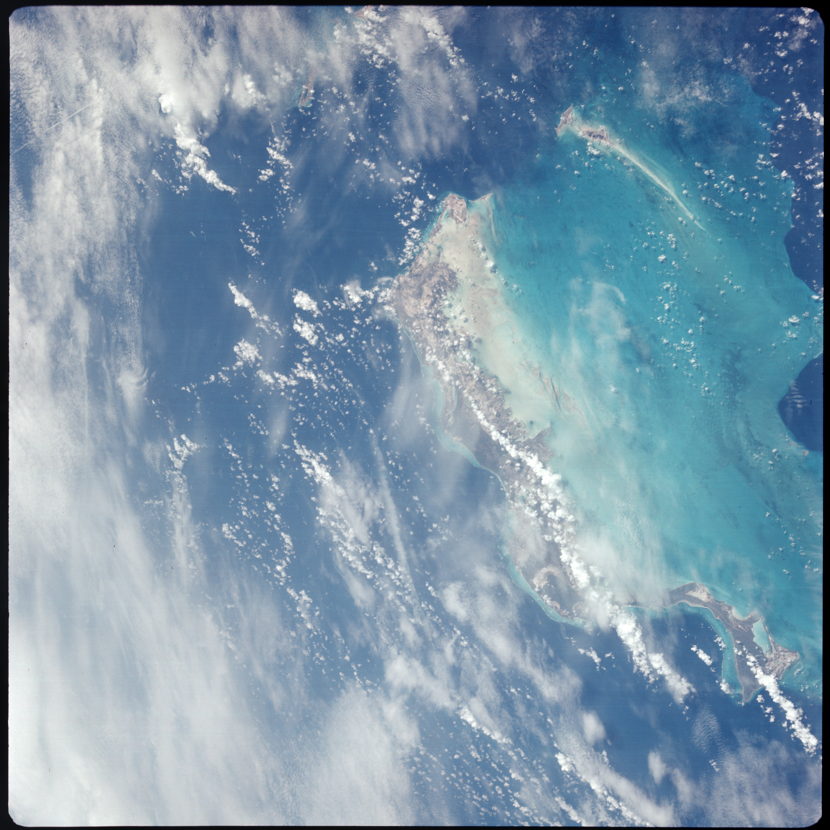 | AS07-08-1897 GEOGRAPHY/CARTOGRAPHY: Caico Islands, Great Abaco Islands, transportation network. GEOLOGY/HYDROLOGY: Quaternary marine and coastal deposits. FORESTRY: Dense tropical hardwood. METEOROLOGY: Cumulus, cirrus. OCEANOGRAPHY: Depth differences. Image credit: Image Science and Analysis Laboratory, NASA-Johnson Space Center. |
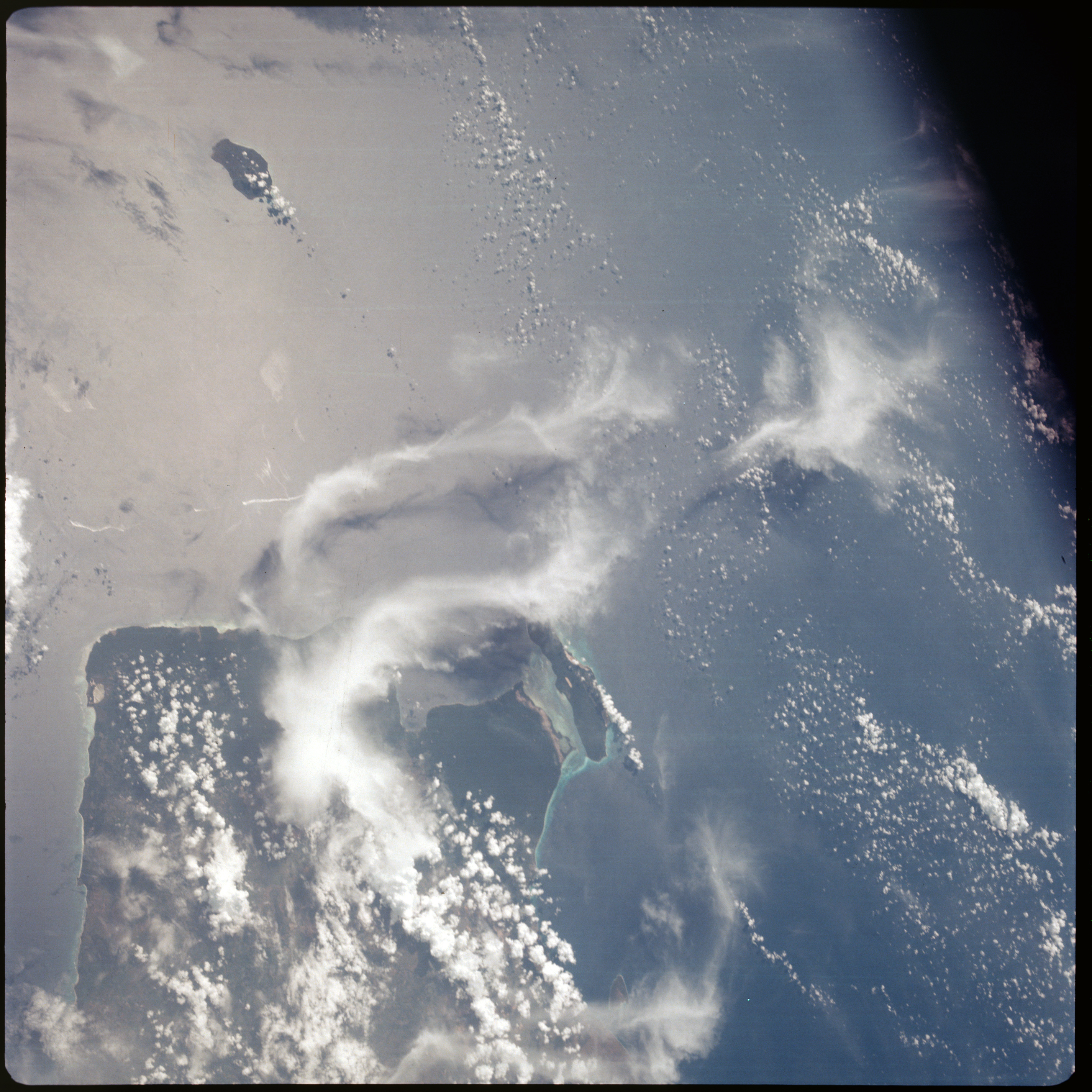 | AS07-08-1898 GEOGRAPHY/CARTOGRAPHY: Dominican Republic, Southwestern end of island. (Dark) GEOLOGY/HYDROLOGY: Quaternary marine and coastal deposits. METEOROLOGY: Cumulus, thick cirrus. FORESTRY: Dense tropical hardwood in southeastern corner of island. OCEANOGRAPHY: Shallow waters along the coast. Image credit: Image Science and Analysis Laboratory, NASA-Johnson Space Center. |
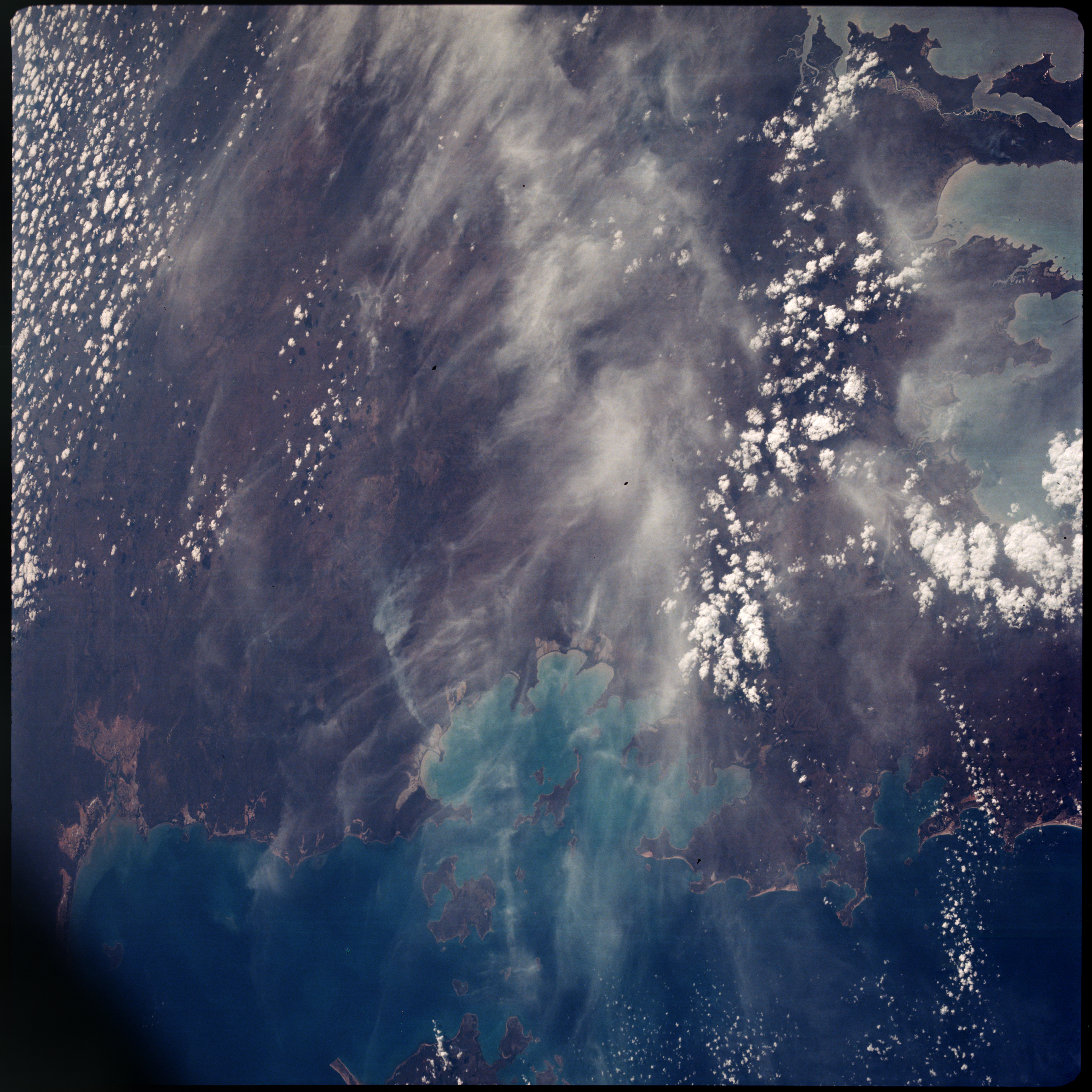 | AS07-08-1899 GEOGRAPHY/CARTOGRAPHY: Australia, Northern Range, Bickerton island, Blue Mud Bay. (Dark) GEOLOGY/HYDROLOGY: Coastal plain region with a shoreline of submergence. METEOROLOGY: Cumulus, cirrus. FORESTRY: Dense forest stands along coast becoming intermittent inland. OCEANOGRAPHY: Coastlines and shallows. Image credit: Image Science and Analysis Laboratory, NASA-Johnson Space Center. |
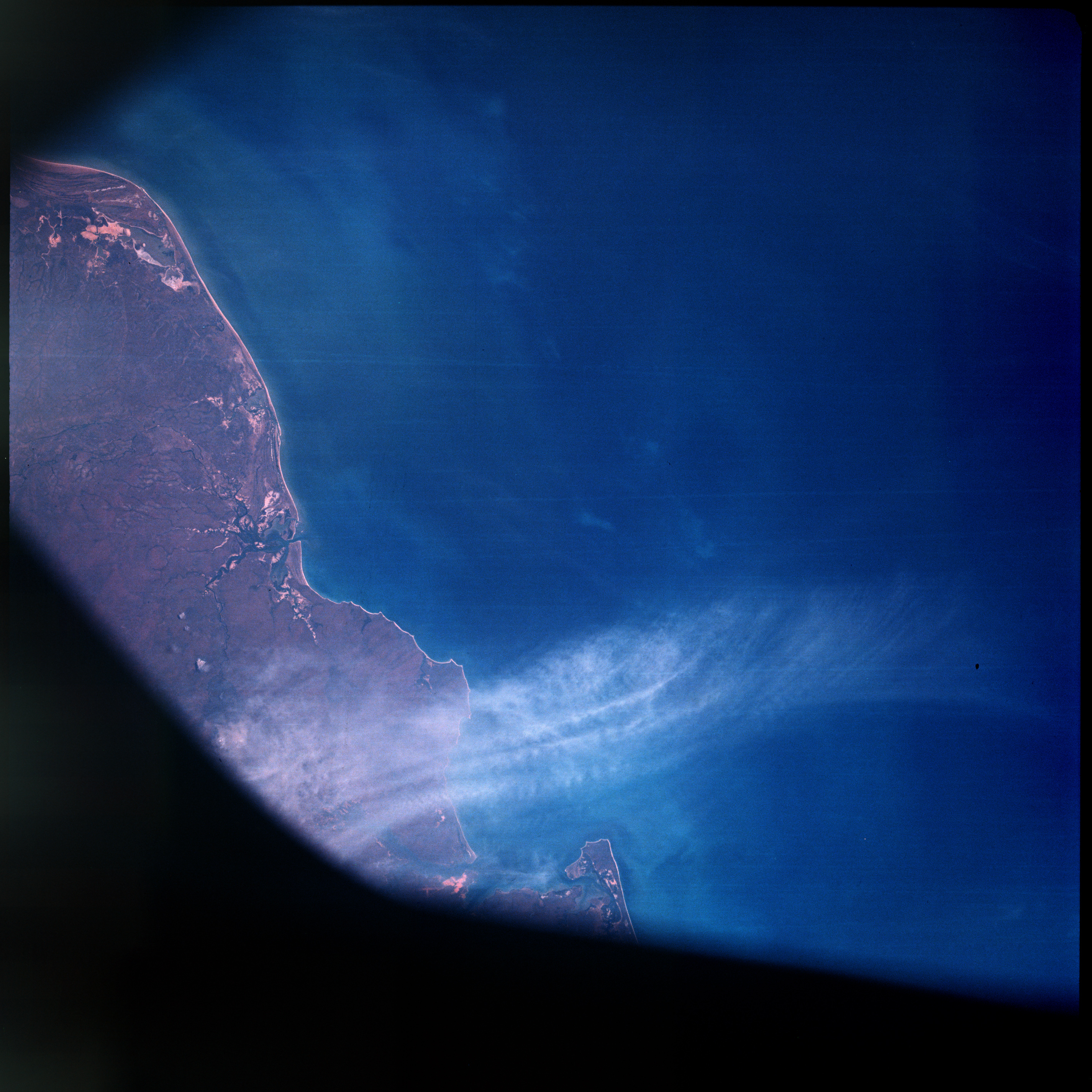 | AS07-08-1900 GEOGRAPHY/CARTOGRAPHY: Australia, West Coast of Cape York, Coral Sea. (Dark) AGRICULTURE: Possible cultivation pattern. GEOLOGY/HYDROLOGY: Coastal plain region bordered by swamp areas. FORESTRY: Intermittent stands ranging from semi-dense to dense, smoke plums. Image credit: Image Science and Analysis Laboratory, NASA-Johnson Space Center. |
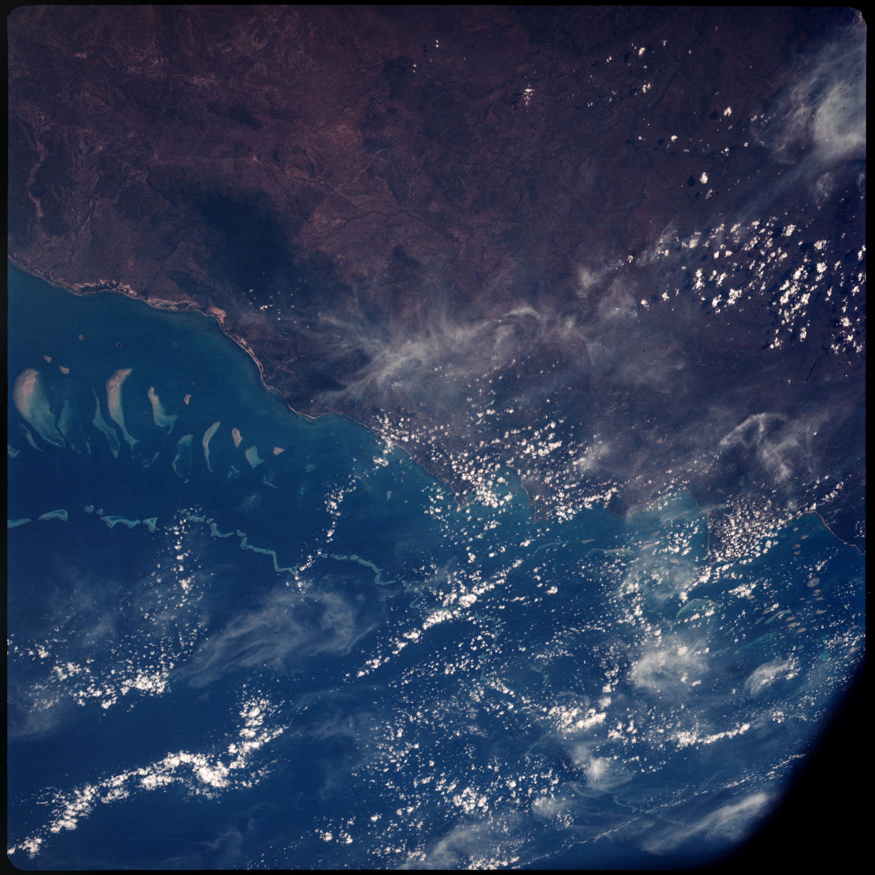 | AS07-08-1901 GEOGRAPHY/CARTOGRAPHY: Australia, West Coast of Cape York, Coral Sea. (Dark) AGRICULTURE: Possible cultivation pattern. GEOLOGY/HYDROLOGY: Coastal plain region bordered by swamp areas. FORESTRY: Intermittent stands ranging from semi-dense to dense, smoke plums. Image credit: Image Science and Analysis Laboratory, NASA-Johnson Space Center. |
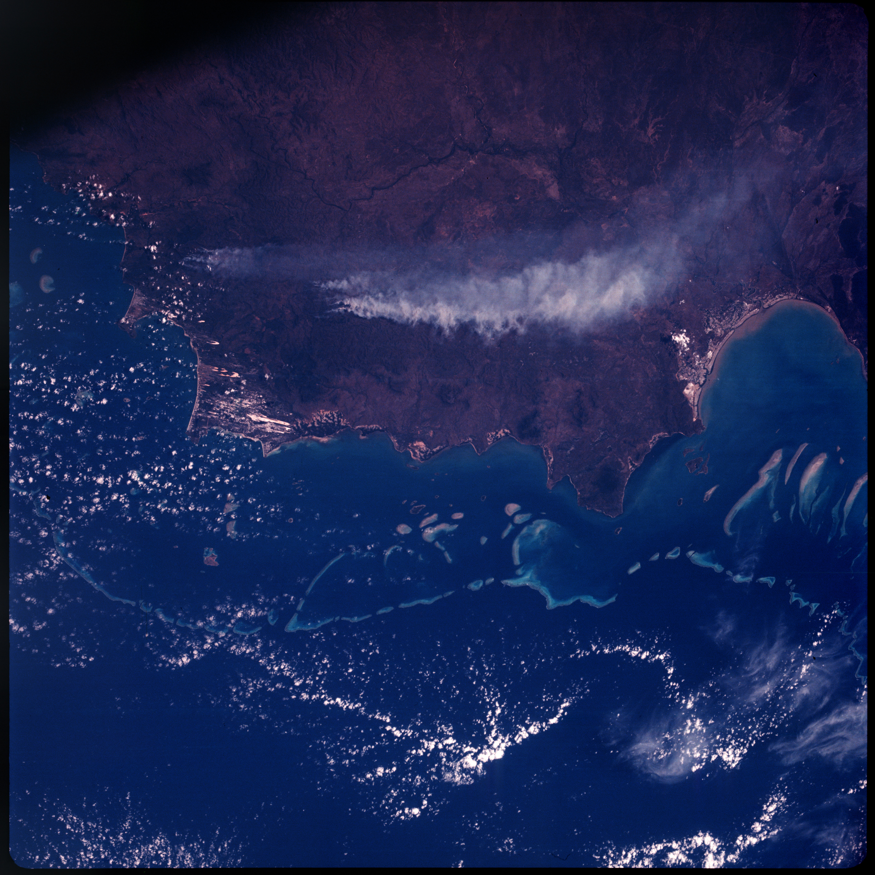 | AS07-08-1902 GEOGRAPHY/CARTOGRAPHY: Australia, Cape Melville Princess Charlotte Bay. (Dark) GEOLOGY/HYDROLOGY: Coastal plain region with coastal swamp, shoreline of submergence, and off shore coral reefs. FORESTRY: Intermittent forests with scattered shrubform and grass, several fires. METEOROLOGY: Cumulus, cirrus. OCEANOGRAPHY: Reefs. Image credit: Image Science and Analysis Laboratory, NASA-Johnson Space Center. |
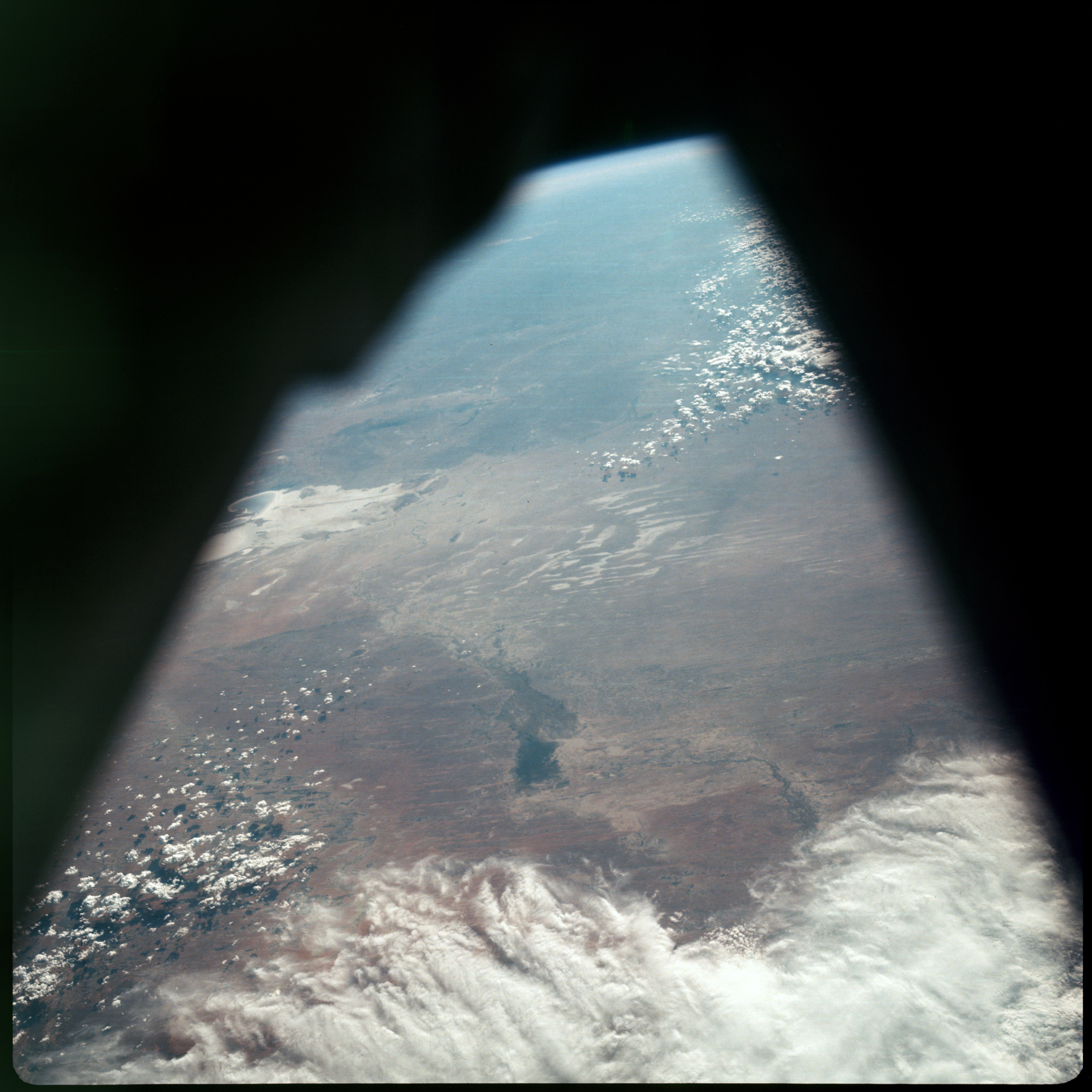 | AS07-08-1903 GEOGRAPHY/CARTOGRAPHY: South Australia, Lake Eyre Basin. (Dark) GEOLOGY/HYDROLOGY: Low interior plains with numerous dry lakes and alkali deposits. FORESTRY: Predominantly desert shrubform and grass. METEOROLOGY: Cumulus, alto-cumulus. Image credit: Image Science and Analysis Laboratory, NASA-Johnson Space Center. |
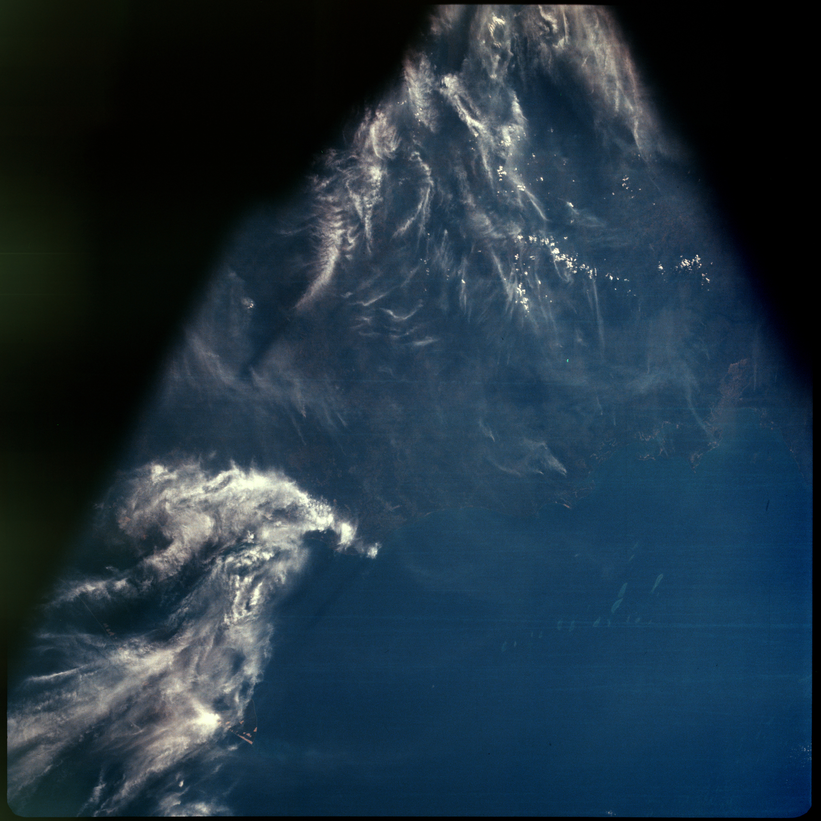 | AS07-08-1904 METEOROLOGY: Cumulus, cirrus. Image credit: Image Science and Analysis Laboratory, NASA-Johnson Space Center. |
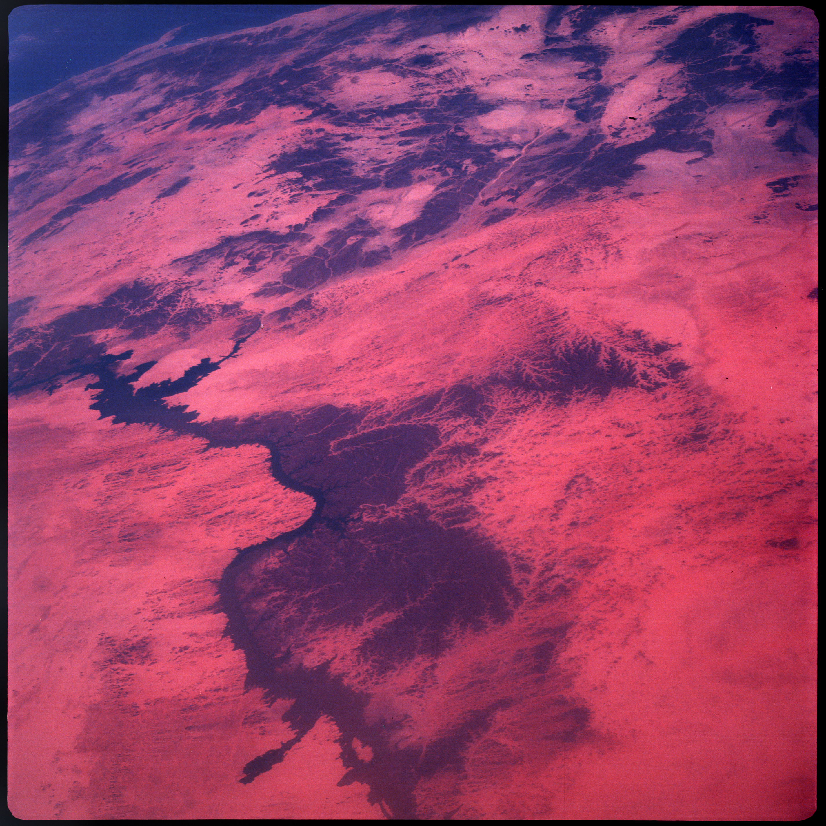 | AS07-08-1905 GEOGRAPHY/CARTOGRAPHY: Nile River to Red Sea. (Dark) GEOLOGY/HYDROLOGY: Alluvial plain, plateau, intermittent dendritic drainage on the plateau. FORESTRY: Predominantly scattered desert shrubform, semi-dense vegetation along banks of Nile. Image credit: Image Science and Analysis Laboratory, NASA-Johnson Space Center. |
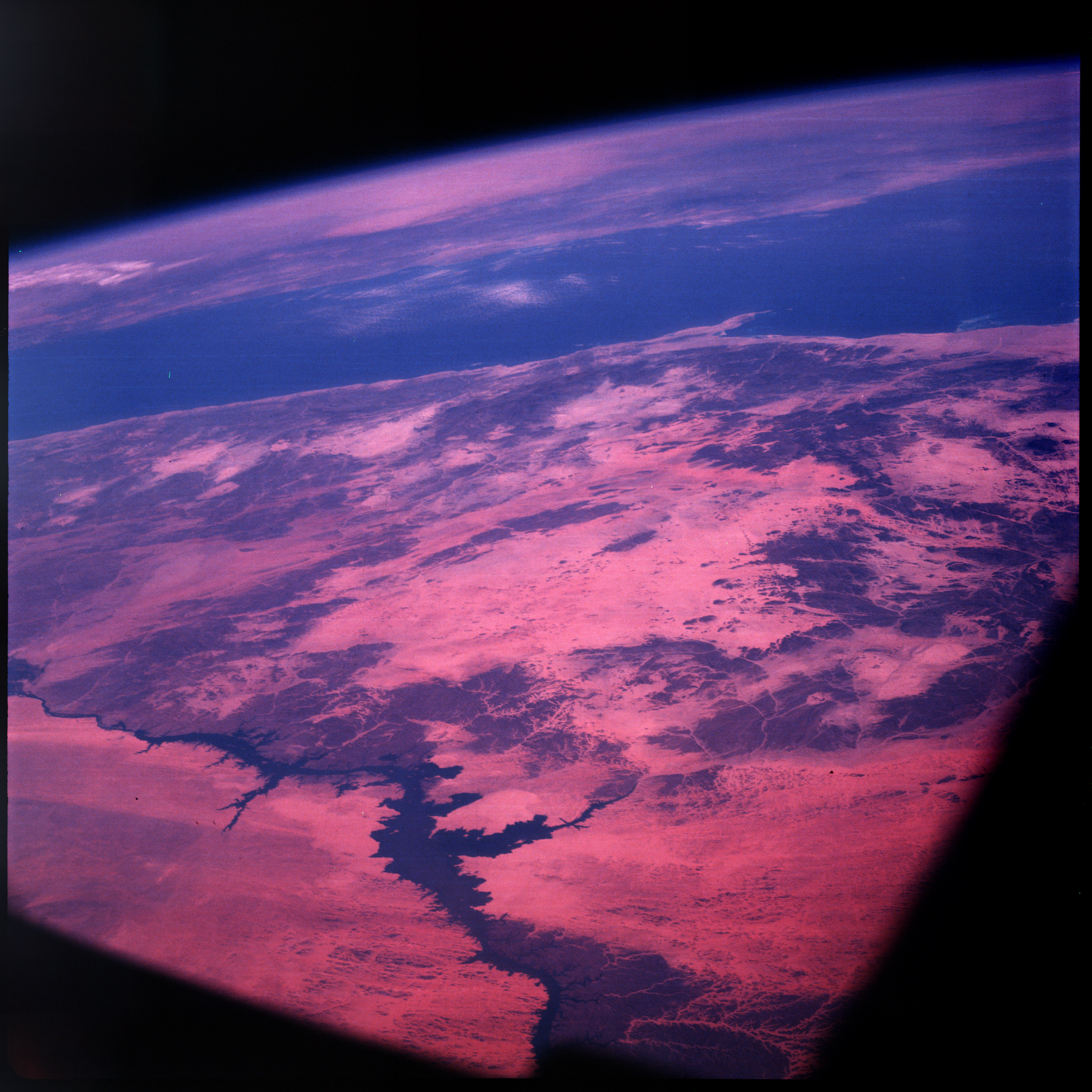 | AS07-08-1906 GEOGRAPHY/CARTOGRAPHY: Nile River to Red Sea. (Dark) GEOLOGY/HYDROLOGY: Alluvial plain, plateau, intermittent dendritic drainage on the plateau. FORESTRY: Scattered desert shrubform with semi-dense vegetation along Nile. Image credit: Image Science and Analysis Laboratory, NASA-Johnson Space Center. |
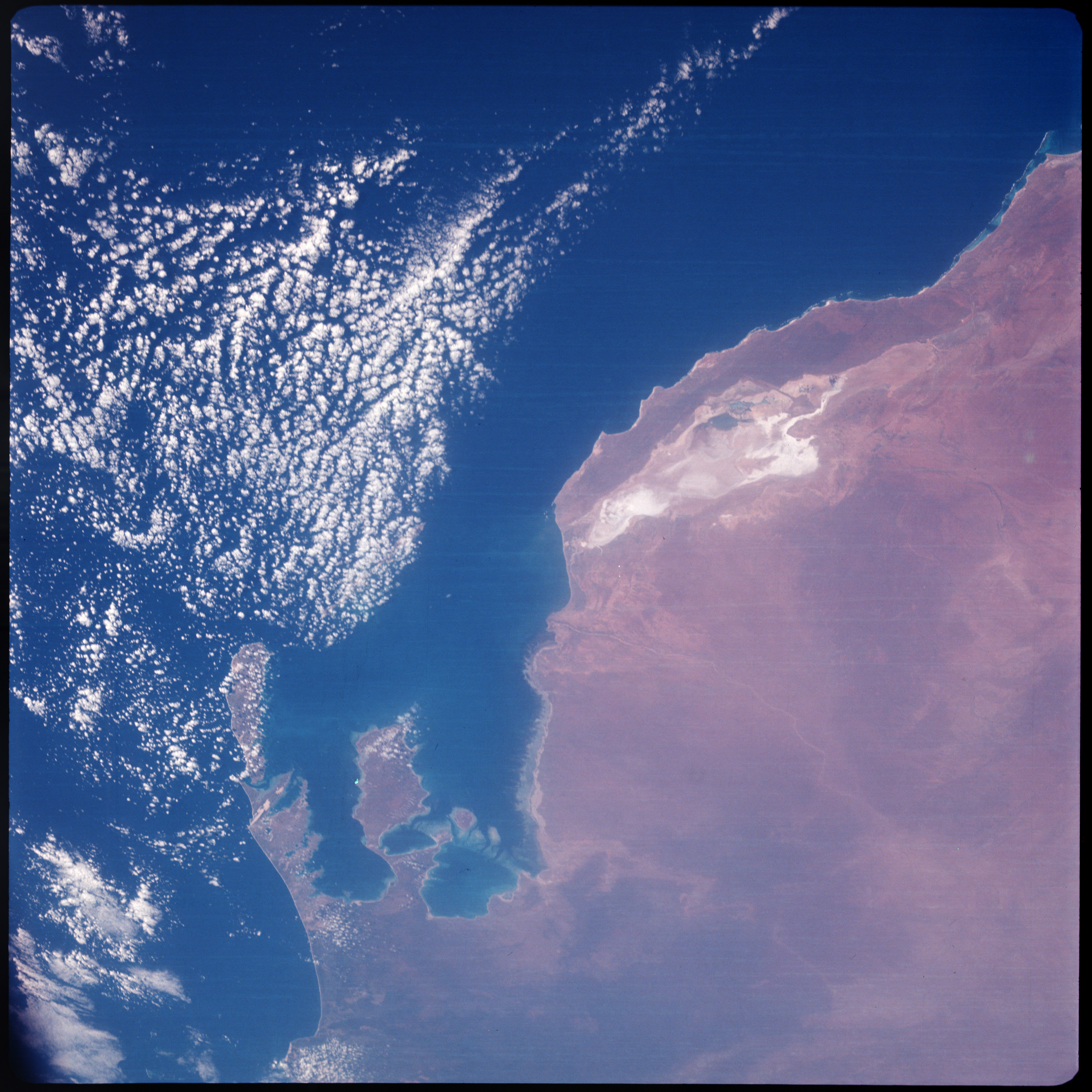 | AS07-08-1907 GEOGRAPHY/CARTOGRAPHY: Shark Bay, Western Australia. GEOLOGY/HYDROLOGY: Coastal plain, hills in the interior, intermittent stream, dendritic drainage. FORESTRY: Primarily shrubform with grass. METEOROLOGY: Cumulus. OCEANOGRAPHY: Depth differences along the coastline. Image credit: Image Science and Analysis Laboratory, NASA-Johnson Space Center. |
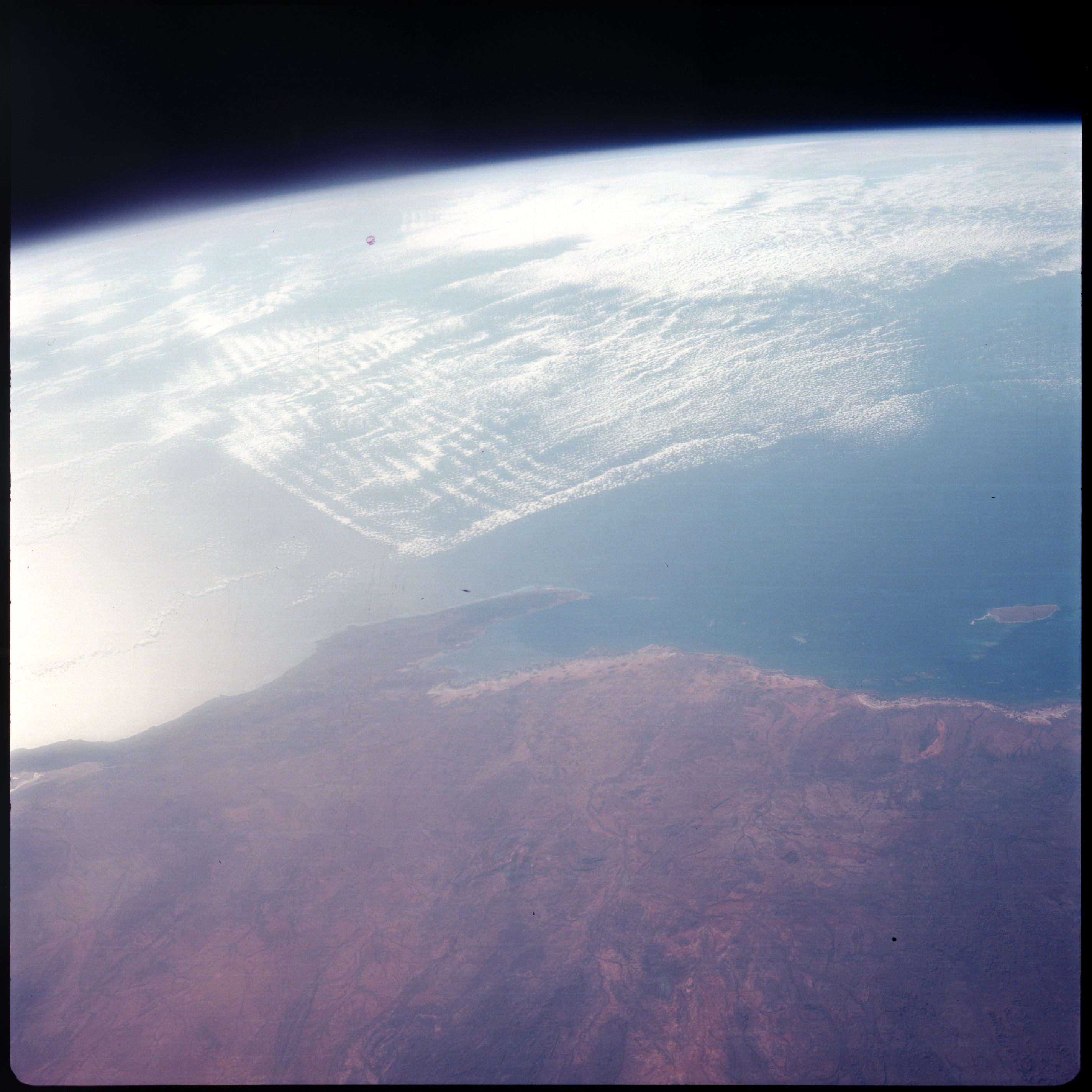 | AS07-08-1908 GEOGRAPHY/CARTOGRAPHY: Exmouth Gulf, Western Australia. (Dark) GEOLOGY/HYDROLOGY: Coastal plain with intermittent consequent drainage patterns. FORESTRY: Scattered shrubform changing to dense shrub. METEOROLOGY: Small cumulus. Image credit: Image Science and Analysis Laboratory, NASA-Johnson Space Center. |
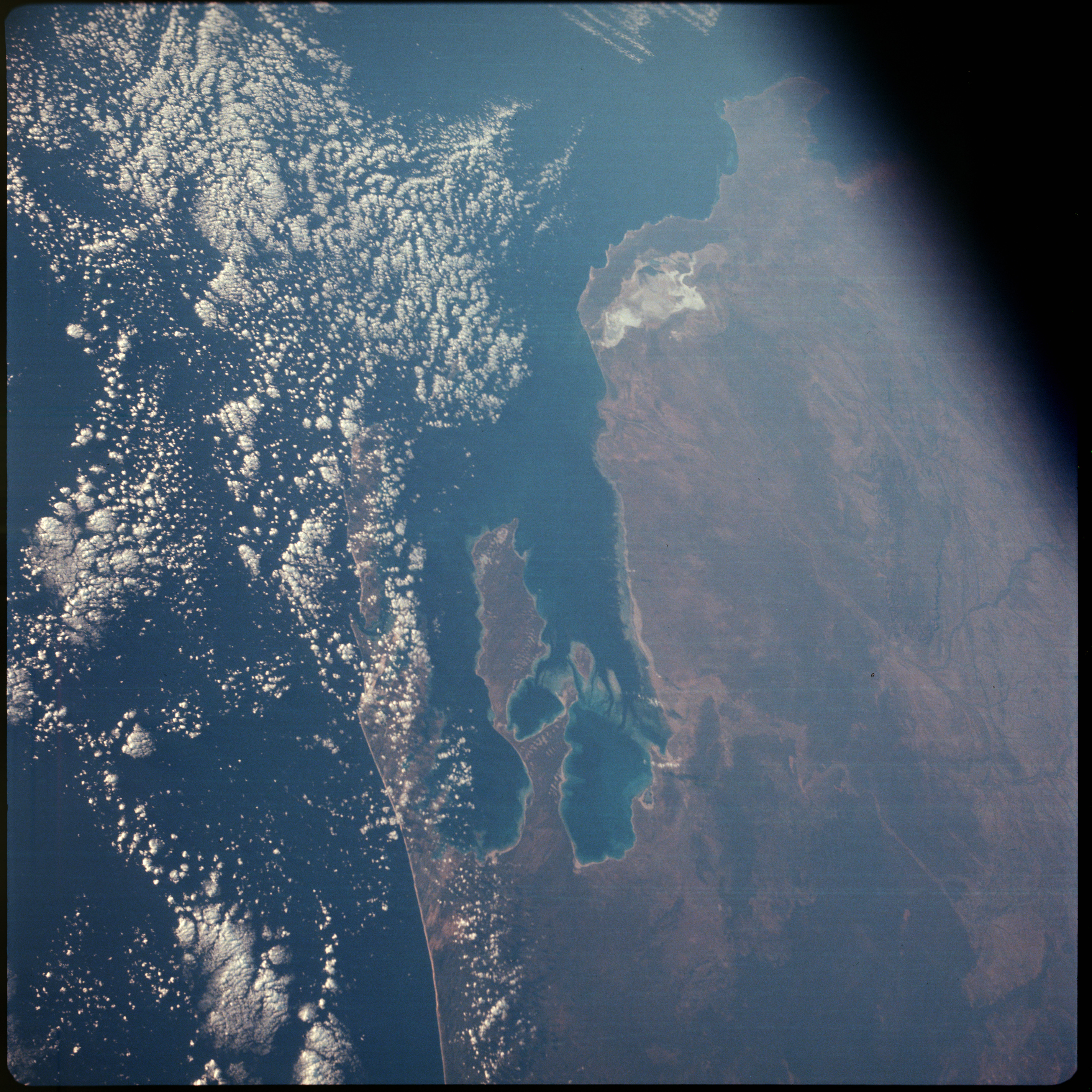 | AS07-08-1909 GEOGRAPHY/CARTOGRAPHY: Shark Bay, Western Australia. (Dark) GEOLOGY/HYDROLOGY: Coastal plain region containing low hills and intermittent consequent drainage. FORESTRY: Grass and scattered shrubform changing to semi-dense forest lands to the south. METEOROLOGY: Cumulus. OCEANOGRAPHY: Coastal shallows. Image credit: Image Science and Analysis Laboratory, NASA-Johnson Space Center. |
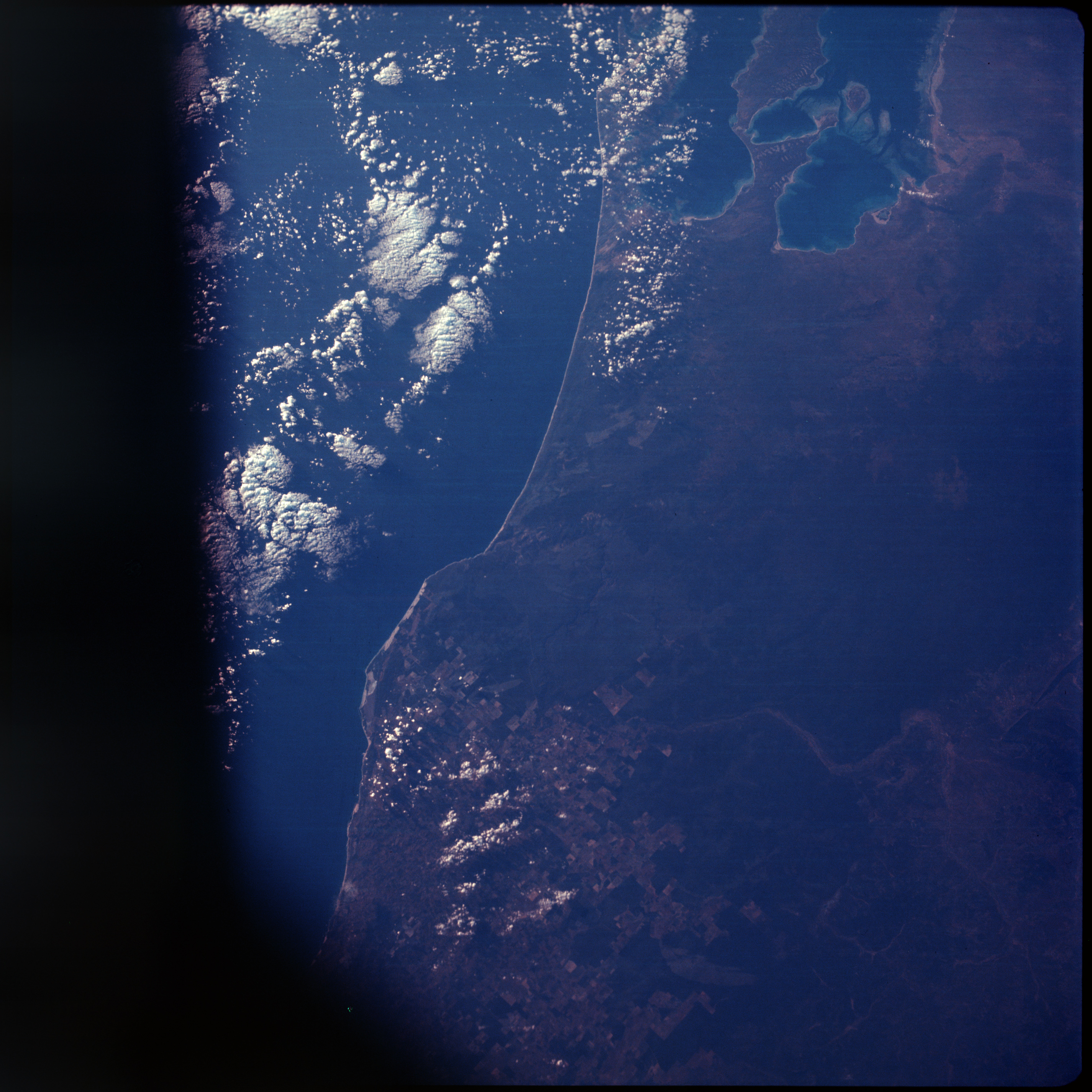 | AS07-08-1910 GEOGRAPHY/CARTOGRAPHY: Shark Bay, Western Australia. (Dark) AGRICULTURE: Extensive field patterns to south. GEOLOGY/HYDROLOGY: Coastal plain region containing low hills and intermittent consequent drainage. FORESTRY: Grass and scattered shrubform. METEOROLOGY: Cumulus. OCEANOGRAPHY: Coastal shallows. Image credit: Image Science and Analysis Laboratory, NASA-Johnson Space Center. |
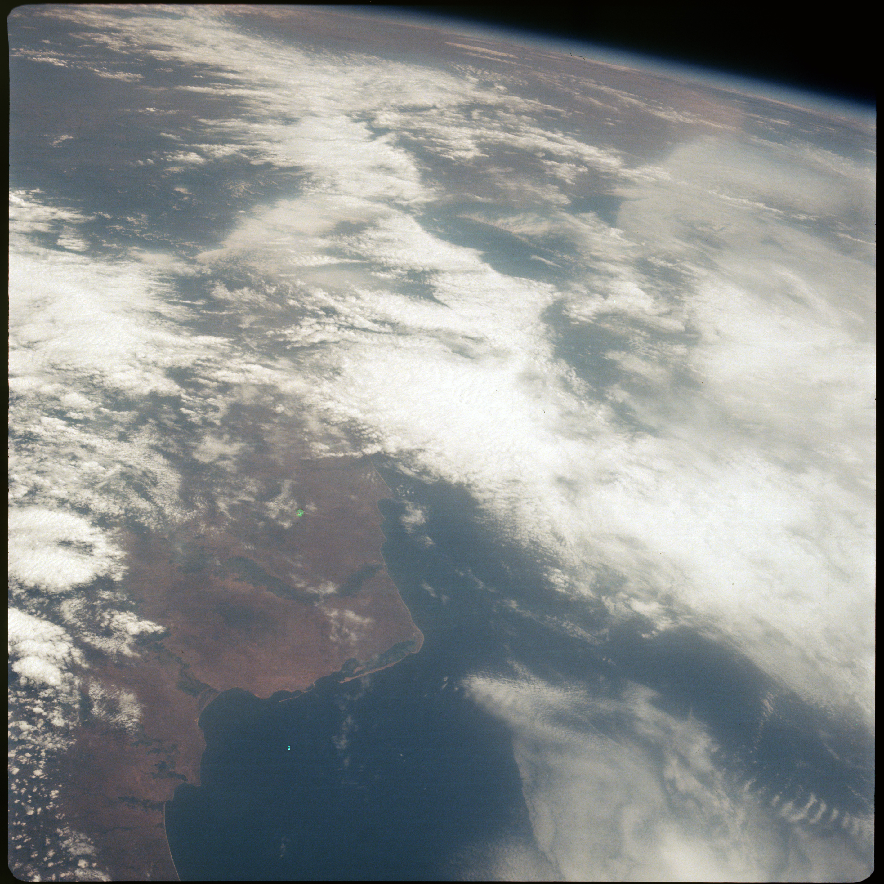 | AS07-08-1911 GEOGRAPHY/CARTOGRAPHY: Angola, coast at Luanda. GEOLOGY/HYDROLOGY: Plateau, narrow coastal plain. FORESTRY: Intermittent tall savanna grass. METEOROLOGY: Cumulus, alto-cumulus. Image credit: Image Science and Analysis Laboratory, NASA-Johnson Space Center. |
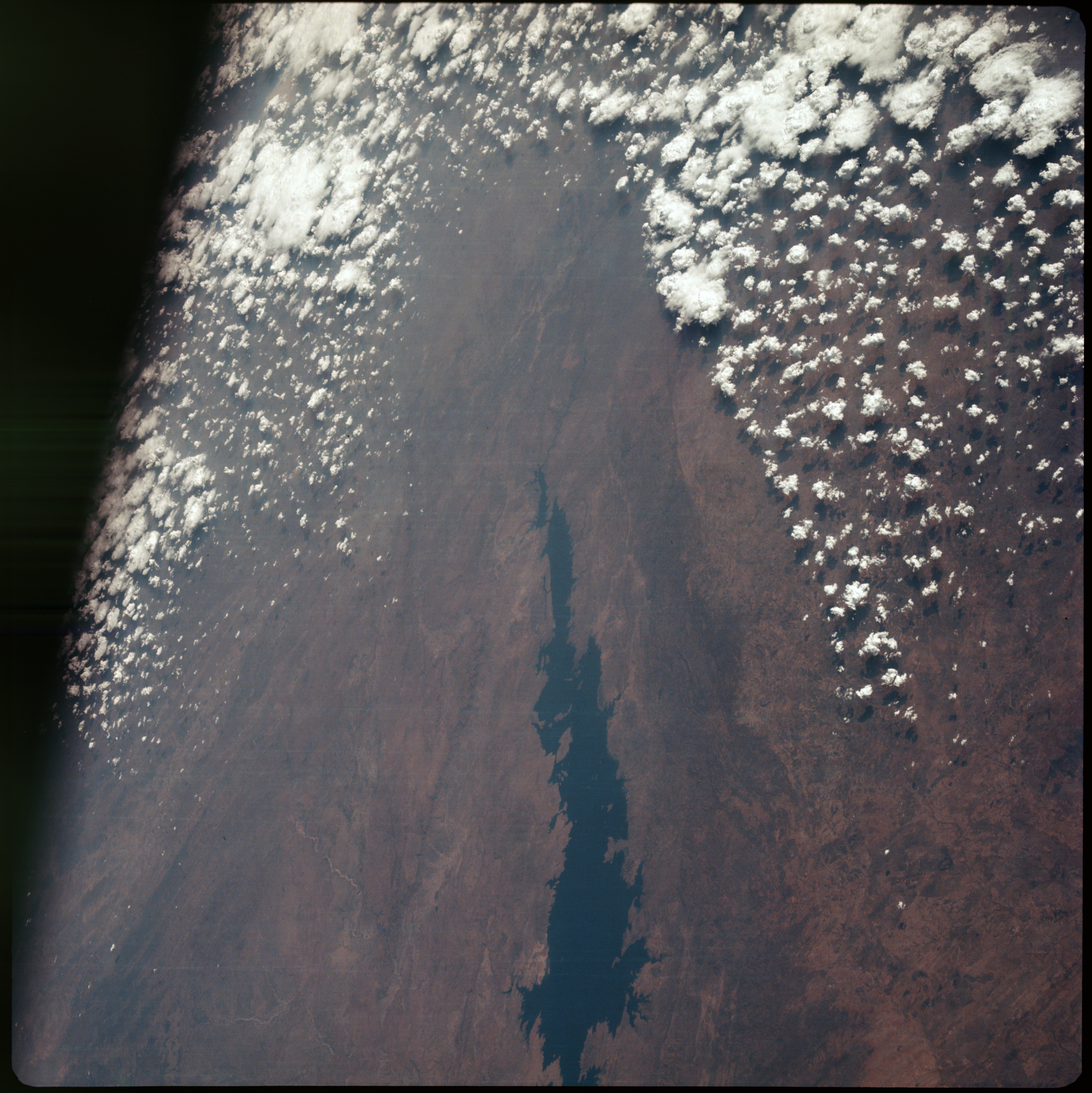 | AS07-08-1912 GEOGRAPHY/CARTOGRAPHY: Zambia, Rhodesia, Lake Kariba. GEOLOGY/HYDROLOGY: Volcanic highlands, plateau. FORESTRY: Intermittent forest and savanna grassland. METEOROLOGY: Cumulus. Image credit: Image Science and Analysis Laboratory, NASA-Johnson Space Center. |
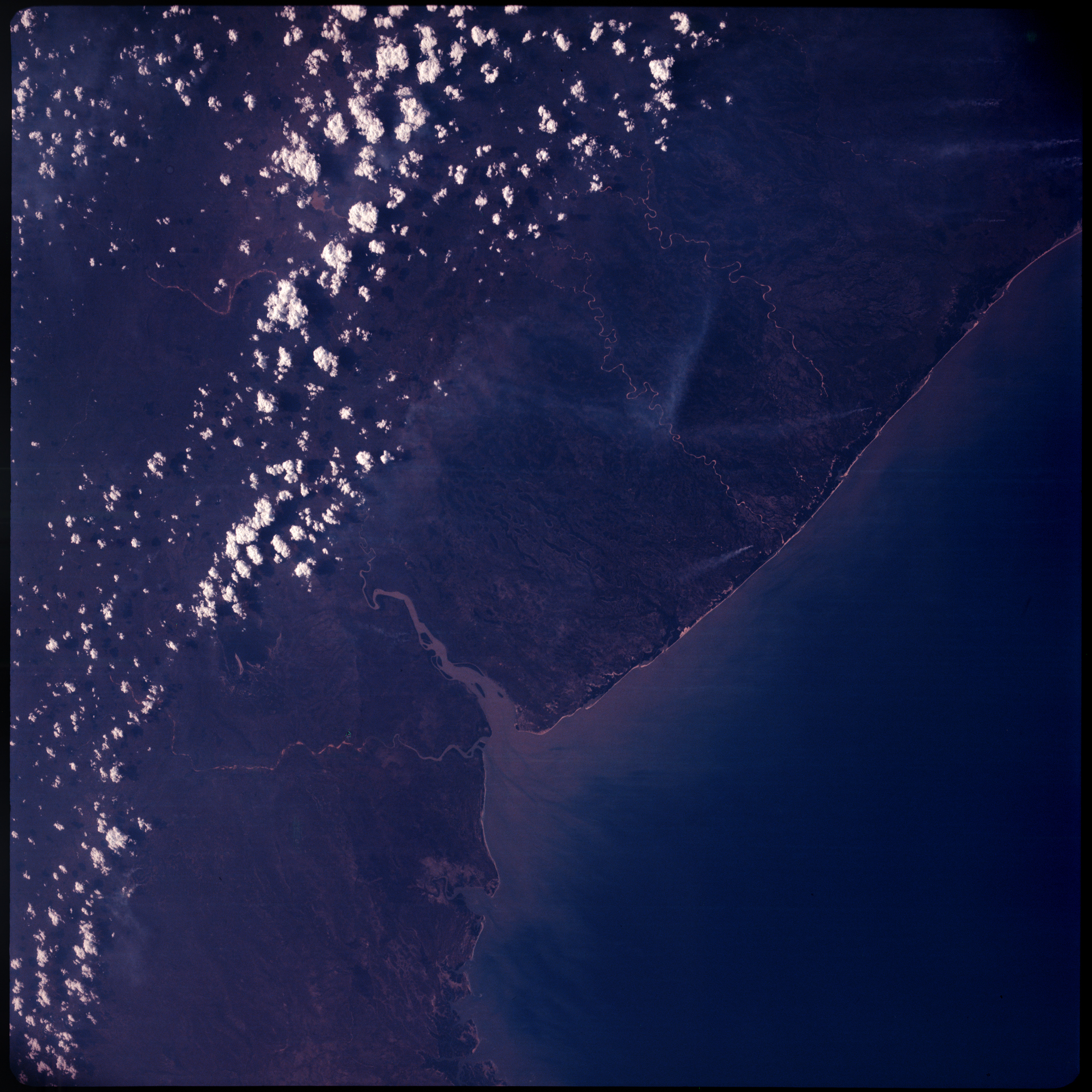 | AS07-08-1913 GEOGRAPHY/CARTOGRAPHY: Mozambique, coast of Beira. (Dark) GEOLOGY/HYDROLOGY: Coastal plain, plateau in the interior. FORESTRY: Mangrove swamps, intermittent rain forests and grasslands, several smoke plumes. METEOROLOGY: Cumulus. OCEANOGRAPHY: Ocean depth variations or sediment. Image credit: Image Science and Analysis Laboratory, NASA-Johnson Space Center. |
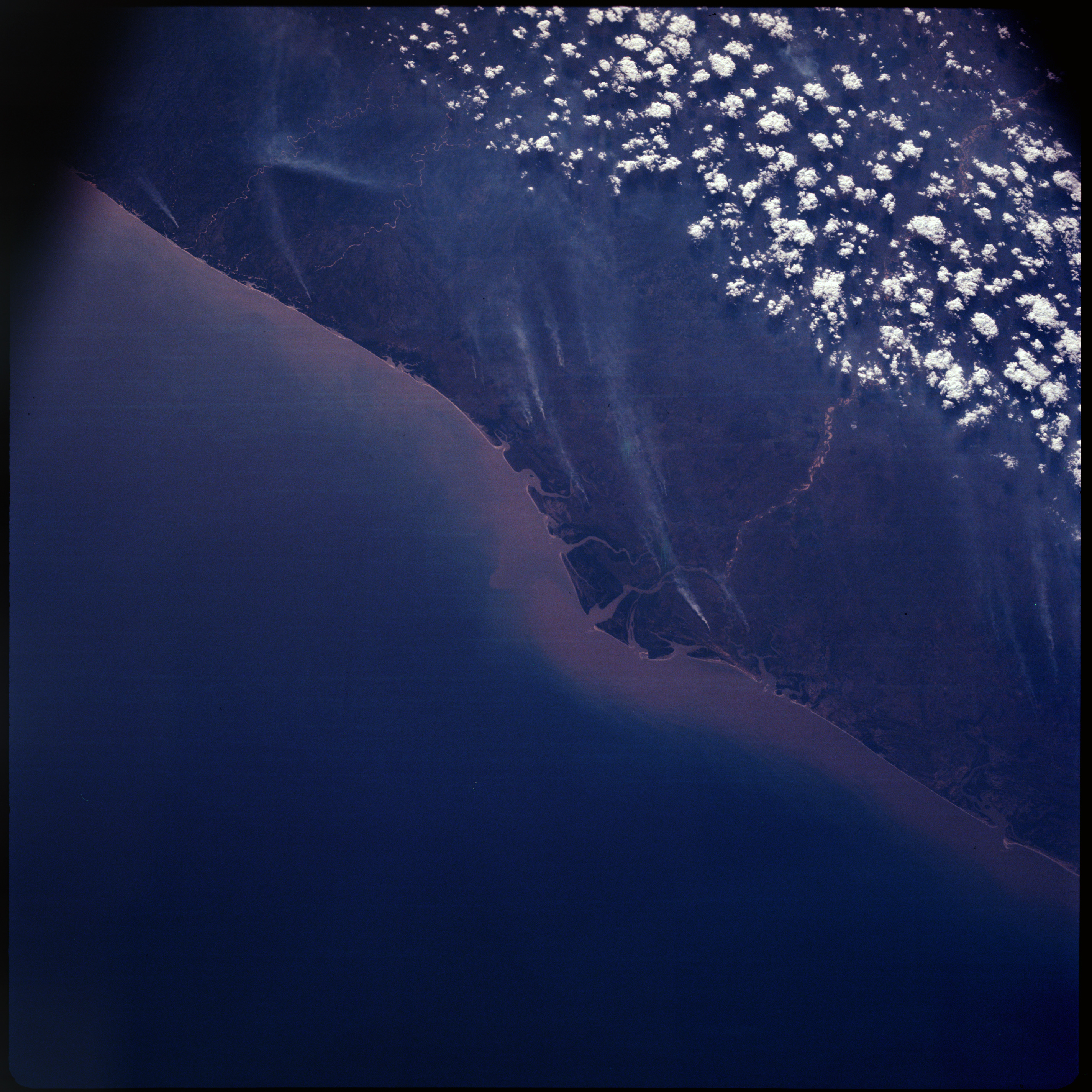 | AS07-08-1914 GEOGRAPHY/CARTOGRAPHY: Mozambique, coast at mouth of Zambezi River. (Dark) GEOLOGY/HYDROLOGY: Delta, coastal plain and plateau. FORESTRY: Mangrove swamps, intermittent rain forests and savanna grasslands, numerous fires. METEOROLOGY: Cumulus. OCEANOGRAPHY: Ocean depth variations or sediment. Image credit: Image Science and Analysis Laboratory, NASA-Johnson Space Center. |
 | AS07-08-1915 Underexposed. Image credit: Image Science and Analysis Laboratory, NASA-Johnson Space Center. |
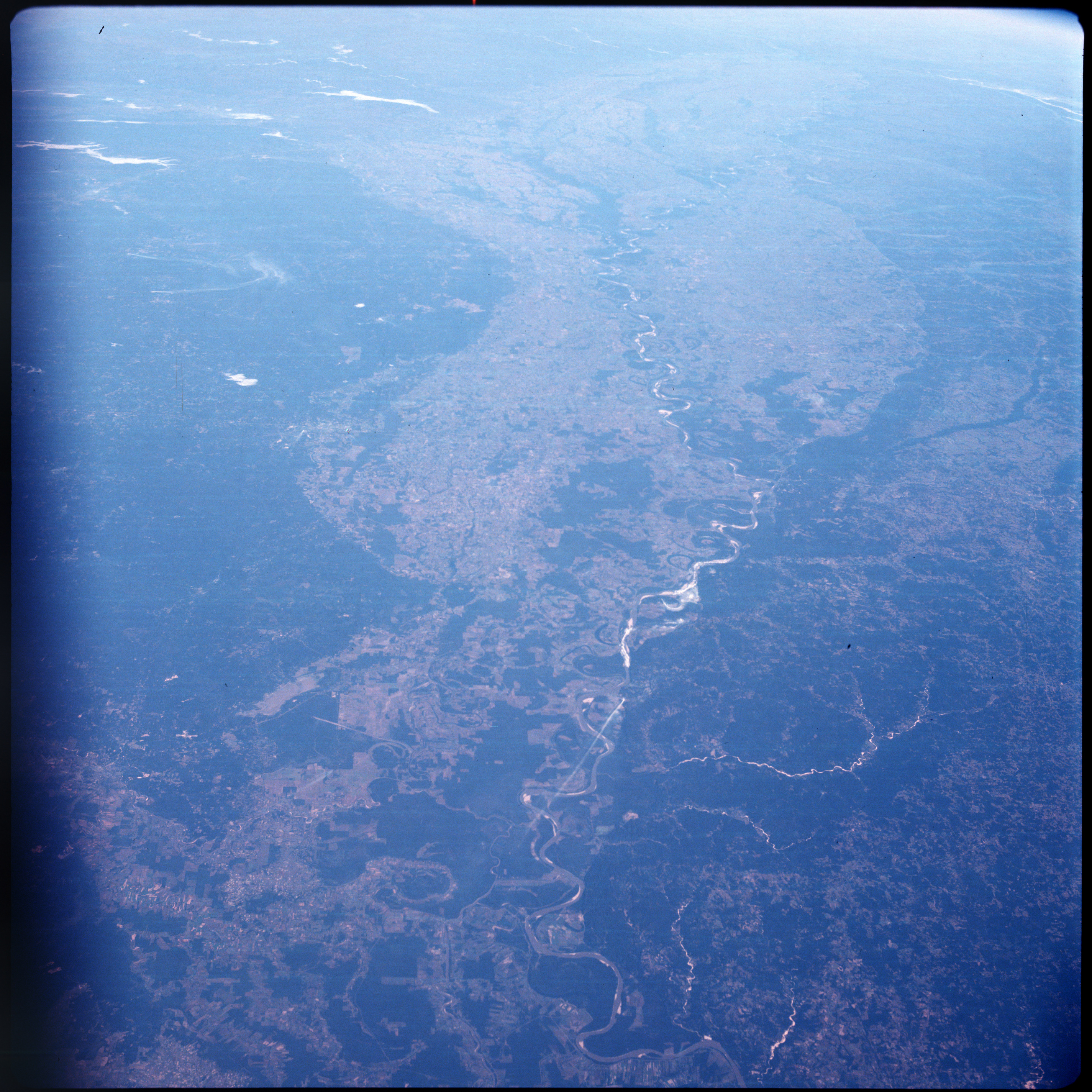 | AS07-08-1916 GEOGRAPHY/CARTOGRAPHY: Alexandria, Louisiana;Jackson, Mississippi; transportation network. (Dark) AGRICULTURE: Extensive cultivation. GEOLOGY/HYDROLOGY: Flood plain, meandering Mississippi River. FORESTRY: Pine-hardwood forests and scattered bottom land hardwoods in river plain. Image credit: Image Science and Analysis Laboratory, NASA-Johnson Space Center. |
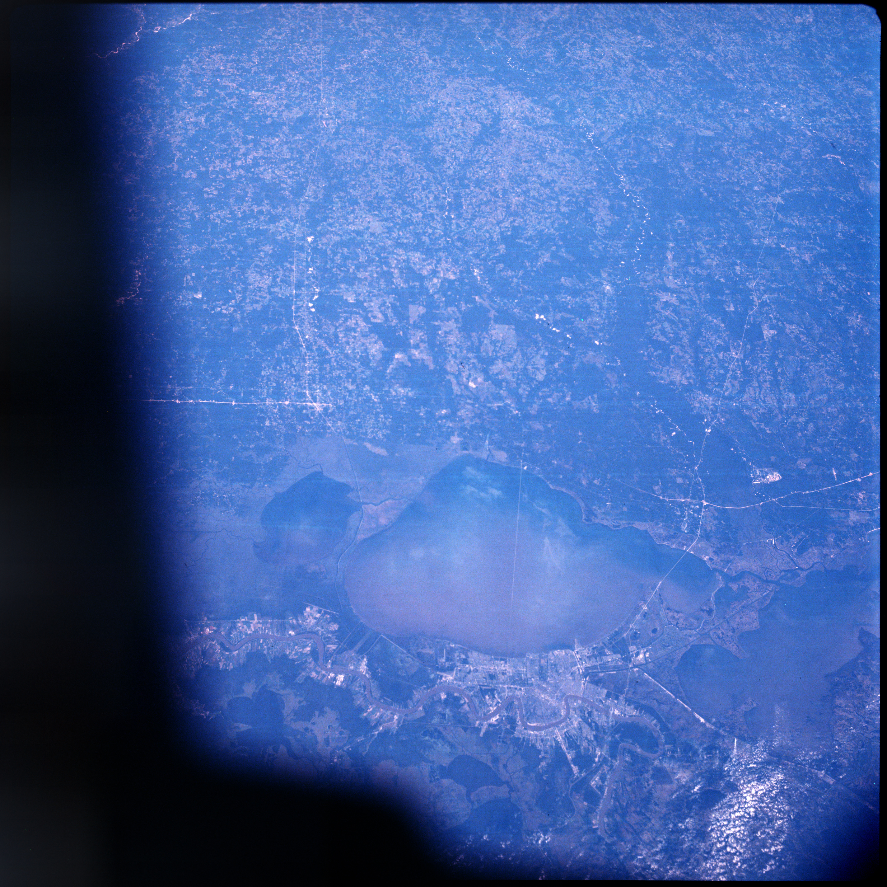 | AS07-08-1917 GEOGRAPHY/CARTOGRAPHY: New Orleans, Louisiana; regional transportation network. (Dark) AGRICULTURE: Extensive cultivation pattern. GEOLOGY/HYDROLOGY: Flood plain, Mississippi River. FORESTRY: Intermittent coastal marsh and mixed forest stands. Image credit: Image Science and Analysis Laboratory, NASA-Johnson Space Center. |
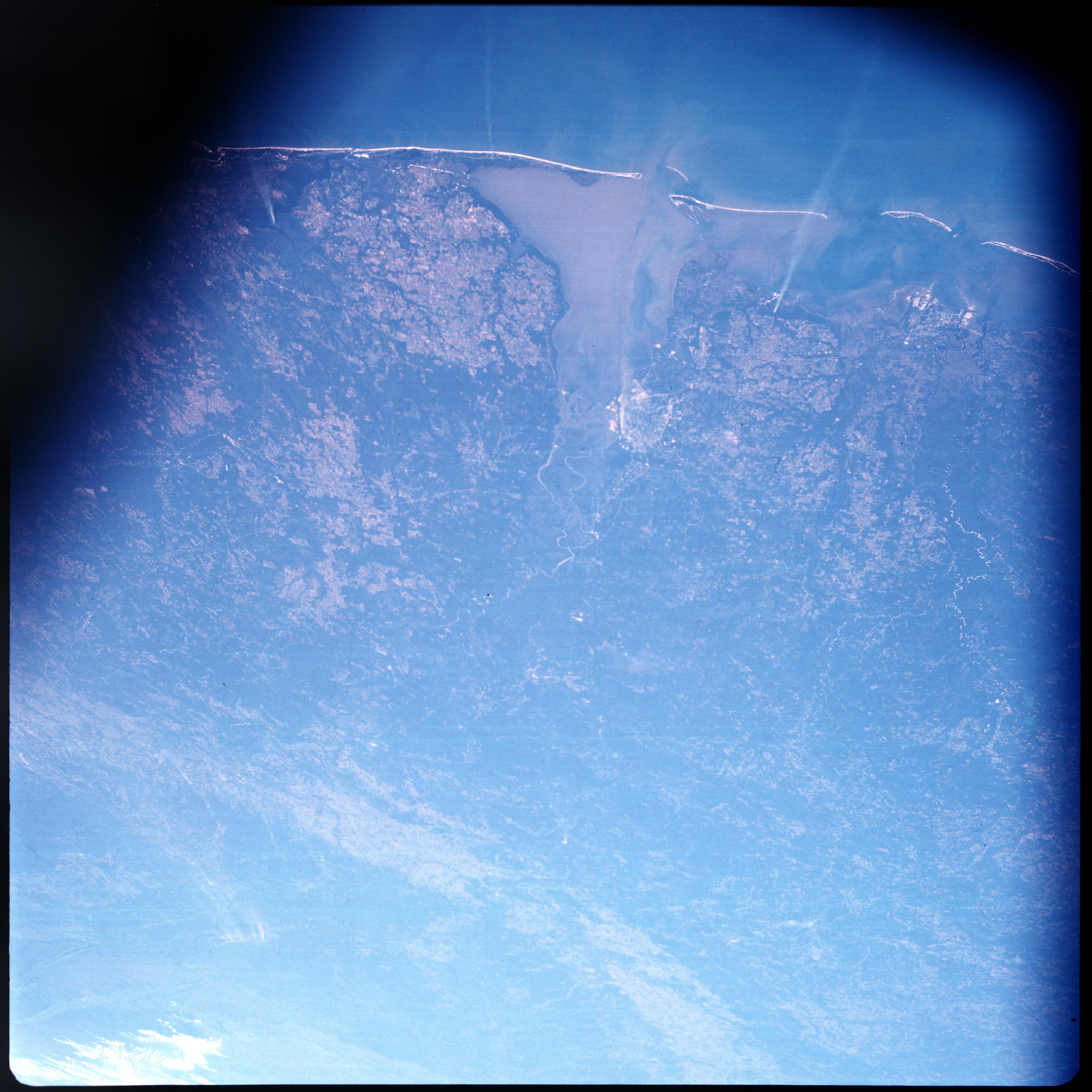 | AS07-08-1918 GEOGRAPHY/CARTOGRAPHY: Mobile, Alabama; regional transportation network. (Dark) AGRICULTURE: Scattered, intense cultivation. GEOLOGY/HYDROLOGY: Coastal plain. FORESTRY: Intermittent coastal marsh vegetation with mixed pine-hardwood forests. OCEANOGRAPHY: Sediment flows into Gulf from Bay. Image credit: Image Science and Analysis Laboratory, NASA-Johnson Space Center. |
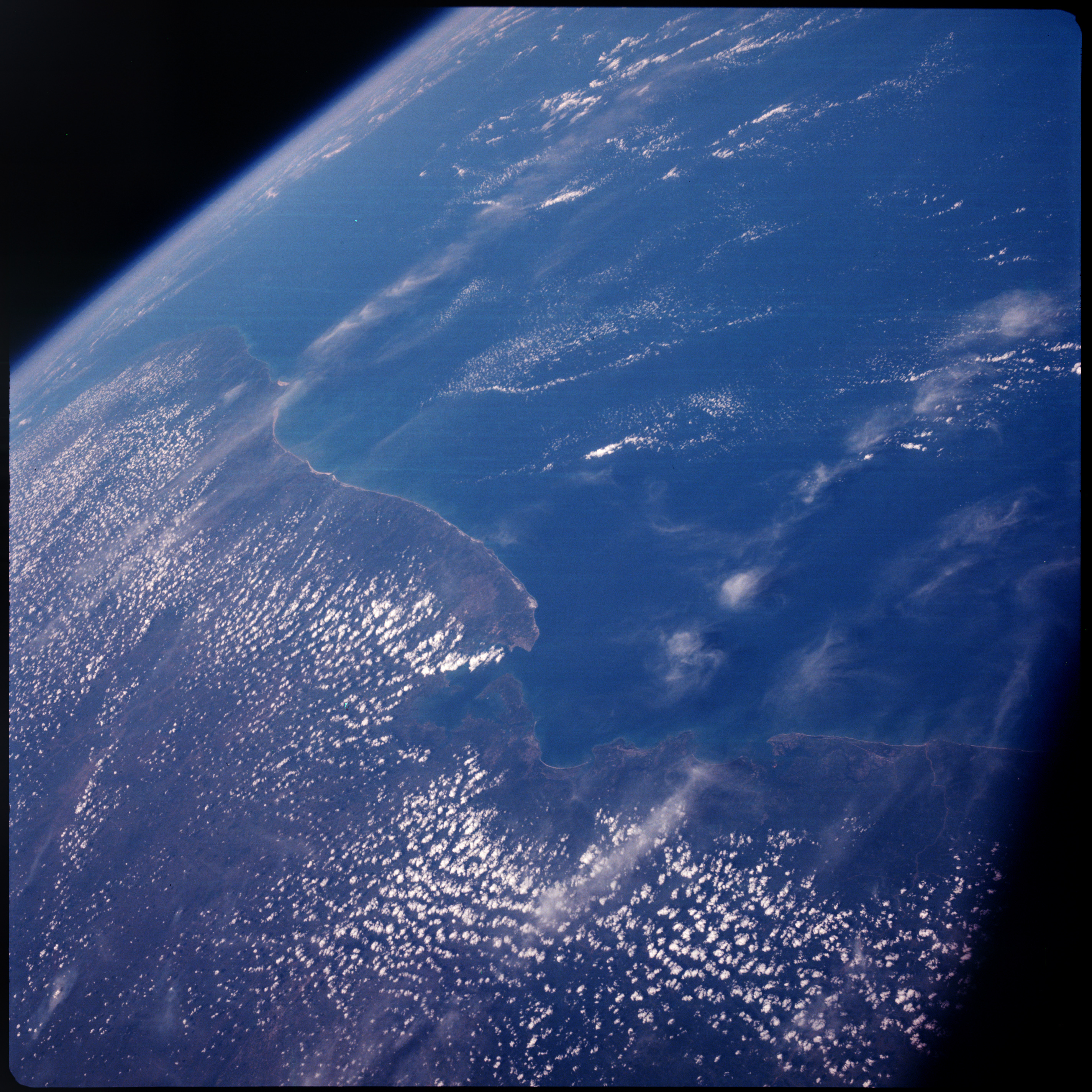 | AS07-08-1924 GEOGRAPHY/CARTOGRAPHY: Brazil, Bahia State, Salvador. (Dark) GEOLOGY/HYDROLOGY: Coastal plain, complex plateau. FORESTRY: Dense tropical forest. METEOROLOGY: Cumulus, cirrus. Image credit: Image Science and Analysis Laboratory, NASA-Johnson Space Center. |
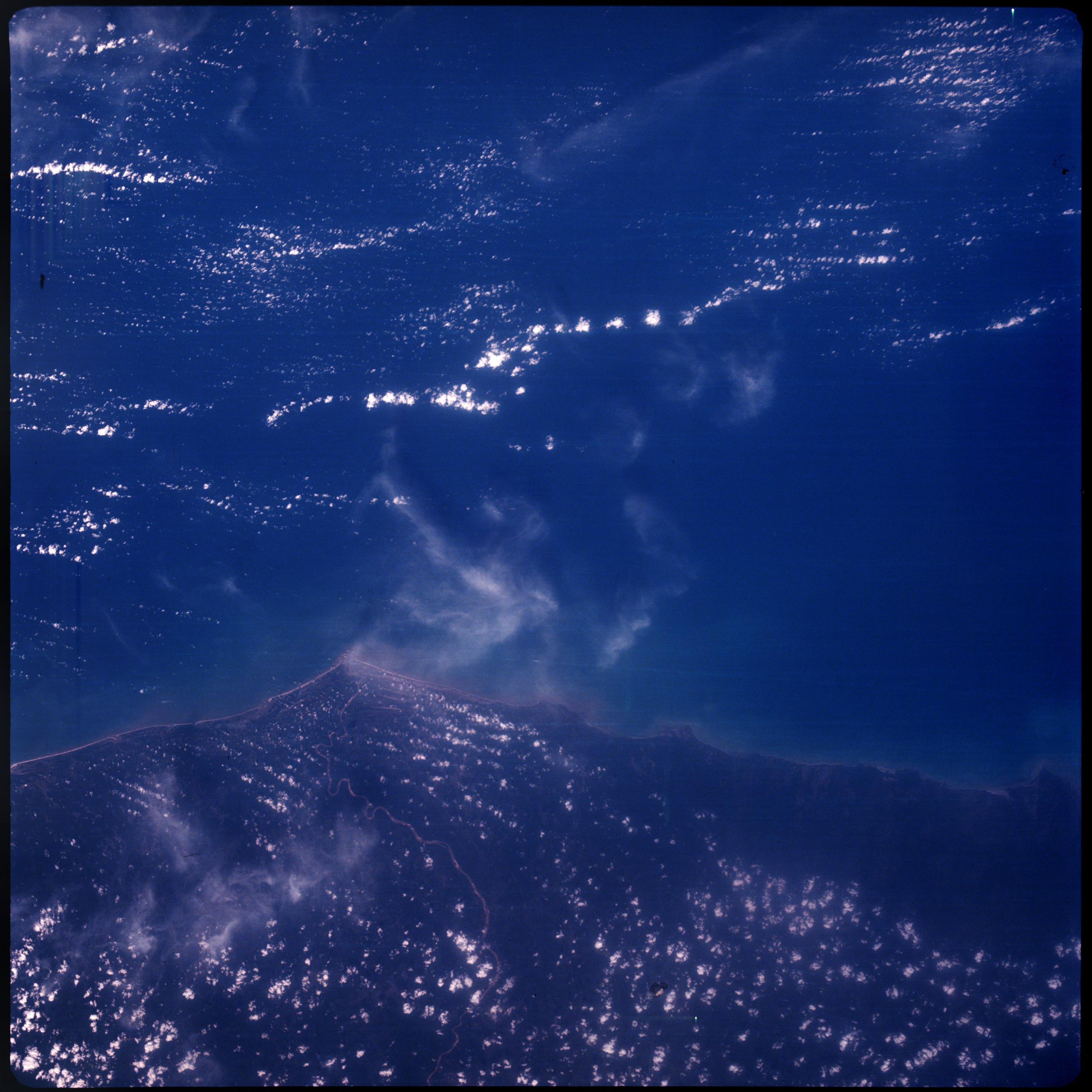 | AS07-08-1925 GEOGRAPHY/CARTOGRAPHY: Brazil, Bahia State, mouth of Jequitinhouhas. GEOLOGY/HYDROLOGY: Coastal plain with perennial drainage. FORESTRY: Dense tropical forests. METEOROLOGY: Cumulus, cirrus. Image credit: Image Science and Analysis Laboratory, NASA-Johnson Space Center. |
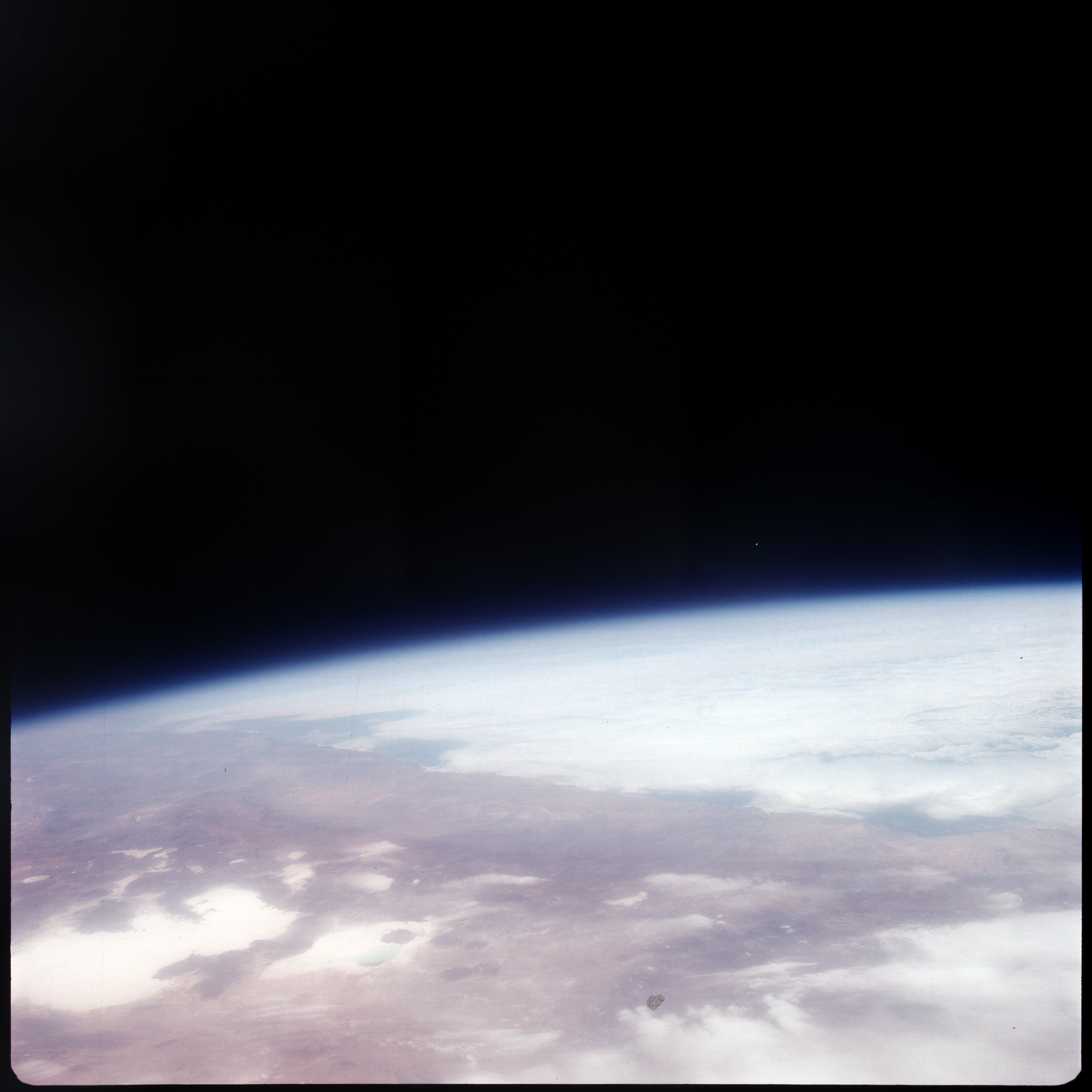 | AS07-08-1926 GEOGRAPHY/CARTOGRAPHY: Chile, Argentina, Saler de Uyuni. METEOROLOGY: Alto-cumulus, thick cirrus. Image credit: Image Science and Analysis Laboratory, NASA-Johnson Space Center. |
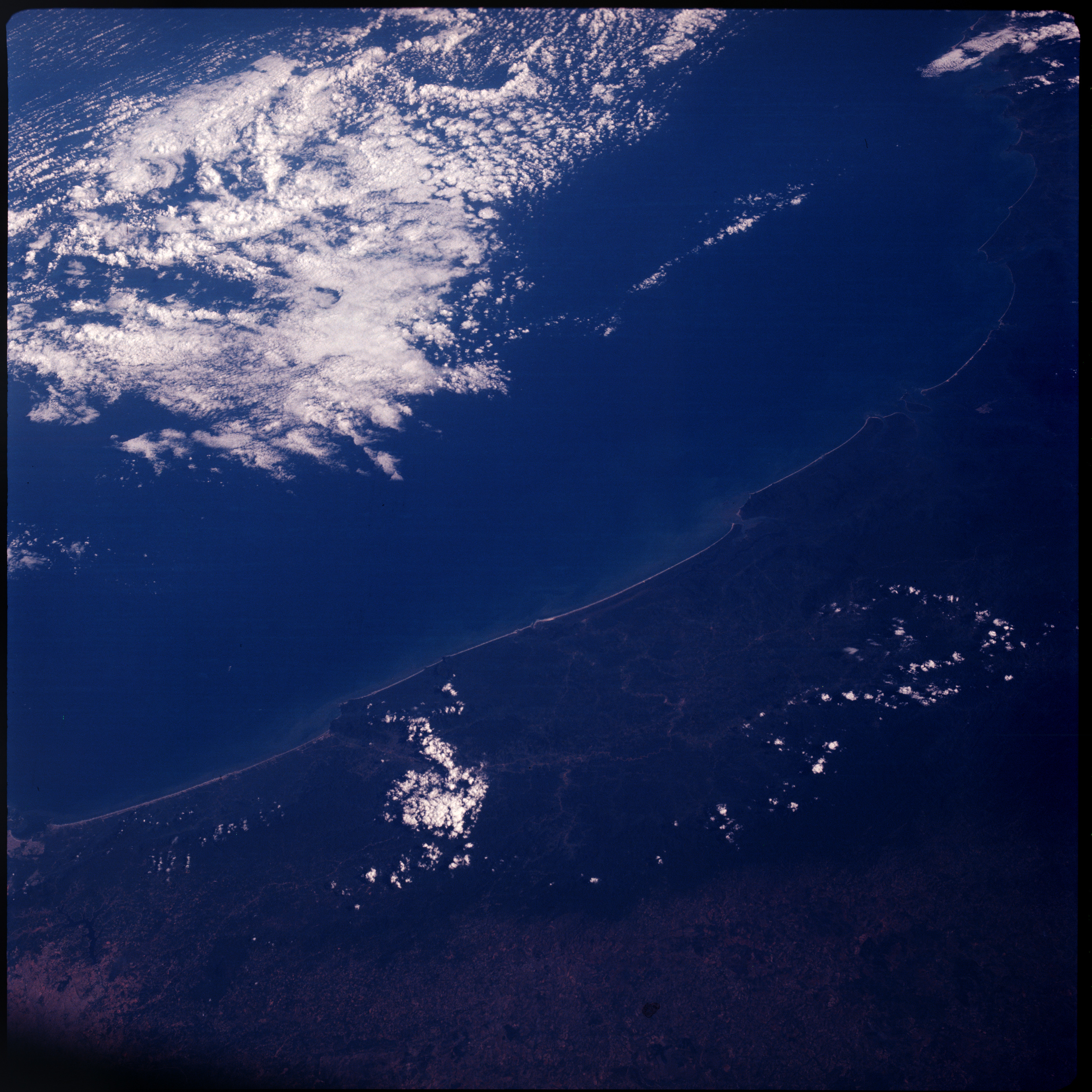 | AS07-08-1927 GEOGRAPHY/CARTOGRAPHY: Brazil Coastline, Santos to Florianopalos. (Dark) GEOLOGY/HYDROLOGY: Coastal plain. FORESTRY: Dense forest. METEOROLOGY: Cumulus, alto-cumulus. OCEANOGRAPHY: Some sediment deposition. Image credit: Image Science and Analysis Laboratory, NASA-Johnson Space Center. |
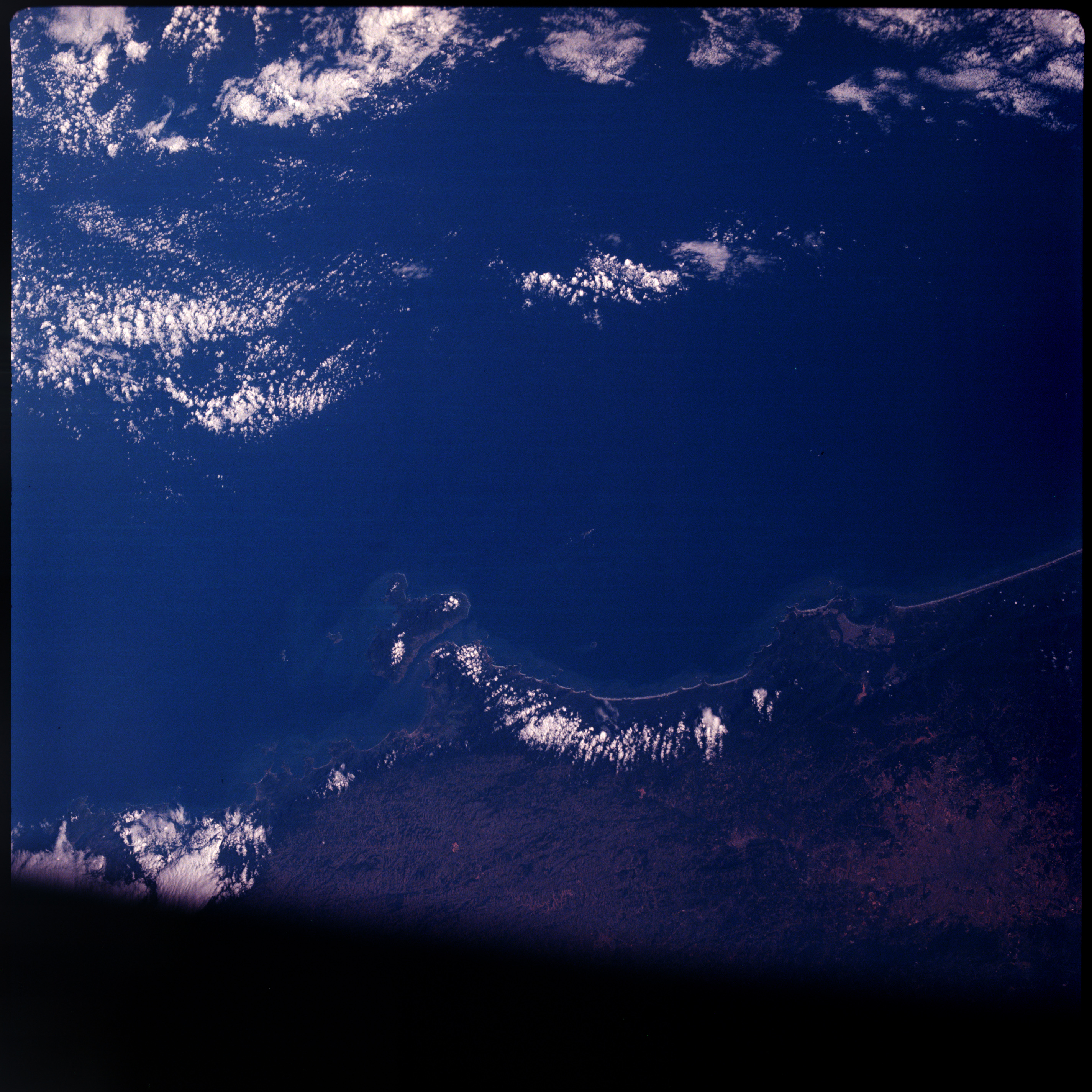 | AS07-08-1928 GEOGRAPHY/CARTOGRAPHY: Brazil coastline, Paruibe, Santos, Ponta de Juatinga. (Dark) AGRICULTURE: Possible field patterns. GEOLOGY/HYDROLOGY: Complex hills, coastal plain. FORESTRY: Dense forests along coast becoming increasingly intermittent inland. OCEANOGRAPHY: Depth differences. Image credit: Image Science and Analysis Laboratory, NASA-Johnson Space Center. |
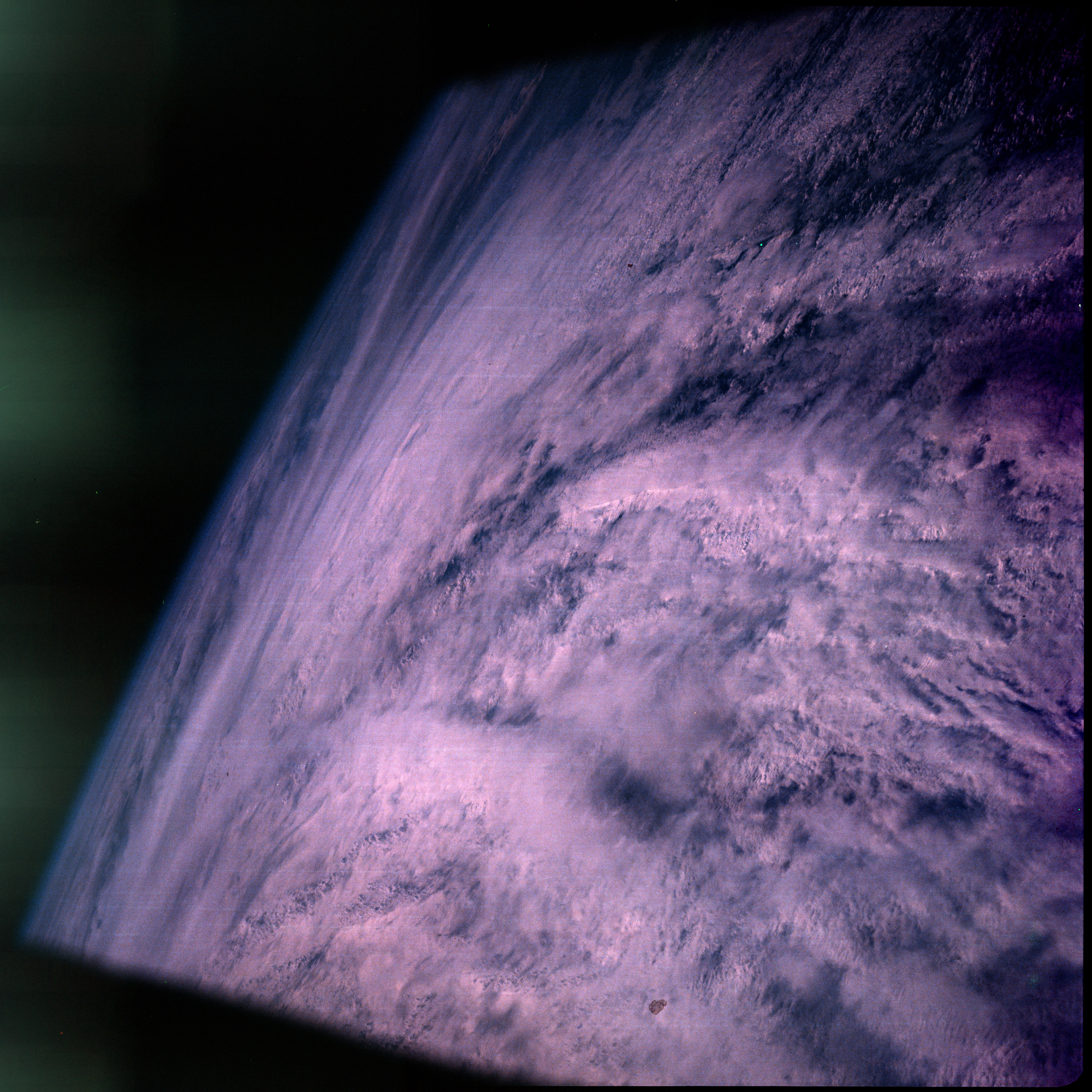 | AS07-08-1929 METEOROLOGY: Hurricane Gloria. Image credit: Image Science and Analysis Laboratory, NASA-Johnson Space Center. |
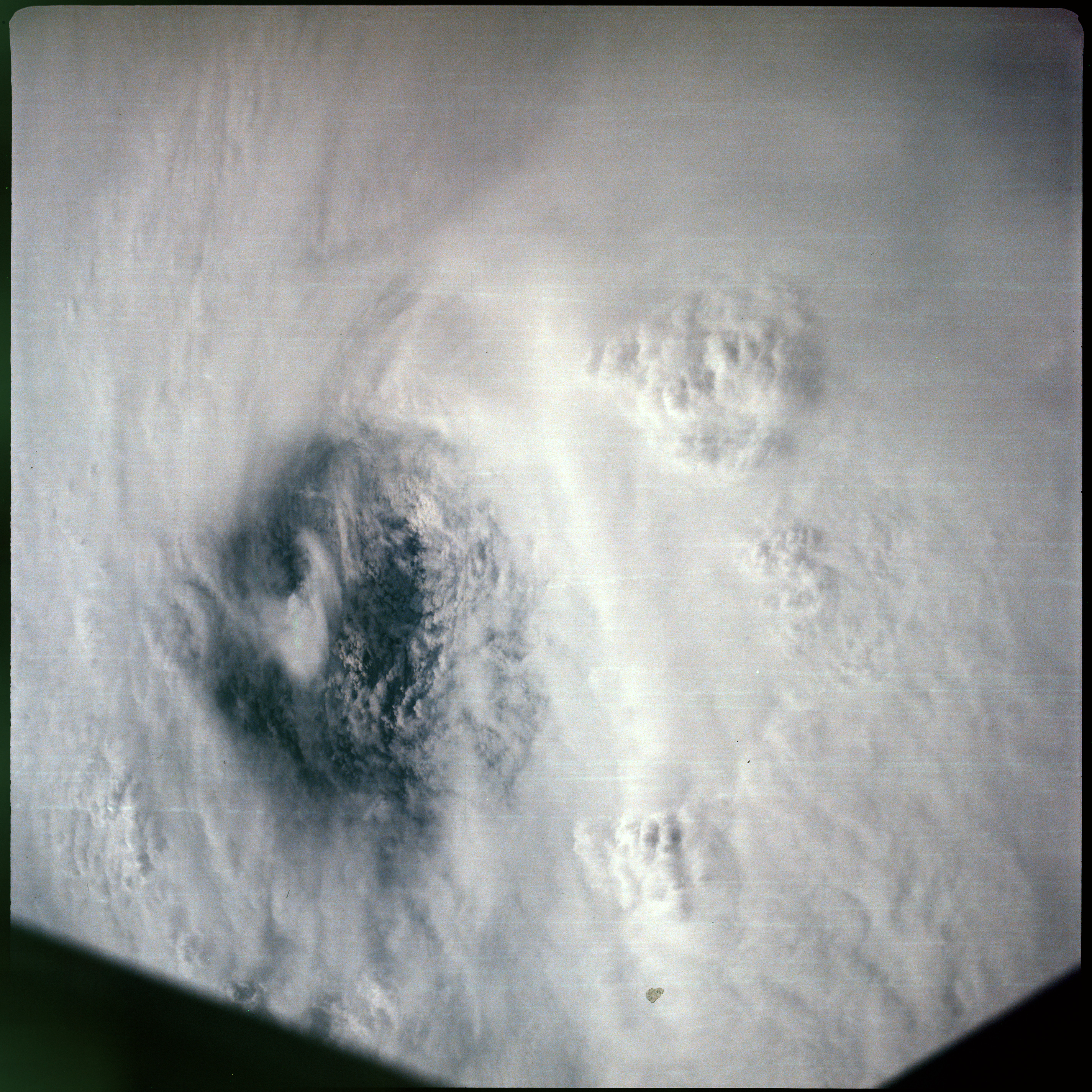 | AS07-08-1930 METEOROLOGY: Hurricane Gloria. Image credit: Image Science and Analysis Laboratory, NASA-Johnson Space Center. |
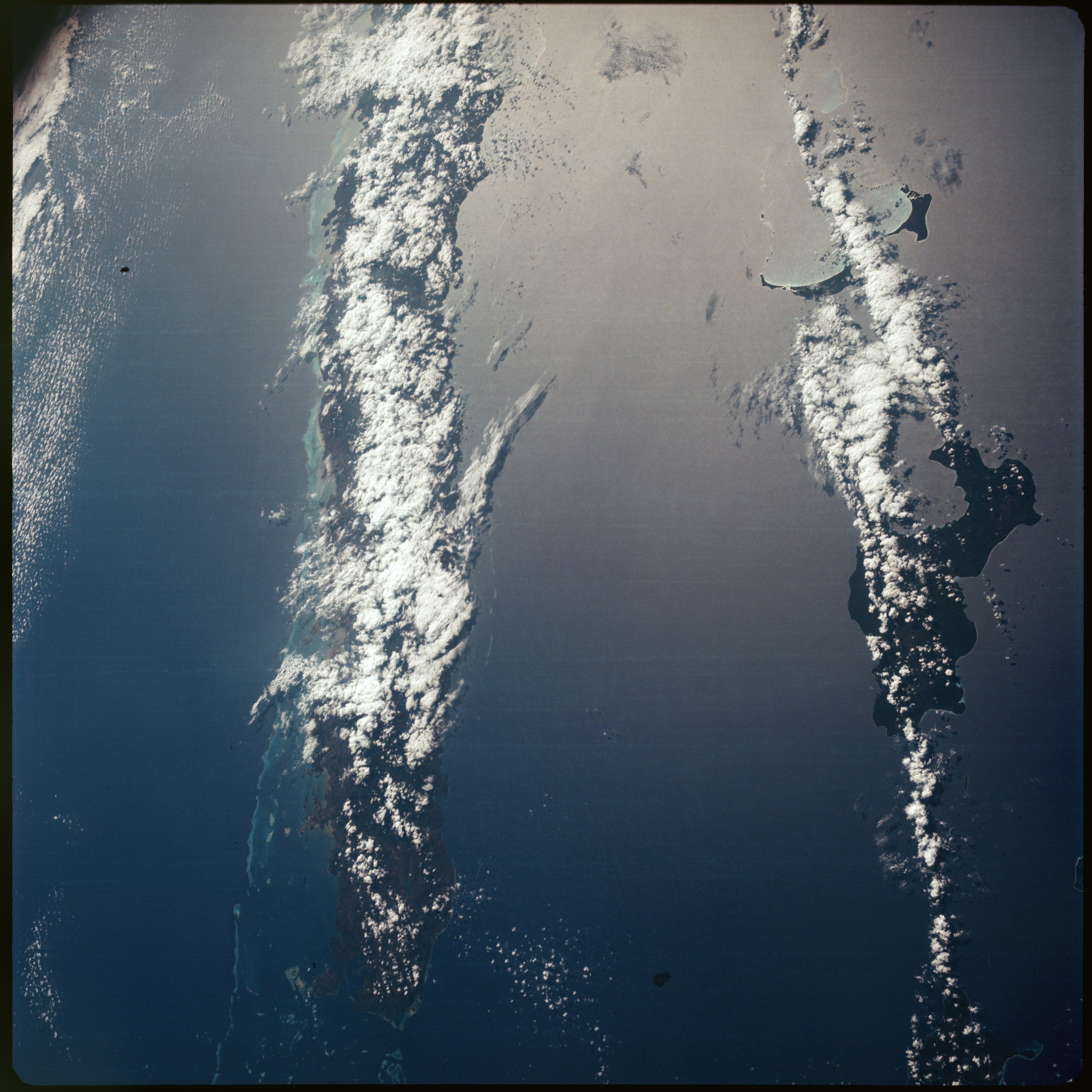 | AS07-08-1931 GEOGRAPHY/CARTOGRAPHY: New Caledonia, Ile Lifou. (Dark) GEOLOGY/HYDROLOGY: Complex mountains. FORESTRY: Dense forest. METEOROLOGY: Cumulus. OCEANOGRAPHY: Reefs, sun-glint. Image credit: Image Science and Analysis Laboratory, NASA-Johnson Space Center. |
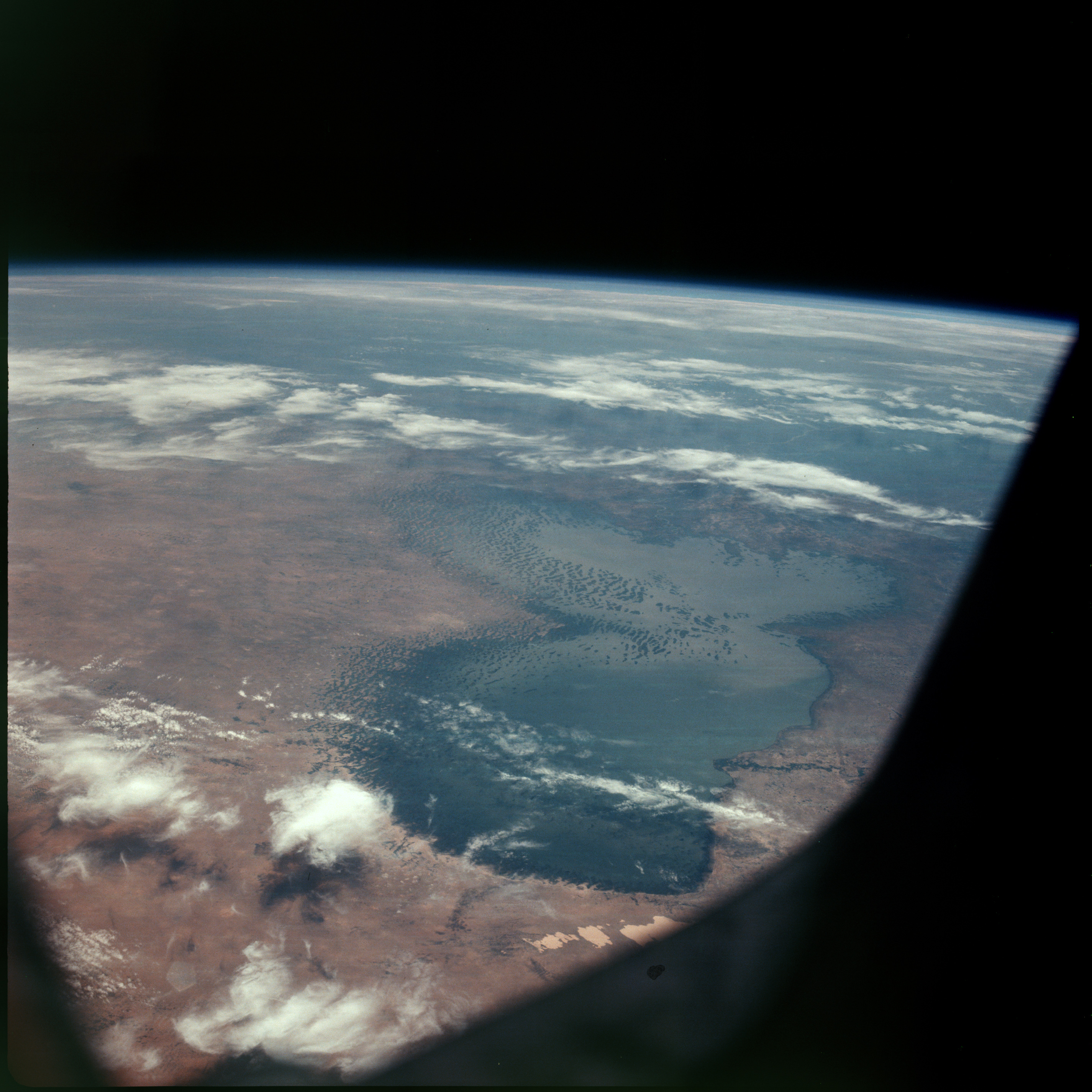 | AS07-08-1932 GEOGRAPHY/CARTOGRAPHY: Lake Chad, Africa. (Dark) GEOLOGY/HYDROLOGY: Interior plain region forming a drainage basin with elevated dunes on the north side. FORESTRY: Savanna grassland, with scattered shrubform. METEOROLOGY: Cirrus. Image credit: Image Science and Analysis Laboratory, NASA-Johnson Space Center. |
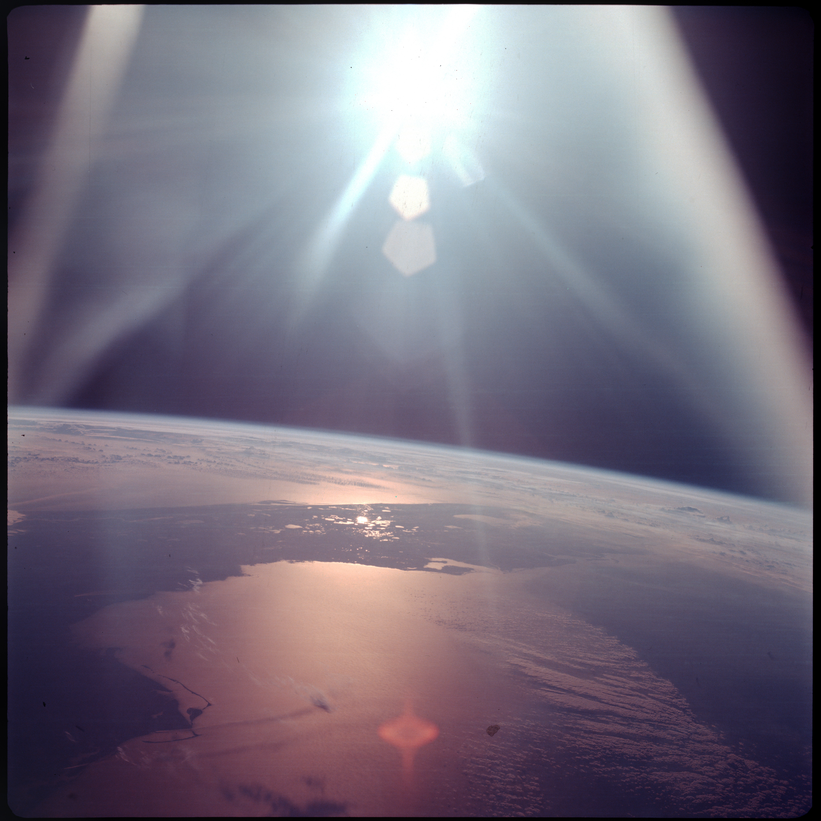 | AS07-08-1933 GEOGRAPHY/CARTOGRAPHY: Florida. (Dark) OCEANOGRAPHY: Sun-glint. Image credit: Image Science and Analysis Laboratory, NASA-Johnson Space Center. |
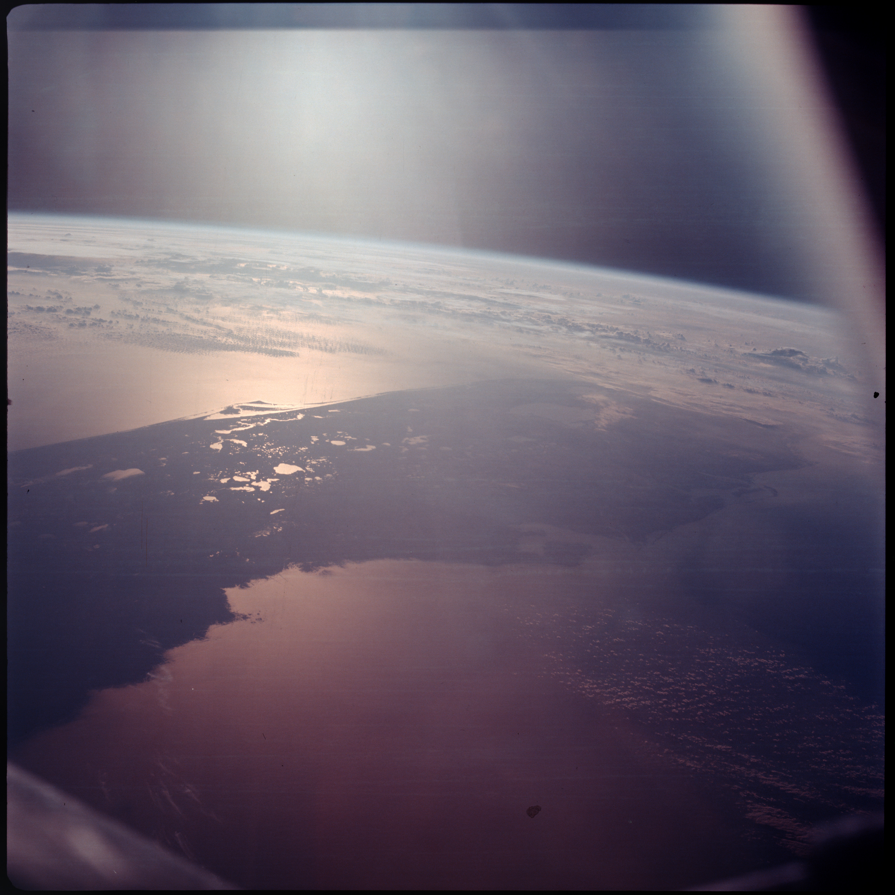 | AS07-08-1934 GEOGRAPHY/CARTOGRAPHY: Florida. (Dark) METEOROLOGY: Clouds, the horizon. OCEANOGRAPHY: Sun-glint. Image credit: Image Science and Analysis Laboratory, NASA-Johnson Space Center. |
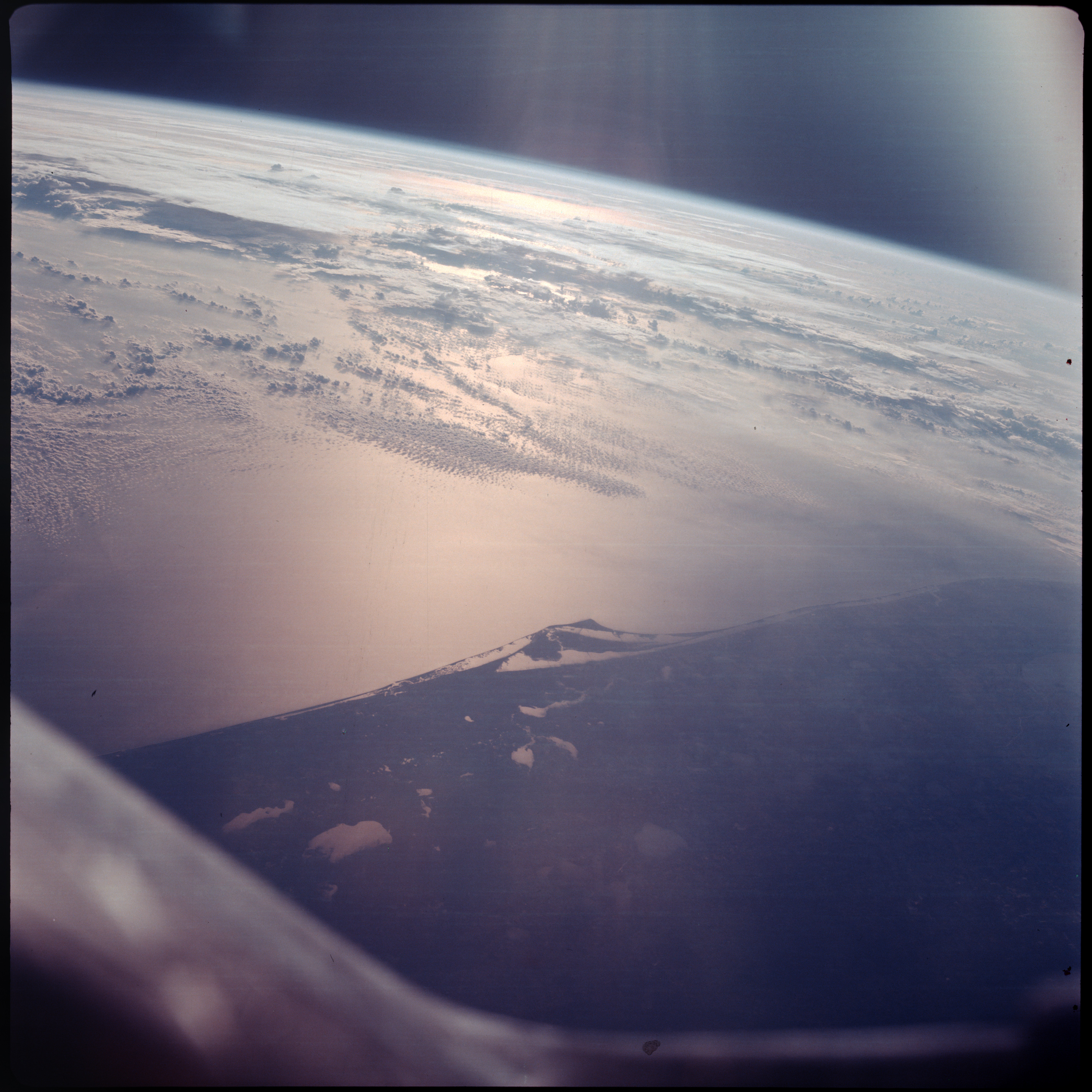 | AS07-08-1935 GEOGRAPHY/CARTOGRAPHY: Florida, KSC. (Dark) METEOROLOGY: Cumulus, cirrus. Image credit: Image Science and Analysis Laboratory, NASA-Johnson Space Center. |
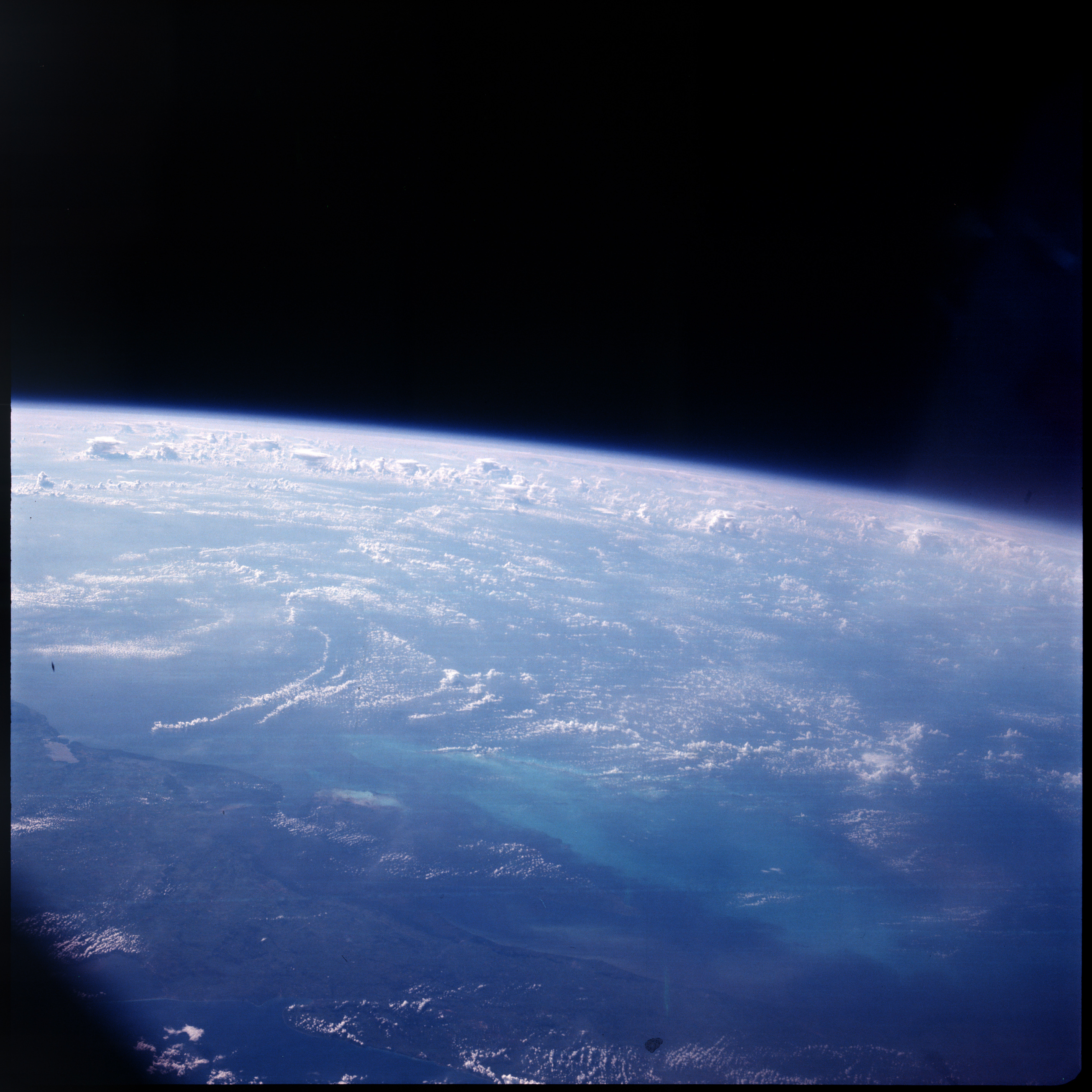 | AS07-08-1936 GEOGRAPHY/CARTOGRAPHY: Cuba, Havana. (Dark) GEOLOGY/HYDROLOGY: Low plain. FORESTRY: Intermittent forest lands. METEOROLOGY: Cumulus, cirrus. Image credit: Image Science and Analysis Laboratory, NASA-Johnson Space Center. |
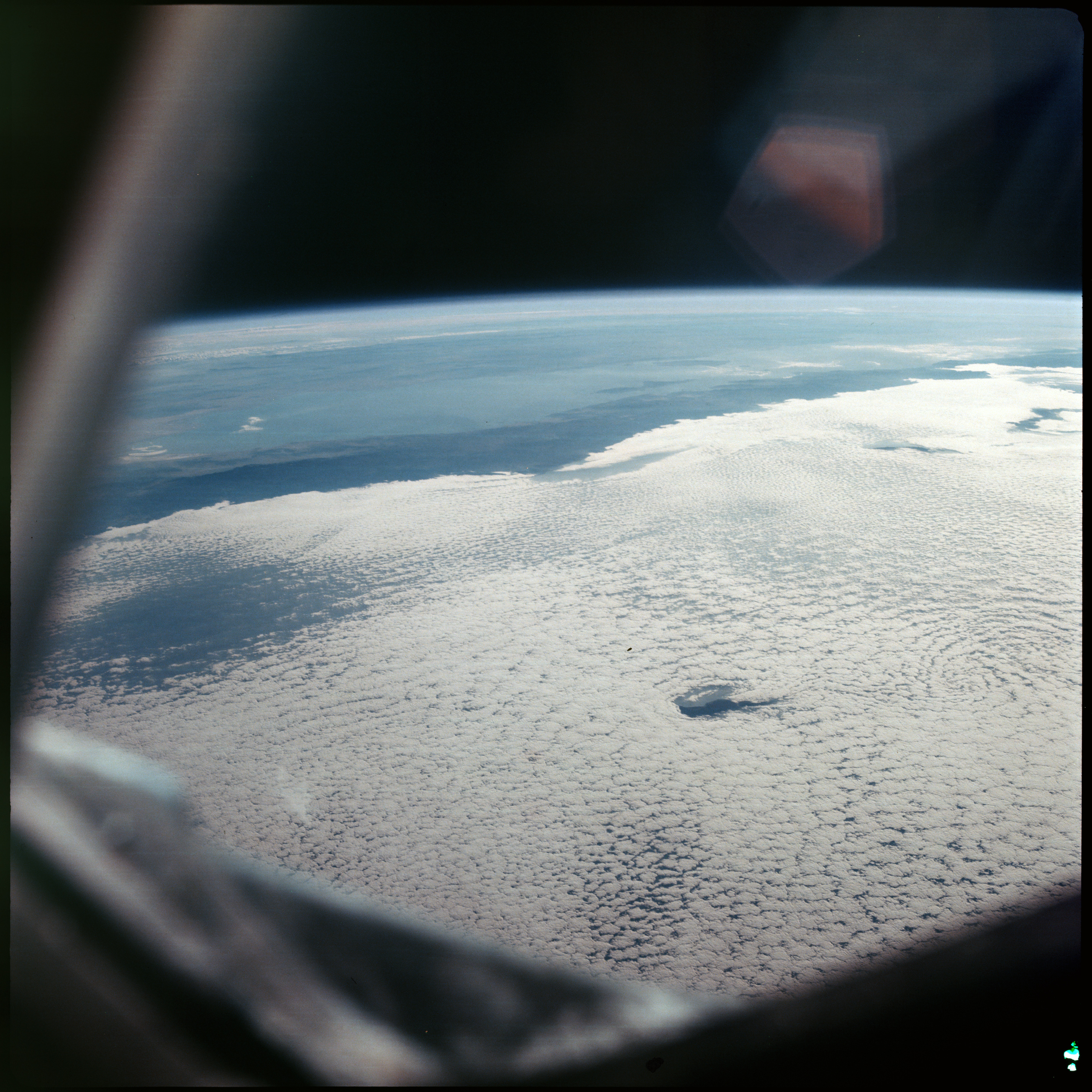 | AS07-08-1937 GEOGRAPHY/CARTOGRAPHY: Gulf of California, Isle, Tiburon and Isle Angel de la Guarda. (Dark) METEOROLOGY: Strato-cumulus. Image credit: Image Science and Analysis Laboratory, NASA-Johnson Space Center. |
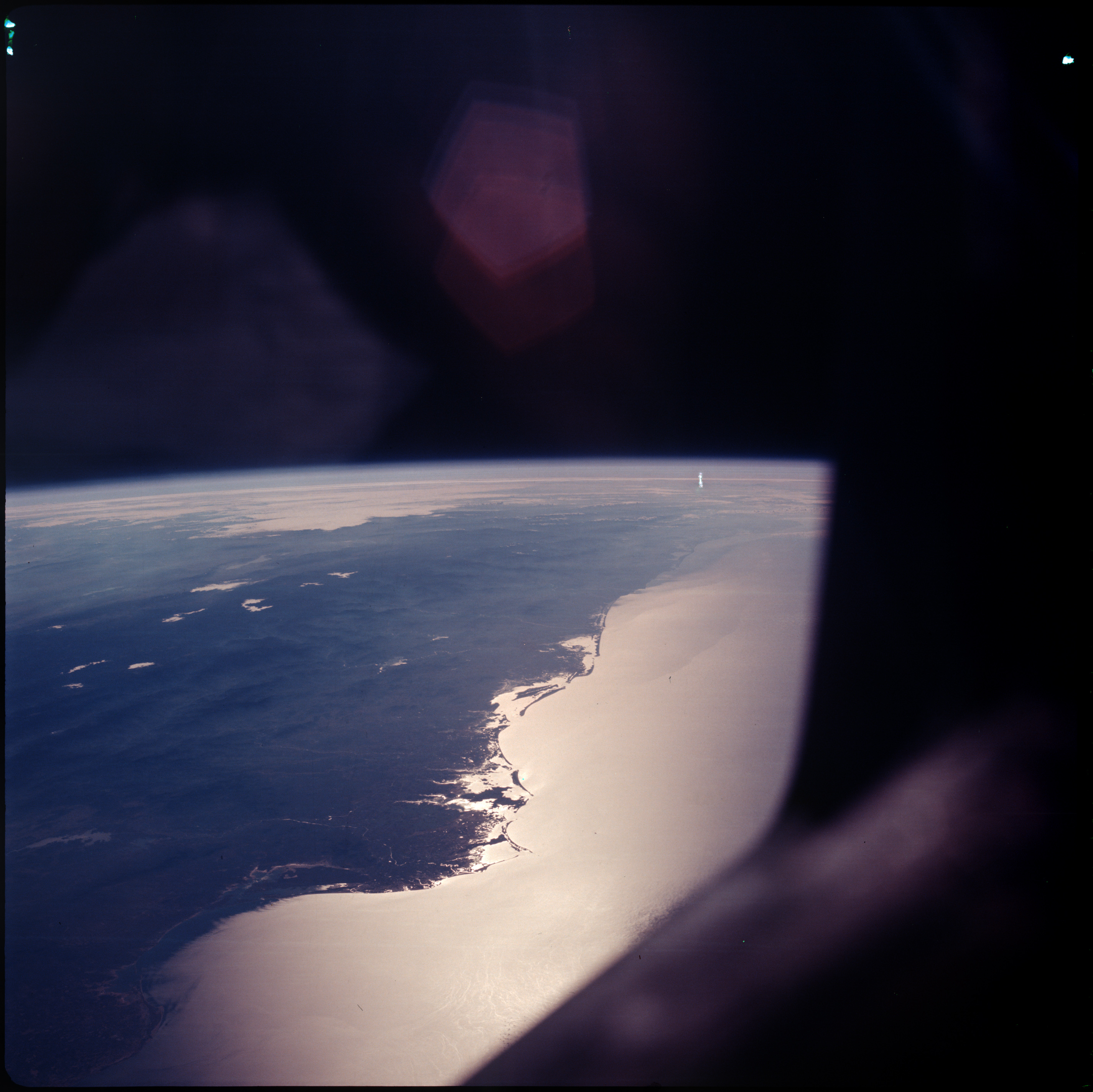 | AS07-08-1938 GEOGRAPHY/CARTOGRAPHY: Southern end of the Gulf of California and Southwestern Mexico coast. (Dark) GEOLOGY/HYDROLOGY: Coastal plain showing off shore build-up on a shoreline of submergence. OCEANOGRAPHY: Sun-glint, good land water contrast. Image credit: Image Science and Analysis Laboratory, NASA-Johnson Space Center. |
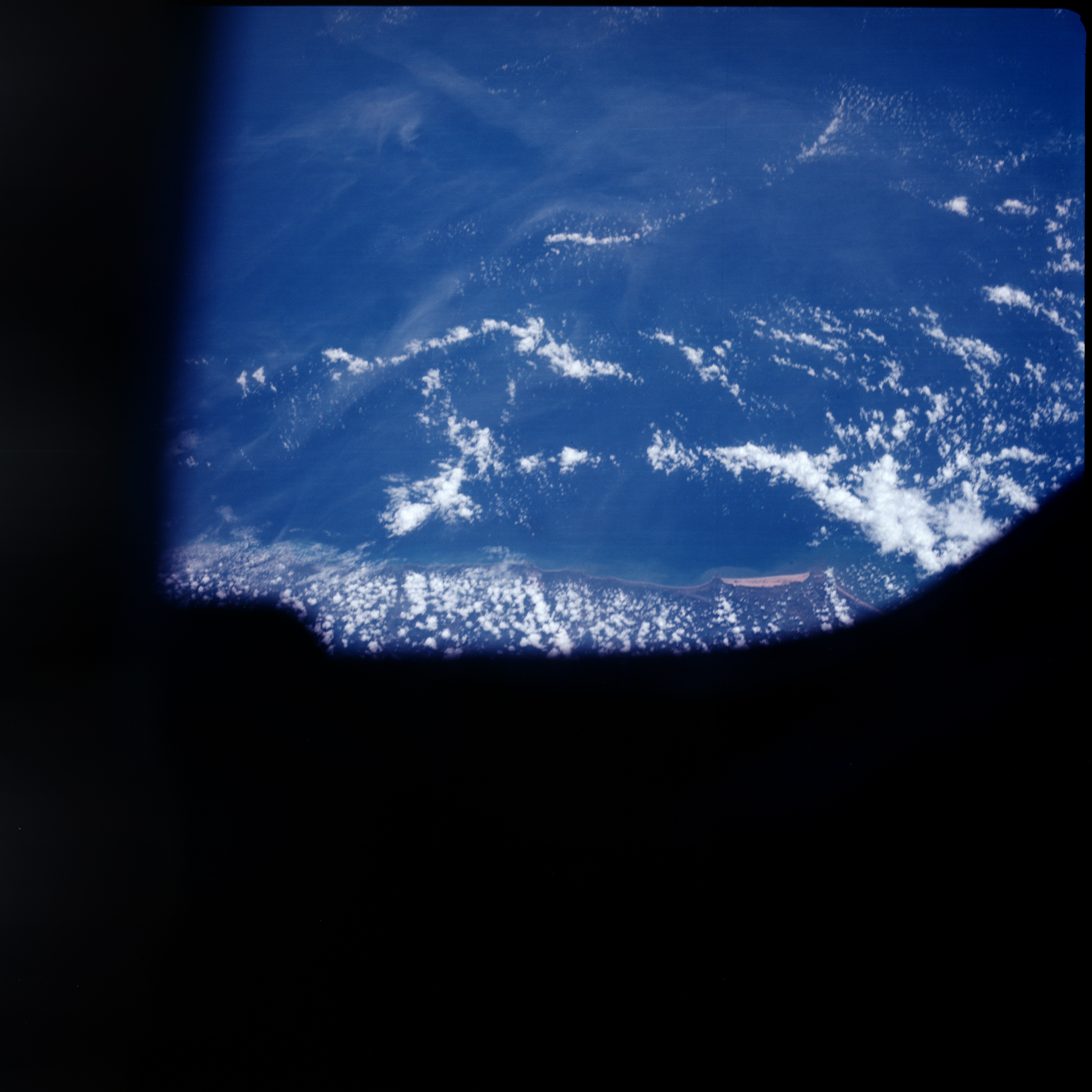 | AS07-08-1939 GEOGRAPHY/CARTOGRAPHY: Brazil, coast near Aracju. GEOLOGY/HYDROLOGY: Coastal plain. METEOROLOGY: Cumulus. OCEANOGRAPHY: Coastal shallows. Image credit: Image Science and Analysis Laboratory, NASA-Johnson Space Center. |
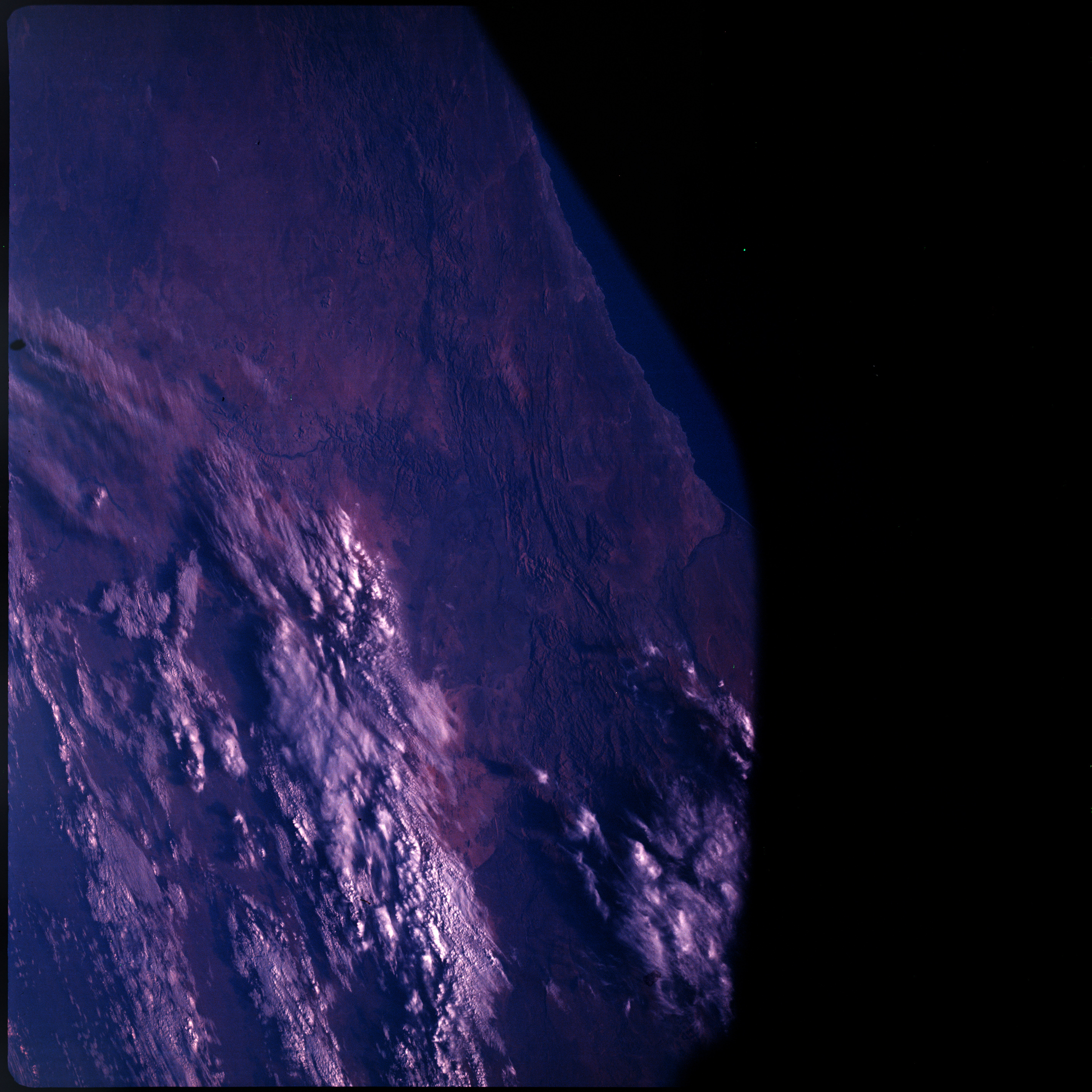 | AS07-08-1940 GEOGRAPHY/CARTOGRAPHY: South Africa, Orange River. (Dark) GEOLOGY/HYDROLOGY: Complex plateau. METEOROLOGY: Cumulus. Image credit: Image Science and Analysis Laboratory, NASA-Johnson Space Center. |
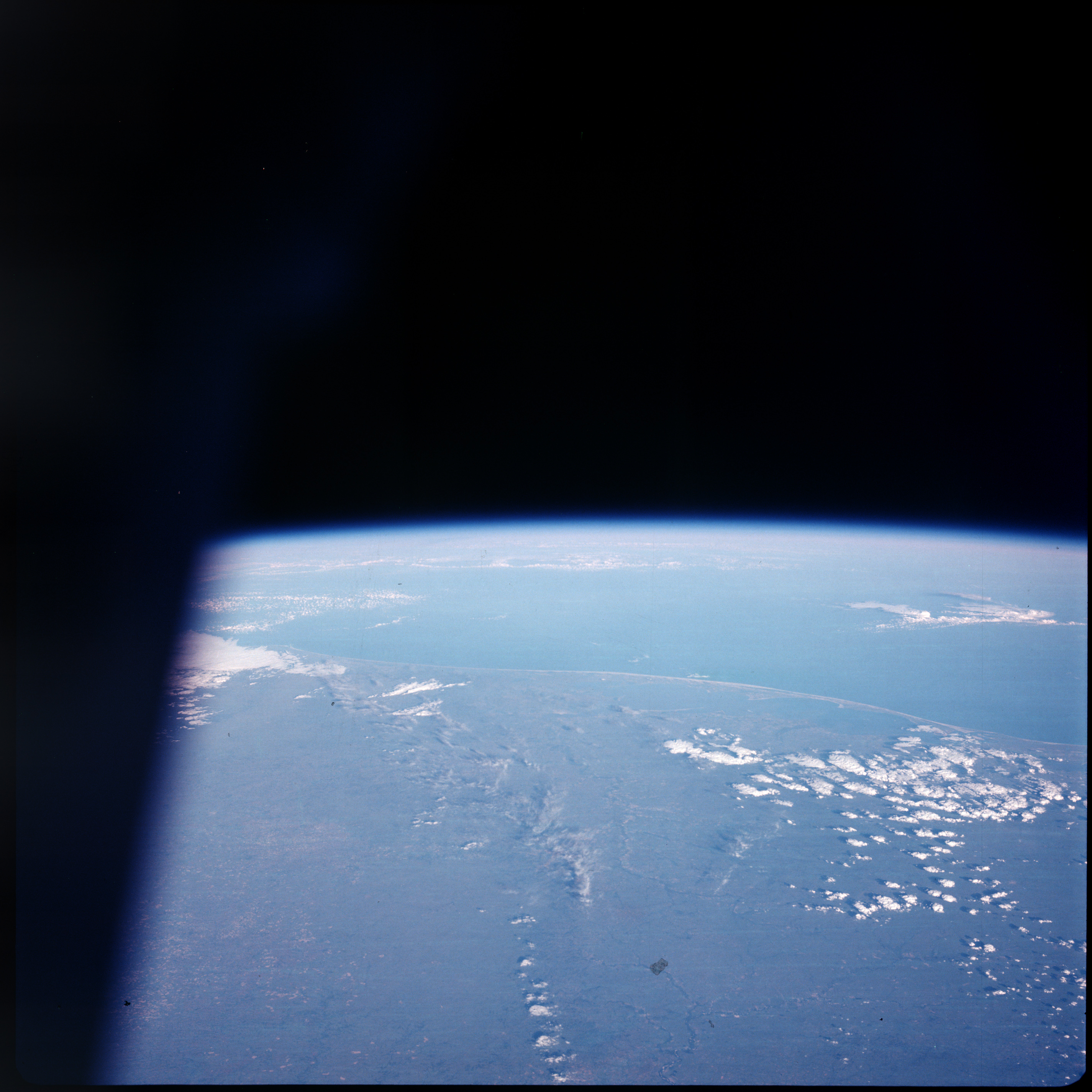 | AS07-08-1941 GEOGRAPHY/CARTOGRAPHY: Porto Alegre, Brazil, South Atlantic Ocean. GEOLOGY/HYDROLOGY: Coastal plain. FORESTRY: Intermittent forest and grassland. METEOROLOGY: Cumulus. Image credit: Image Science and Analysis Laboratory, NASA-Johnson Space Center. |
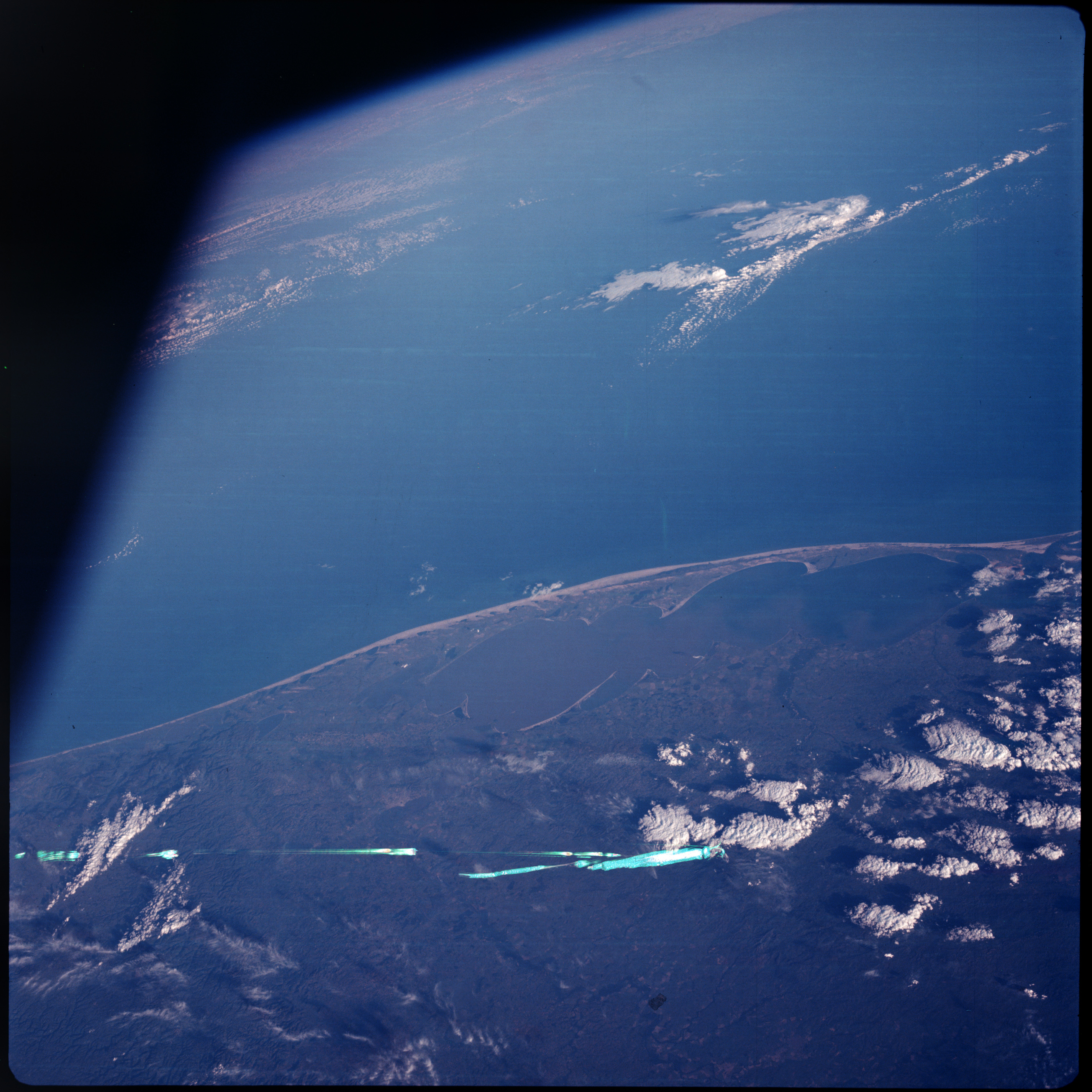 | AS07-08-1942 GEOGRAPHY/CARTOGRAPHY: Porto Alegre, Brazil, South Atlantic Ocean. AGRICULTURE: Some cultivation around Lagoa doa Patos. GEOLOGY/HYDROLOGY: Coastal plain, swamp. : FORESTRY: Low shrubform. METEOROLOGY: Cumulus, cirrus. Image credit: Image Science and Analysis Laboratory, NASA-Johnson Space Center. |
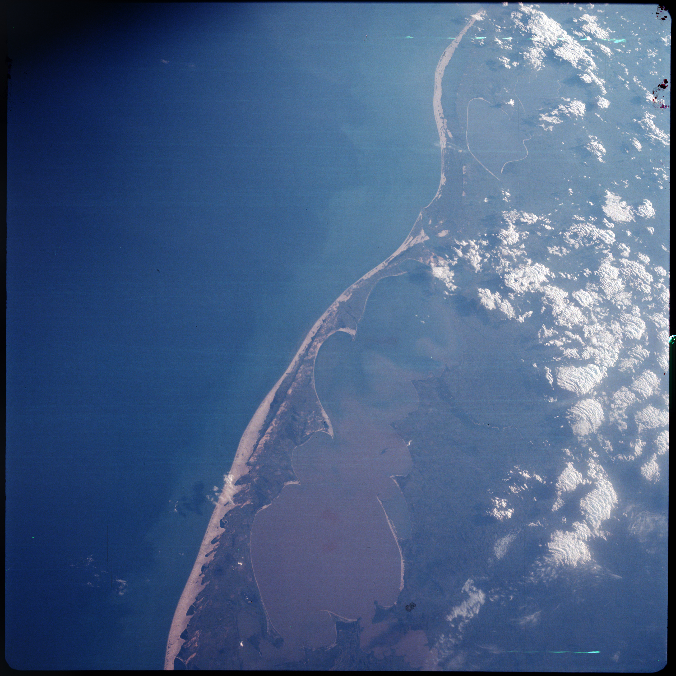 | AS07-08-1943 GEOGRAPHY/CARTOGRAPHY: Porto Alegre, Brazil, South Atlantic Ocean. GEOLOGY/HYDROLOGY: Coastal plain, swamp, sediment flow patterns in lagoon. FORESTRY: Low shrubform. METEOROLOGY: Cumulus, cirrus. OCEANOGRAPHY: Off shore sediment flows. Image credit: Image Science and Analysis Laboratory, NASA-Johnson Space Center. |
|
|
|
| 70-mm magazine S - AS07-07-1738 to 1878 |
Photography Index | 70-mm magazine V - AS07-09-1944 to 1948 |