
 |
 |
 |
| 70-mm magazine N - AS07-04-1558 to 1612 |
Photography Index | 70-mm magazine O - AS07-06-1672 to 1737 |
No copyright is asserted for NASA photographs. If a recognizable person appears in a photo, use for commercial purposes may infringe a right of privacy or publicity. Photos may not be used to state or imply the endorsement by NASA or by any NASA employee of a commercial product, process or service, or used in any other manner that might mislead. Accordingly, it is requested that if a NASA photograph is used in advertising and other commercial promotion, layout and copy be submitted to NASA prior to release. NASA photos reproduced from this archive should include photo credit to "NASA" or "National Aeronautics and Space Administration" and should include scanning credit to the appropriate individuals or agencies as noted in the captions.
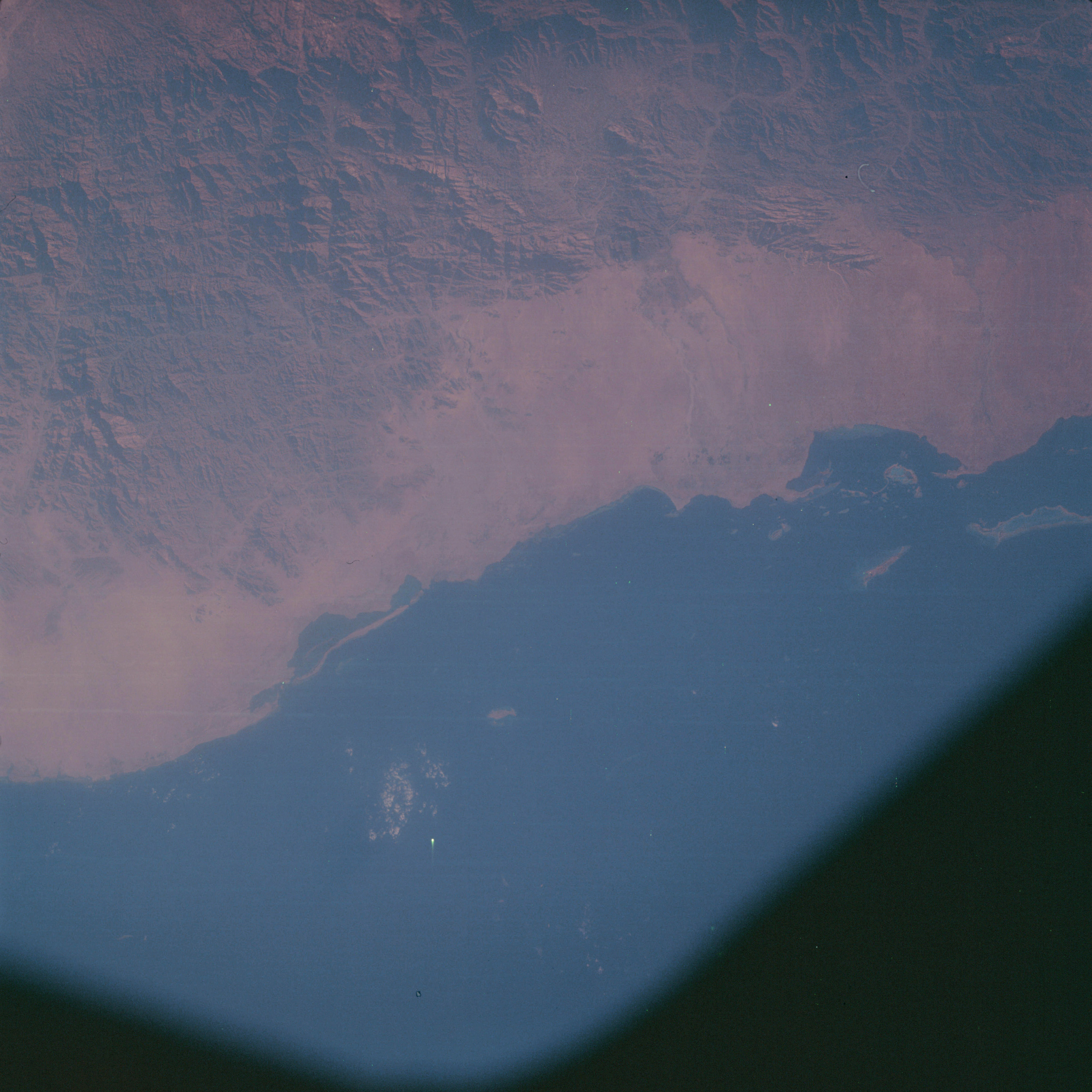 | AS07-05-1613 GEOGRAPHY/CARTOGRAPHY: Saudi Arabia, Red Sea, Coast of Al Lith. AGRICULTURE: Grazing. GEOLOGY/HYDROLOGY: Highly fractured igneous mountain region and an adjacent elevated desert plain. FORESTRY: Scattered low shrubform. OCEANOGRAPHY: Submerged land forms visible. Image credit: Image Science and Analysis Laboratory, NASA-Johnson Space Center. |
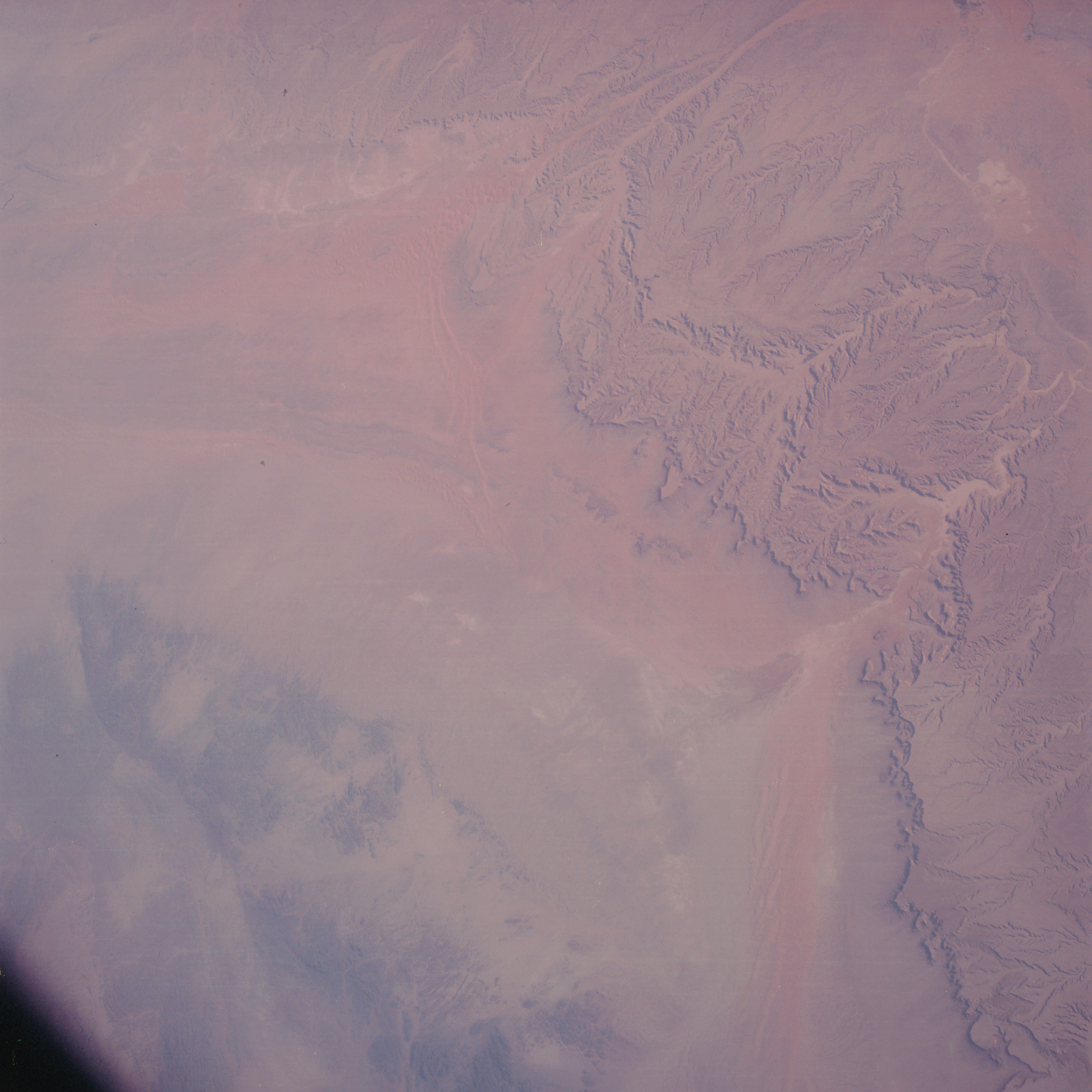 | AS07-05-1614 GEOGRAPHY/CARTOGRAPHY: Saudi Arabia, Jabel Tuwayq, south of Ar Riyad, Marrah. AGRICULTURE: Nomadic herding. ‘GEOLOGY/HYDROLOGY: Dissected sedimentary plateau and erg plain region. Dendritic drainage throughout the plateau. FORESTRY: Scattered low shrubform. Image credit: Image Science and Analysis Laboratory, NASA-Johnson Space Center. |
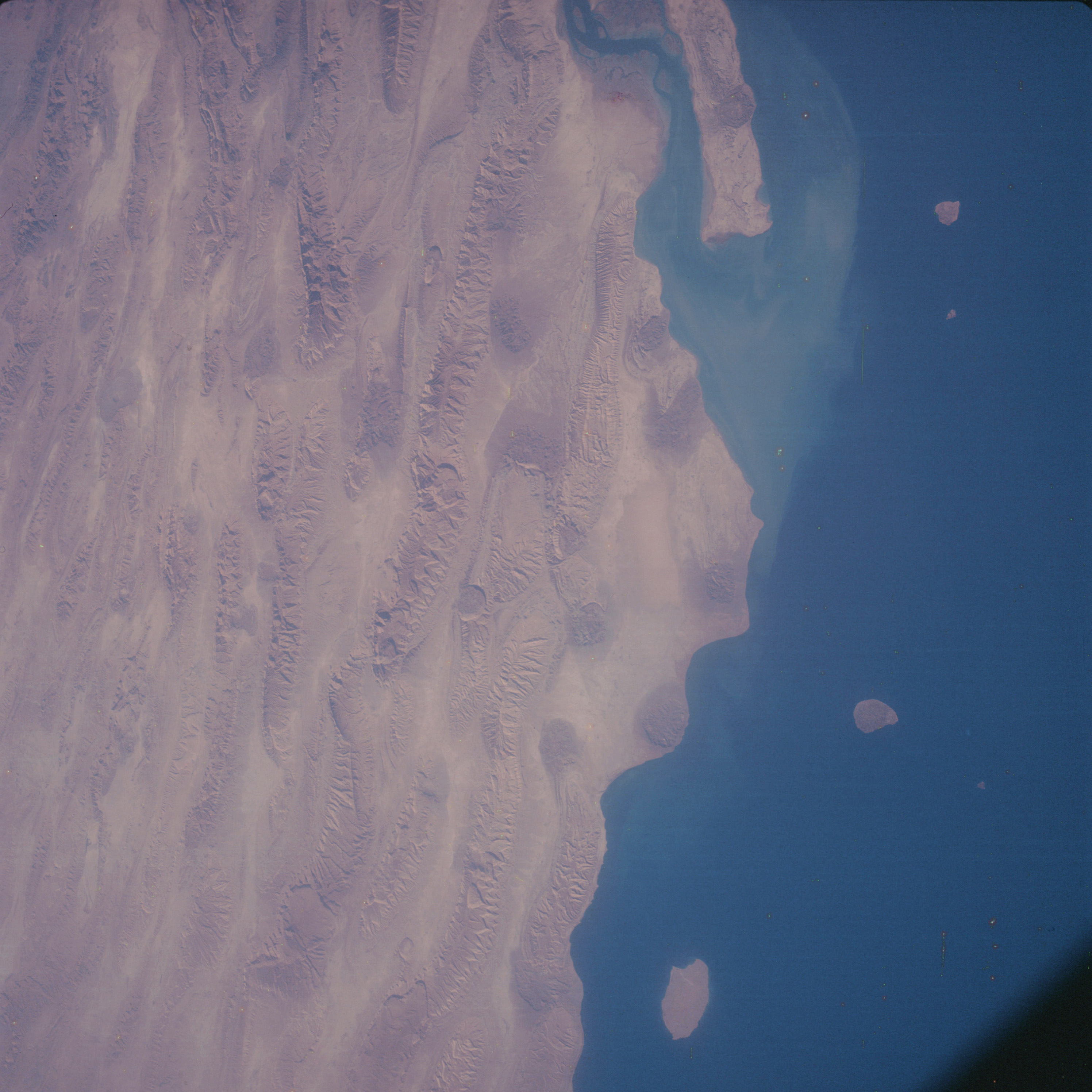 | AS07-05-1615 GEOGRAPHY/CARTOGRAPHY: Southern coast of Iran, Bandarte Lengeh, Qishm Island, Qeys Island. AGRICULTURE: Nomadic herding. GEOLOGY/HYDROLOGY: Highly folded region of anticlines with possible salt plug intrusions. FORESTRY: Grass and low scattered shrubform. OCEANOGRAPHY: Sediment patterns from Rud-l-kul River. Image credit: Image Science and Analysis Laboratory, NASA-Johnson Space Center. |
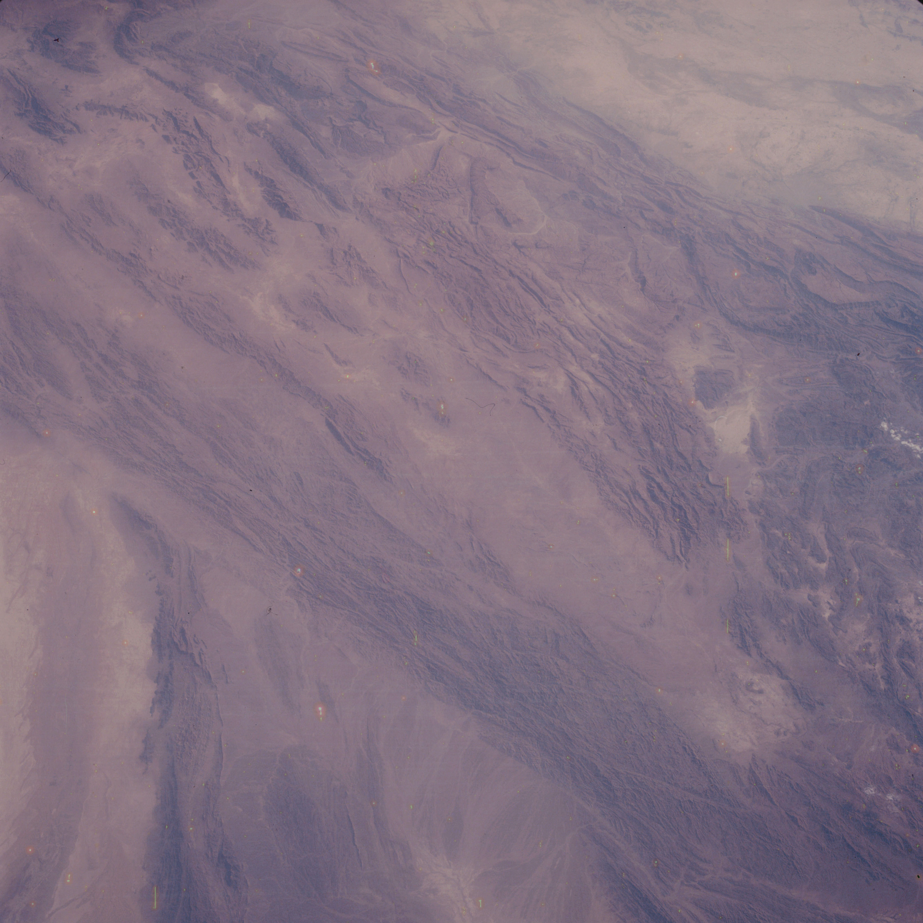 | AS07-05-1616 GEOGRAPHY/CARTOGRAPHY: Pakistan, Kirthar and Makran Ranges, Quetta. GEOLOGY/HYDROLOGY: Folded and fractured mountainous region. FORESTRY: Intermittent grasslands. Image credit: Image Science and Analysis Laboratory, NASA-Johnson Space Center. |
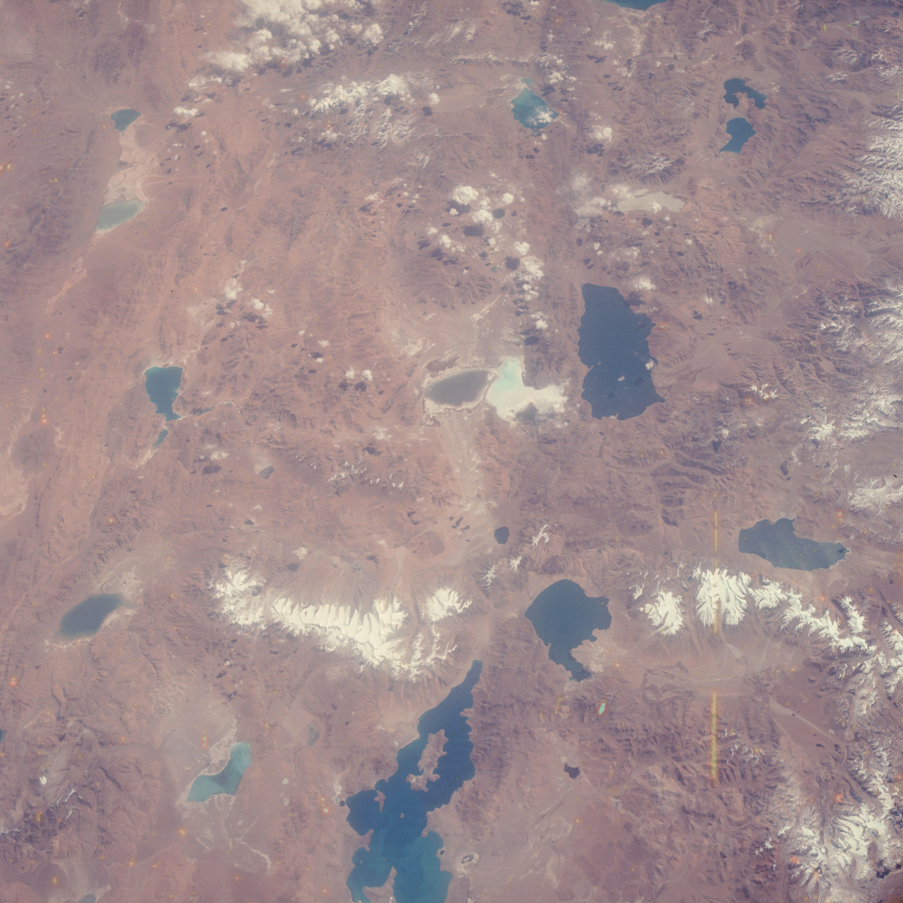 | AS07-05-1617 GEOGRAPHY/CARTOGRAPHY: Tibet, Ngangiaring Tsho Lake, Tarok Taho Lake. GEOLOGY/HYDROLOGY: Complex hills and mountains of Tibet Plateau. METEOROLOGY: Cumulus, alto-cumulus. Image credit: Image Science and Analysis Laboratory, NASA-Johnson Space Center. |
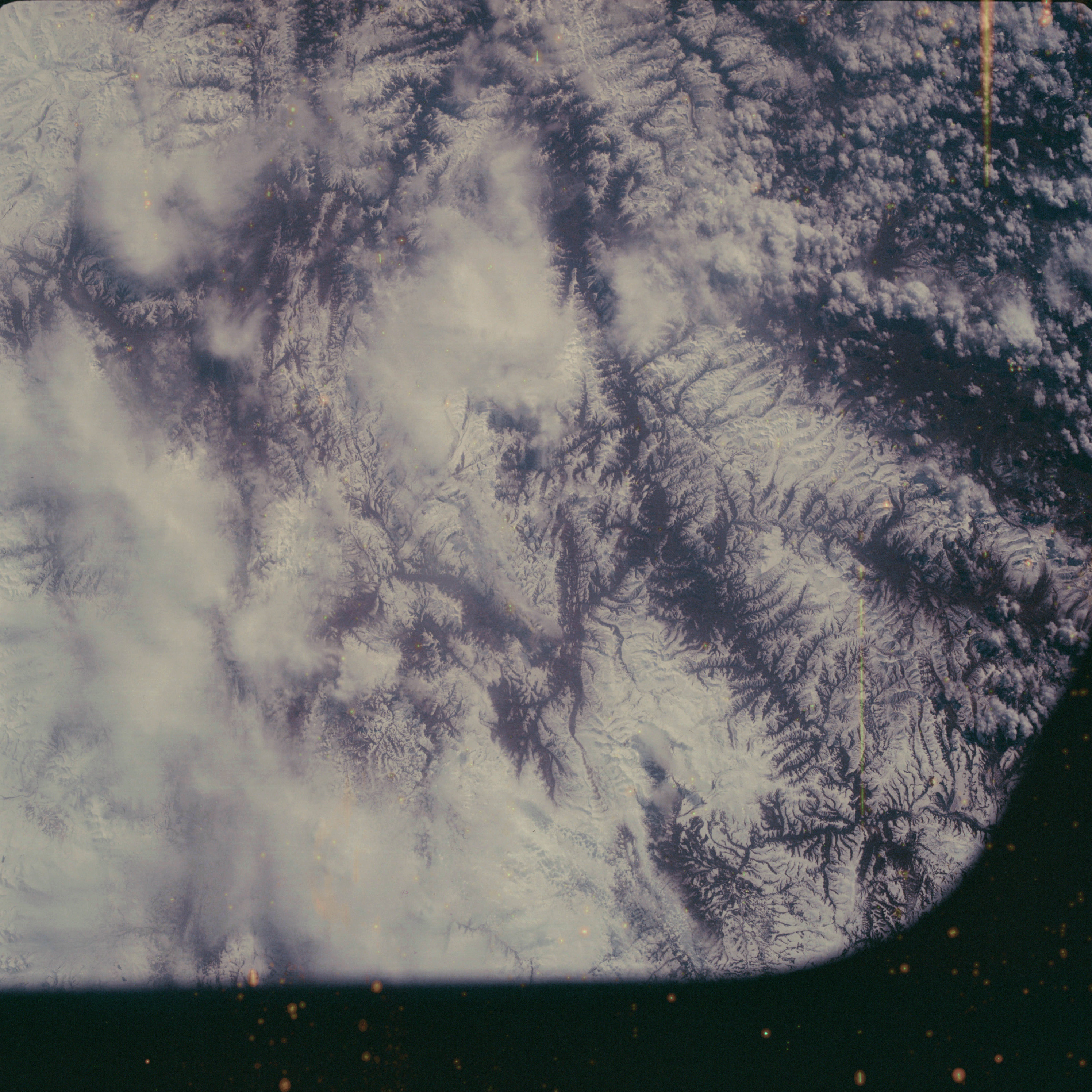 | AS07-05-1618 GEOGRAPHY/CARTOGRAPHY: Tibet, Himalayas. (Dark) GEOLOGY/HYDROLOGY: Complex mountainous region. METEOROLOGY: Cirrus, alto-cumulus. Image credit: Image Science and Analysis Laboratory, NASA-Johnson Space Center. |
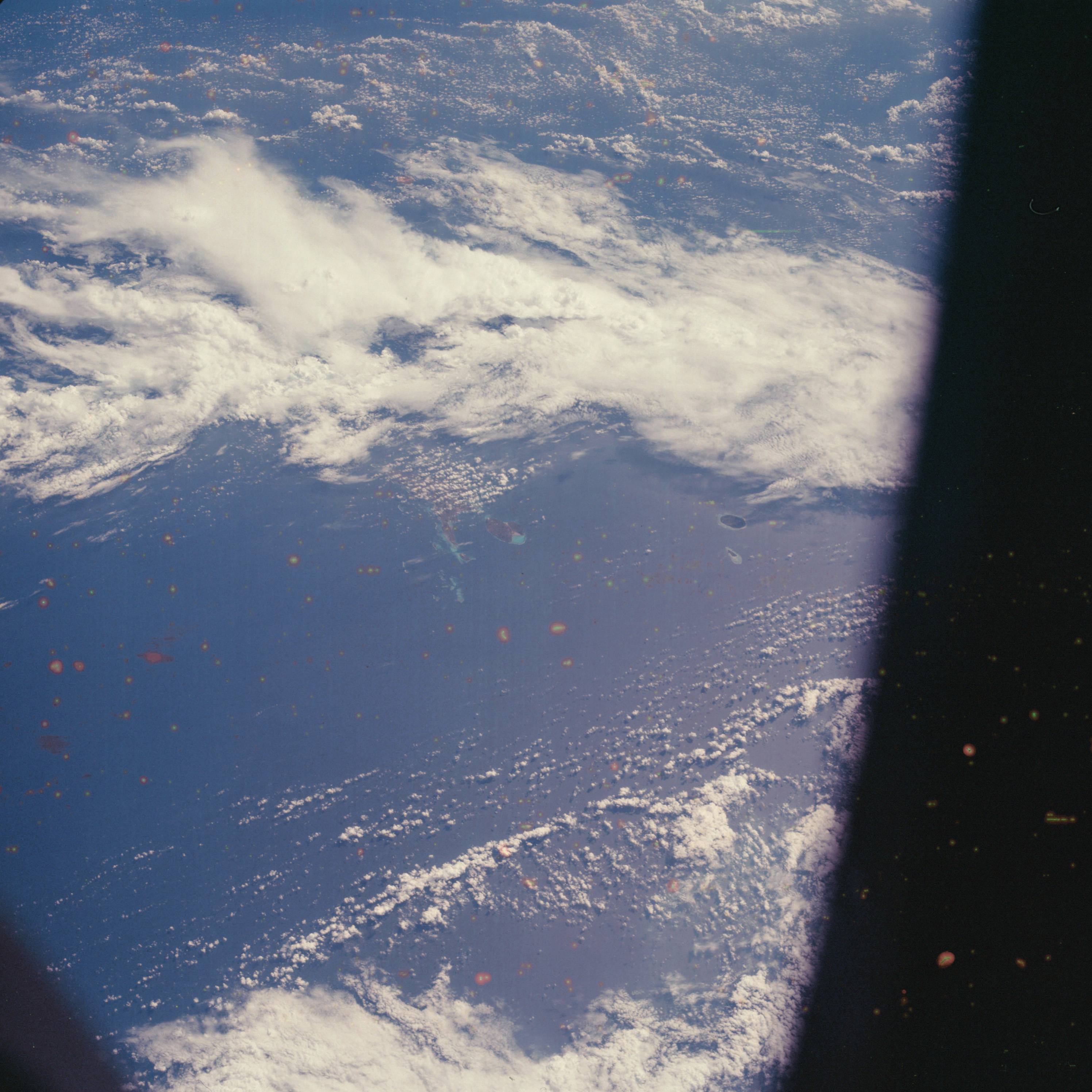 | AS07-05-1619 GEOGRAPHY/CARTOGRAPHY: Ryukyu Island, Tarama, Irabtu, Miyako GEOLOGY/HYDROLOGY: Marine coral deposits. METEOROLOGY: Cumulus, alto-cumulus, cirrus. OCEANOGRAPHY: Island atolls. Image credit: Image Science and Analysis Laboratory, NASA-Johnson Space Center. |
 | AS07-05-1620 GEOGRAPHY/CARTOGRAPHY: Niger, Grand Erg sand dunes. (Dark) GEOLOGY; Linear Self Dune Plain Region of the Sahara. Image credit: Image Science and Analysis Laboratory, NASA-Johnson Space Center. |
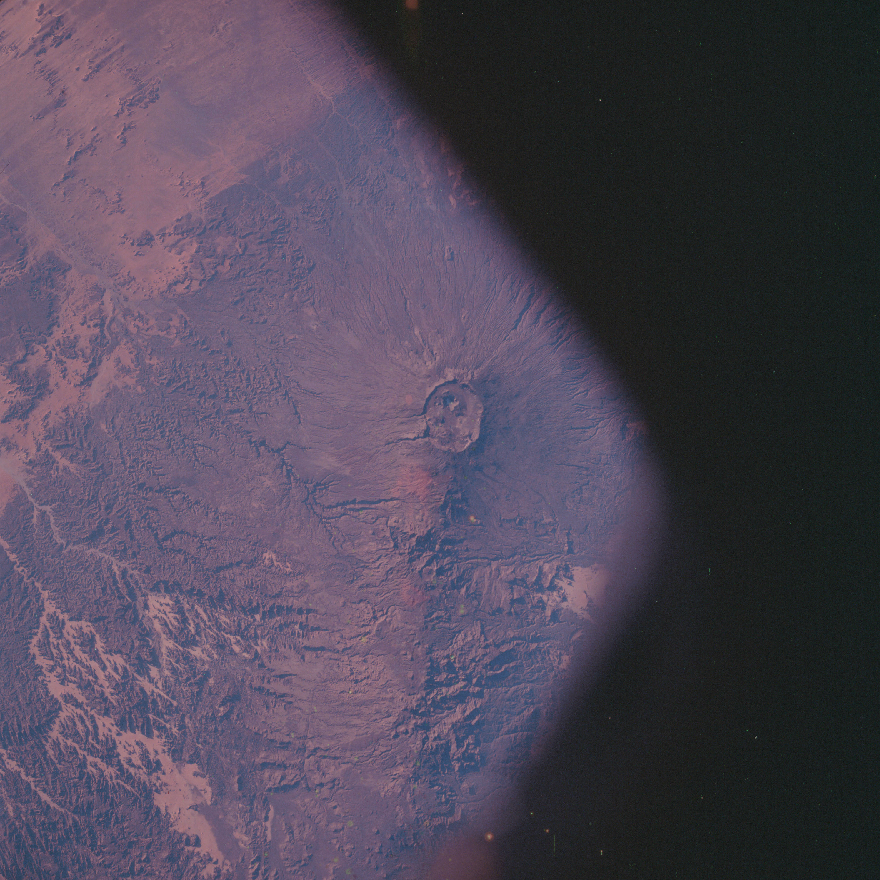 | AS07-05-1621 GEOGRAPHY/CARTOGRAPHY: Chad, Tibesti Mountains, Emi Koussi volcano. (Dark) GEOLOGY/HYDROLOGY: Volcanic mountains of basalt in the Sahara, Image credit: Image Science and Analysis Laboratory, NASA-Johnson Space Center. |
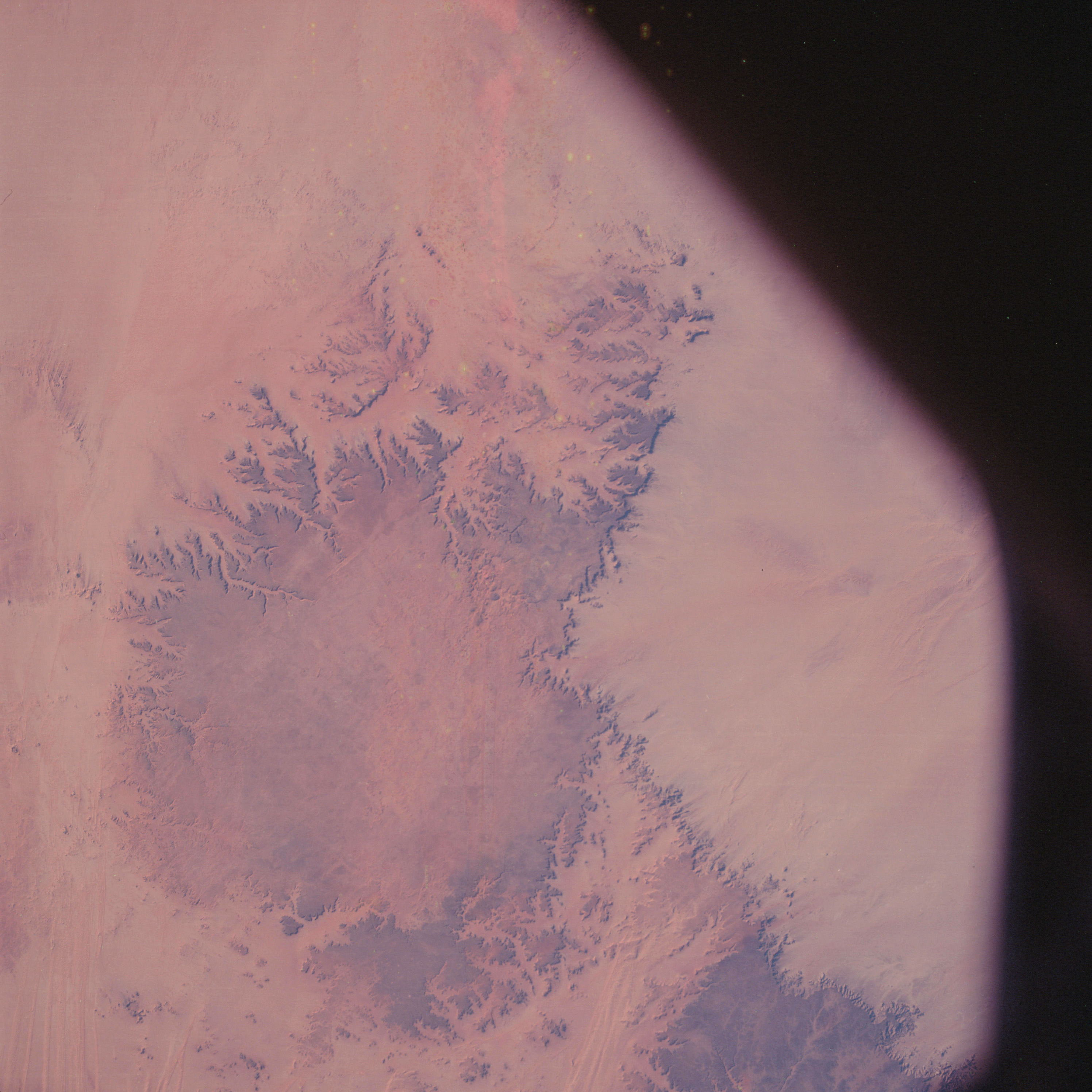 | AS07-05-1622 GEOGRAPHY/CARTOGRAPHY: United Arab Republic, Gilf Kabar Plateau. (Dark) GEOLOGY/HYDROLOGY: Sedimentary plateau elevated above the erg plains. Image credit: Image Science and Analysis Laboratory, NASA-Johnson Space Center. |
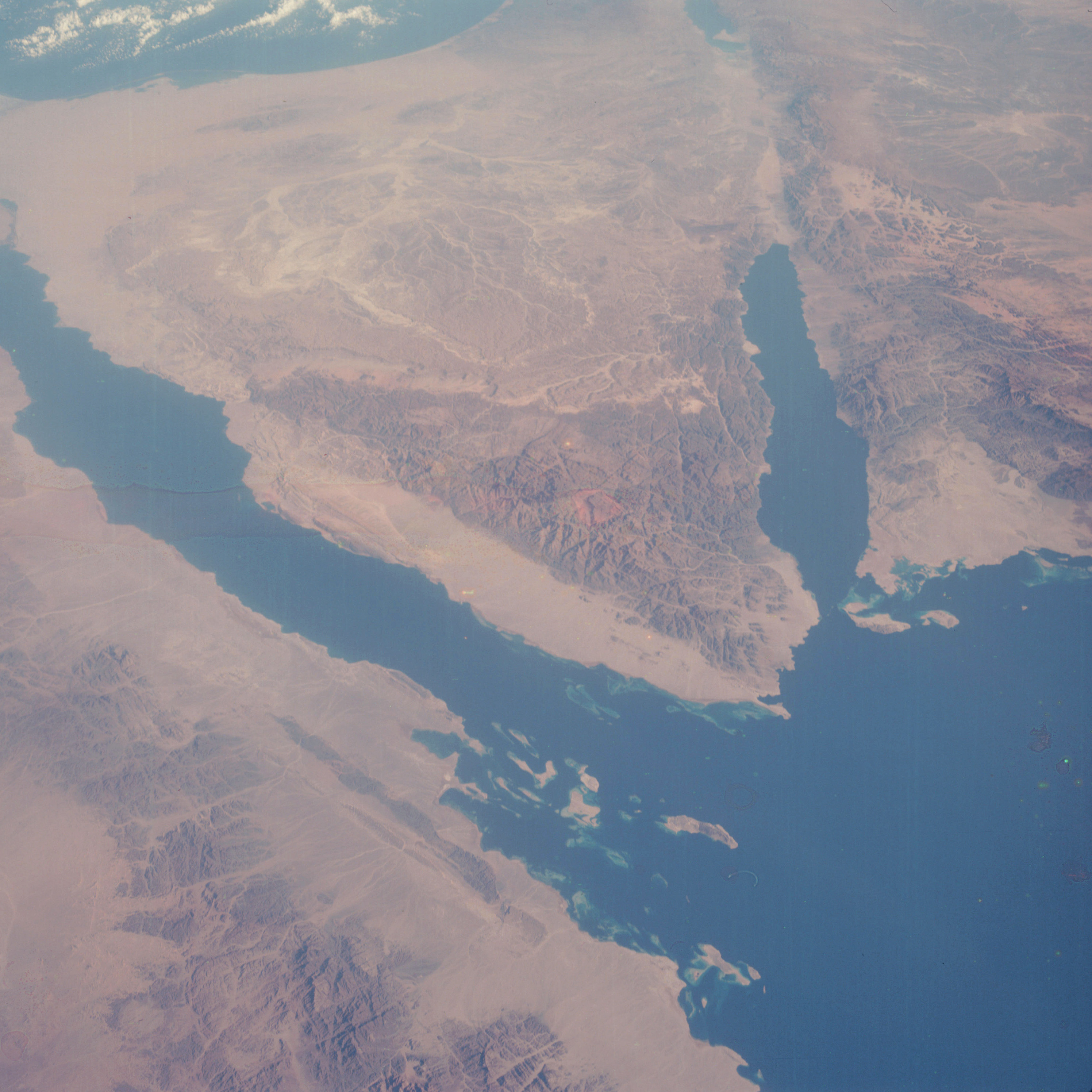 | AS07-05-1623 GEOGRAPHY/CARTOGRAPHY: Sinai Peninsula, Red Sea, Gulf of Suez, Gulf of Aqaba. GEOLOGY/HYDROLOGY: Fractured mountainous granitic region, and coastal erg plains. OCEANOGRAPHY: Coral reef buildup and sedimentation along the coast. Image credit: Image Science and Analysis Laboratory, NASA-Johnson Space Center. |
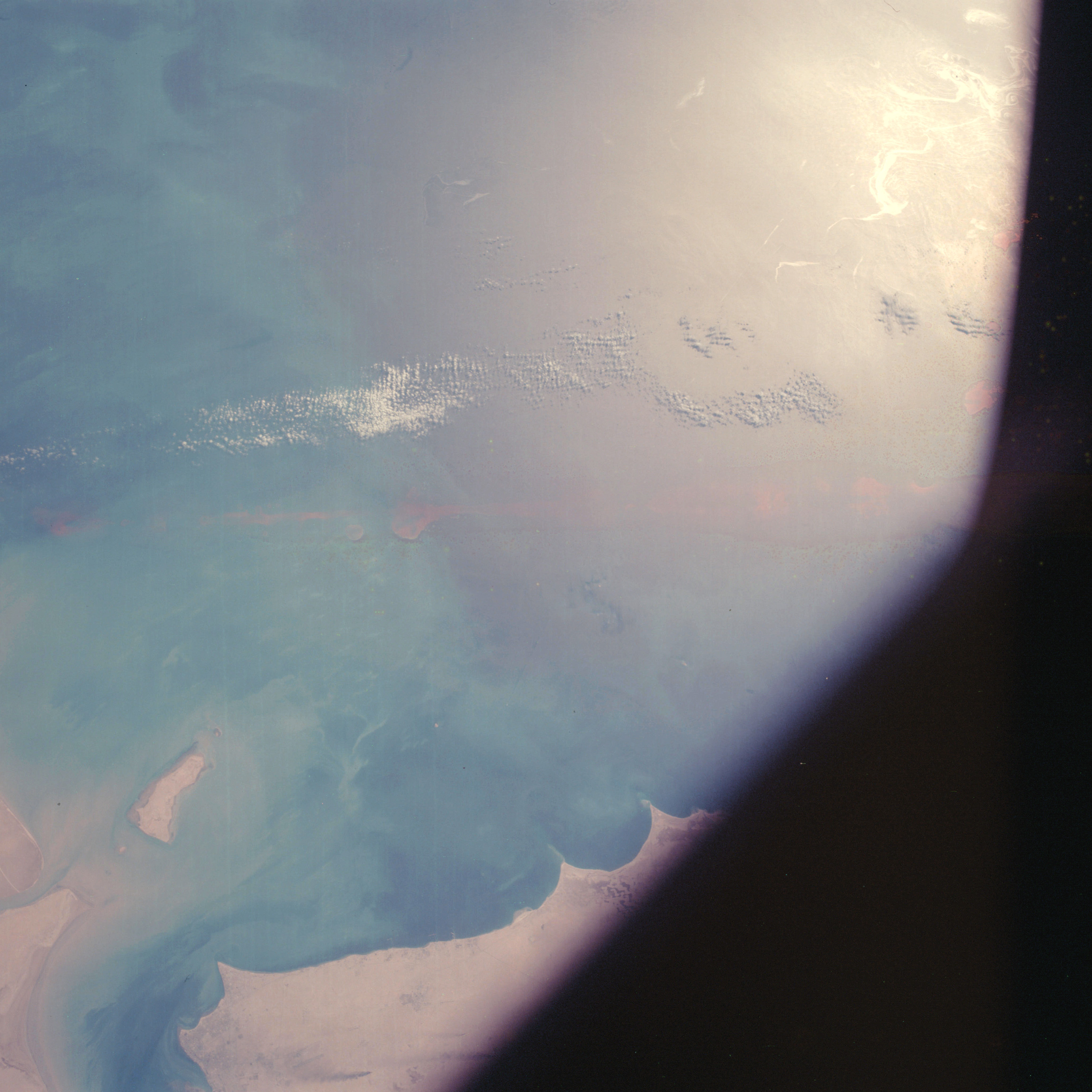 | AS07-05-1624 GEOGRAPHY/CARTOGRAPHY: Kuwait, Persian Gulf coast, Failaka Island. AGRICULTURE: Dry land cultivation along coast. GEOLOGY/HYDROLOGY: Coastal Plain and sedimentation deposits, METEOROLOGY: Cumulus. OCEANOGRAPHY: Fresh-salt water interface, current patterns showing sediment flows, sun glint. Image credit: Image Science and Analysis Laboratory, NASA-Johnson Space Center. |
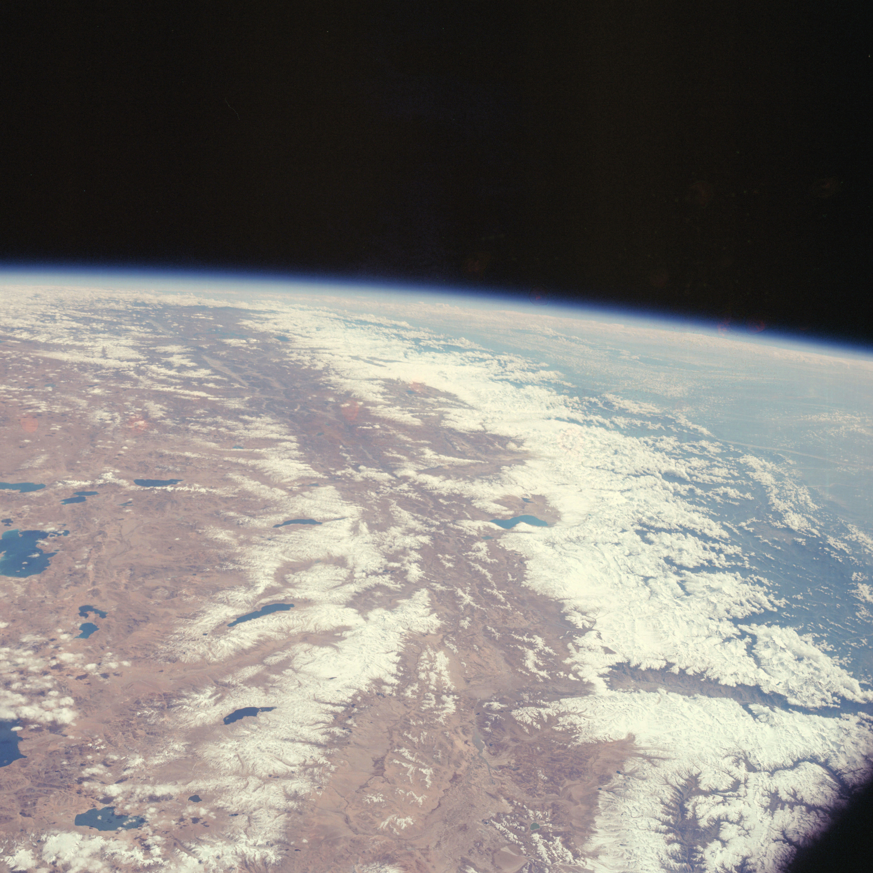 | AS07-05-1625 GEOGRAPHY/CARTOGRAPHY: Nepal, Tibet, India, Ganges Plain. GEOLOGY/HYDROLOGY: Mountainous region of basement complex bounded by a sedimentary plain. METEOROLOGY: Alto-cumulus. Image credit: Image Science and Analysis Laboratory, NASA-Johnson Space Center. |
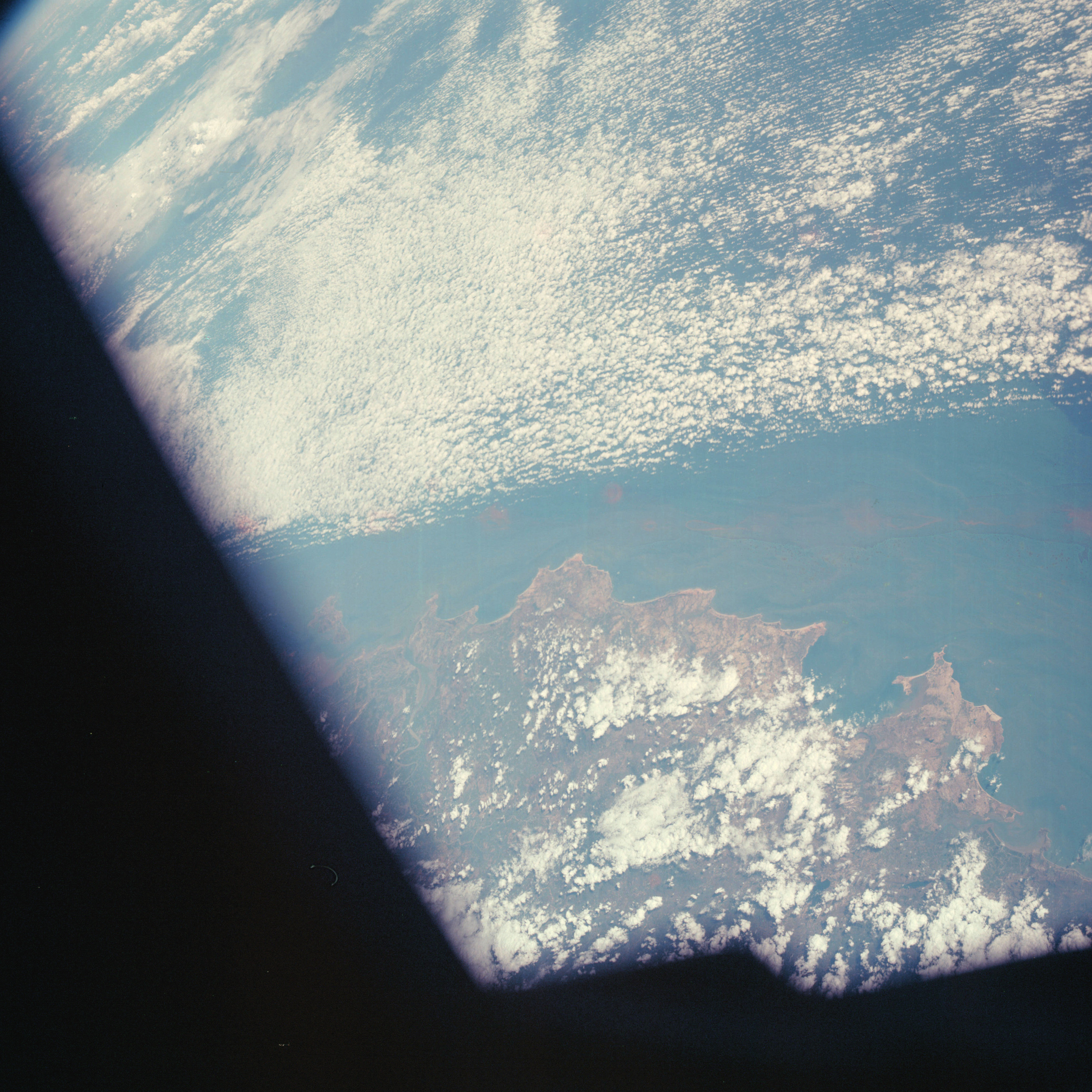 | AS07-05-1626 GEOGRAPHY/CARTOGRAPHY: China, Han River, Shan-T'Oli. AGRICULTURE: Irrigated subsistence. GEOLOGY/HYDROLOGY: Submerged coastline, dissected hills and mountains of complex structure. FORESTRY: Intermittent evergreen forests. METEOROLOGY: Cumulus, strato-cumulus. OCEANOGRAPHY: Fresh-salt water interfaces, sediment flow patterns. Image credit: Image Science and Analysis Laboratory, NASA-Johnson Space Center. |
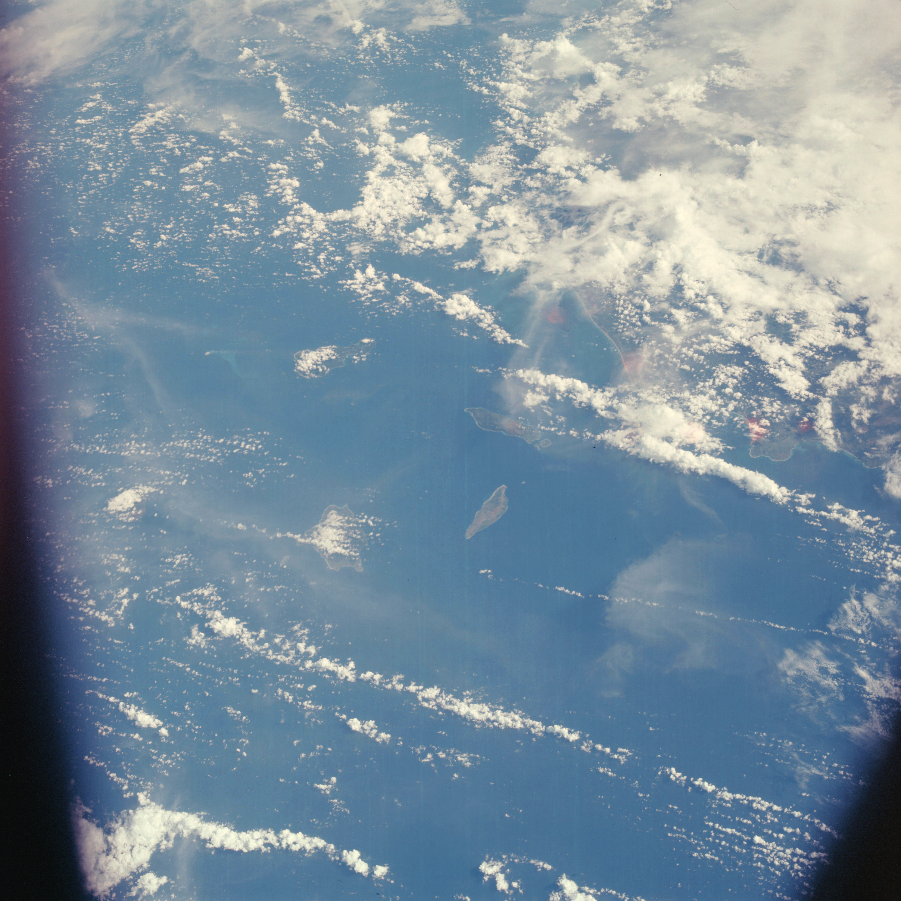 | AS07-05-1627 GEOGRAPHY/CARTOGRAPHY: Philippine Island, north Luzon coast, Babuyan Island, Luzon Strait. GEOLOGY/HYDROLOGY: Complex hill structure and volcanic islands. FORESTRY: Scattered tropical hardwood forests. METEOROLOGY: Cumulus, alto-cumulus. OCEANOGRAPHY: Well developed beaches, some water tonal differences. Image credit: Image Science and Analysis Laboratory, NASA-Johnson Space Center. |
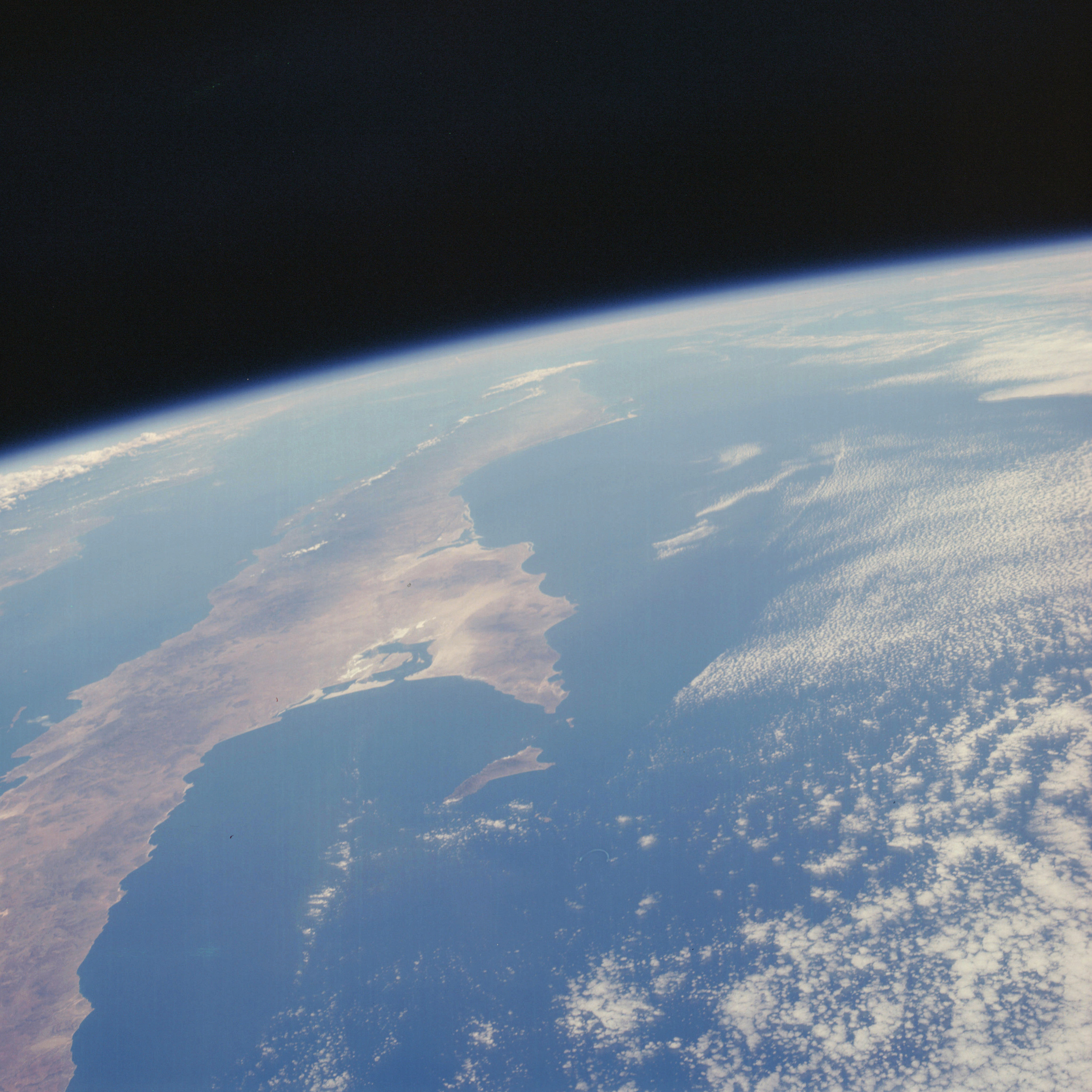 | AS07-05-1628 GEOGRAPHY/CARTOGRAPHY: Baja California, Gulf of California, western coast of Mexico. GEOLOGY/HYDROLOGY: Coastal plain deposits and dissected hilis and mountains. METEOROLOGY: Cumulus. OCEANOGRAPHY: Faint tonal changes. Image credit: Image Science and Analysis Laboratory, NASA-Johnson Space Center. |
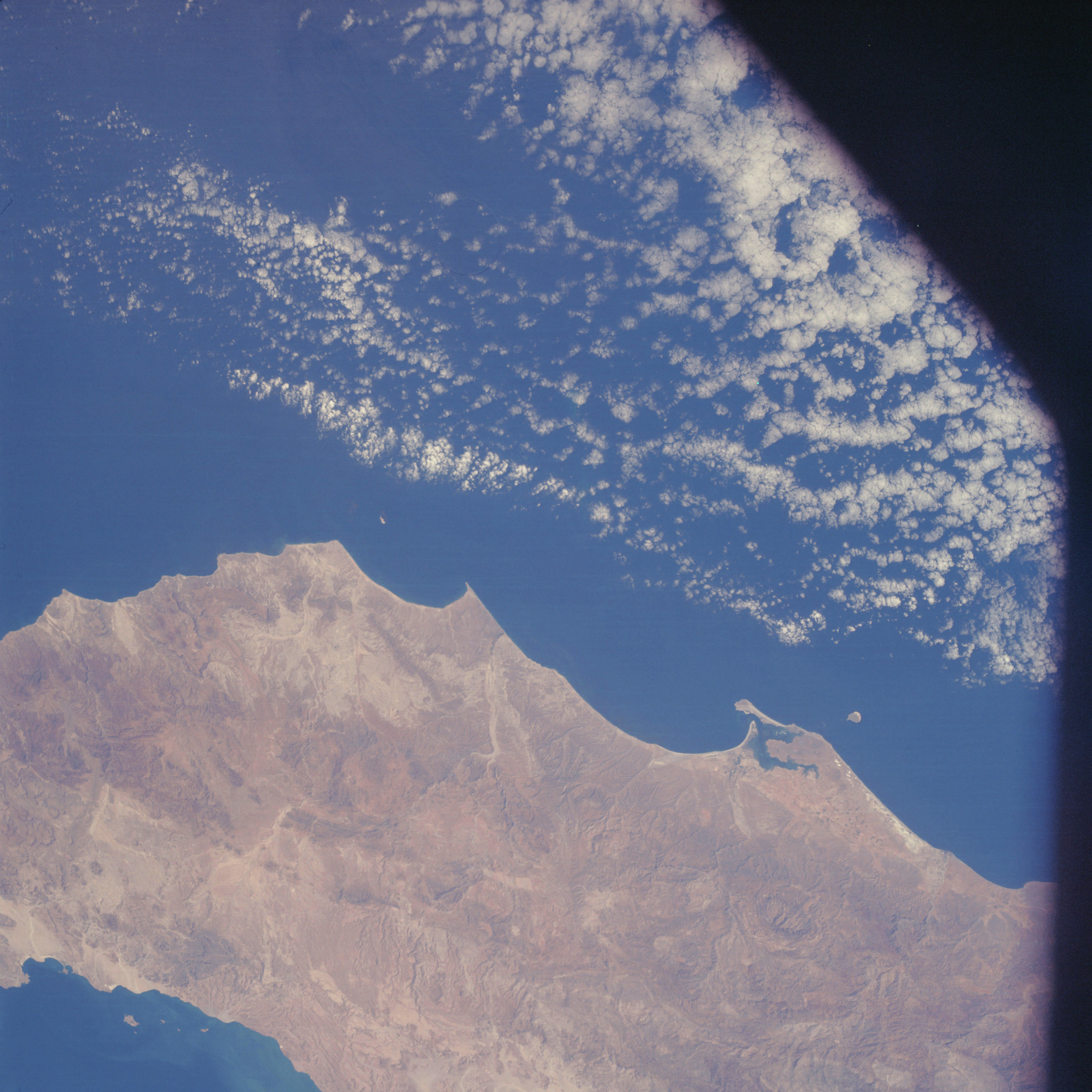 | AS07-05-1629 GEOGRAPHY/CARTOGRAPHY: Baja California, Bahia San Quintin. AGRICULTURE: Cultivation patterns apparent along western coast. GEOLOGY/HYDROLOGY: Folded and basement complex hill and mountainous region. Intermittent dendritic drainages. FORESTRY: Scattered desert shrubform. METEOROLOGY: Cumulus, towering-cumulus. OCEANOGRAPHY: Tonal changes along eastern coast. Image credit: Image Science and Analysis Laboratory, NASA-Johnson Space Center. |
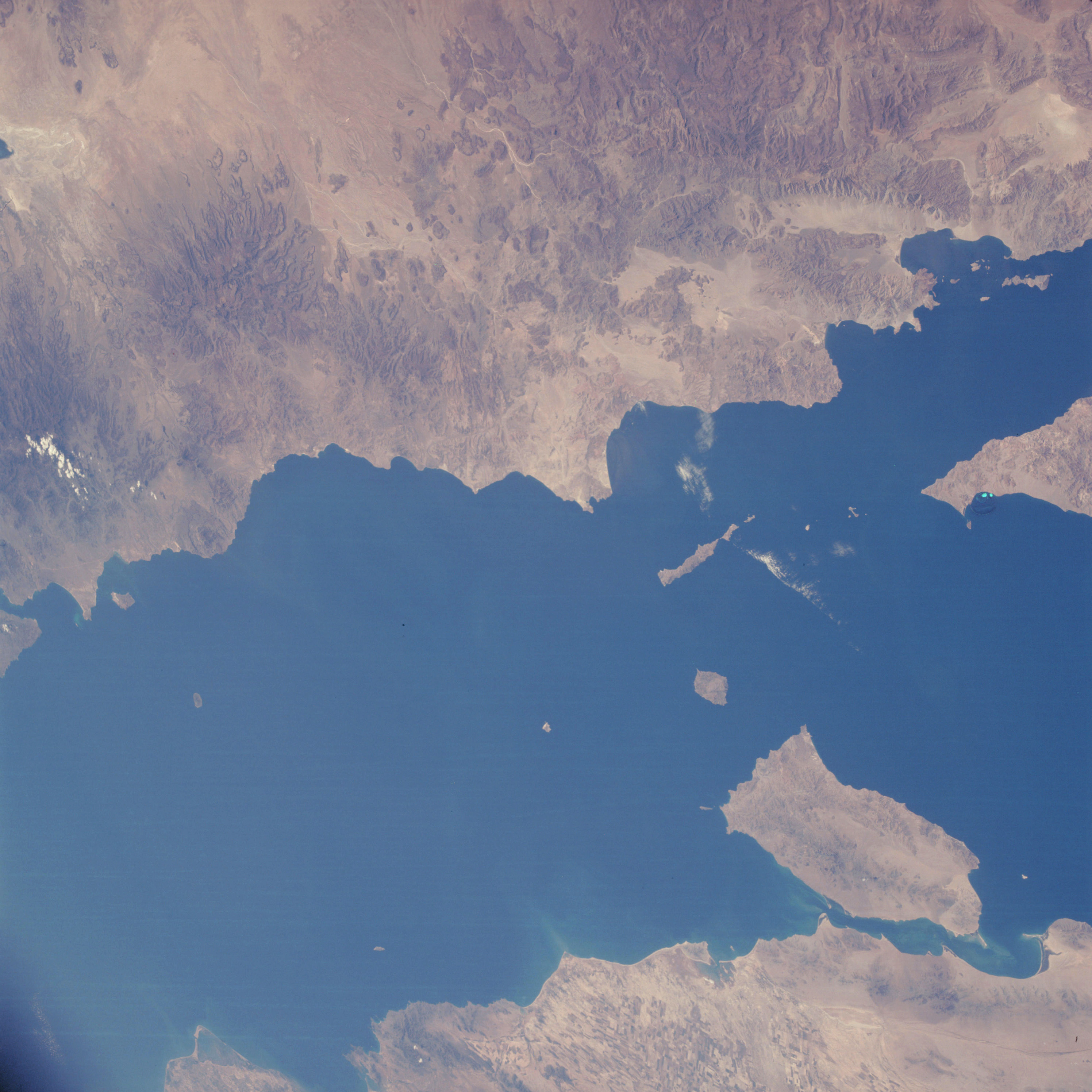 | AS07-05-1630 GEOGRAPHY/CARTOGRAPHY: Baja California, Gulf of California, Mexico, Tiburon Island. AGRICULTURE: Extensive cultivation along Sonora River delta. GEOLOGY/HYDROLOGY: Complex and volcanic hills and mountains, with coastal and alluvial plains. FORESTRY: Scattered desert shrubform. OCEANOGRAPHY: Current patterns along Mexican coast. Image credit: Image Science and Analysis Laboratory, NASA-Johnson Space Center. |
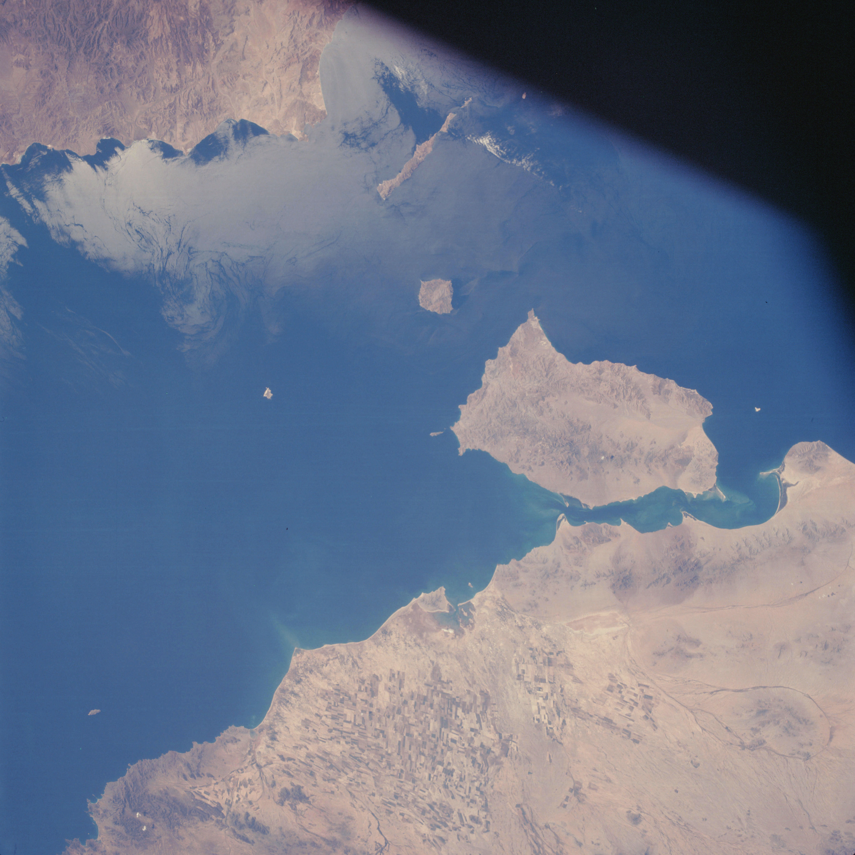 | AS07-05-1631 GEOGRAPHY/CARTOGRAPHY: West coast of Mexico, Gulf of California, Tiburan Island. AGRICULTURE: Extensive cultivation along Sonora River Delta. . GEOLOGY/HYDROLOGY: Deltaic, coastal and alluvial plains with complex hills distributed throughout. FORESTRY: Scattered desert shrubform. OCEANOGRAPHY: Sun glint showing surface currents. Image credit: Image Science and Analysis Laboratory, NASA-Johnson Space Center. |
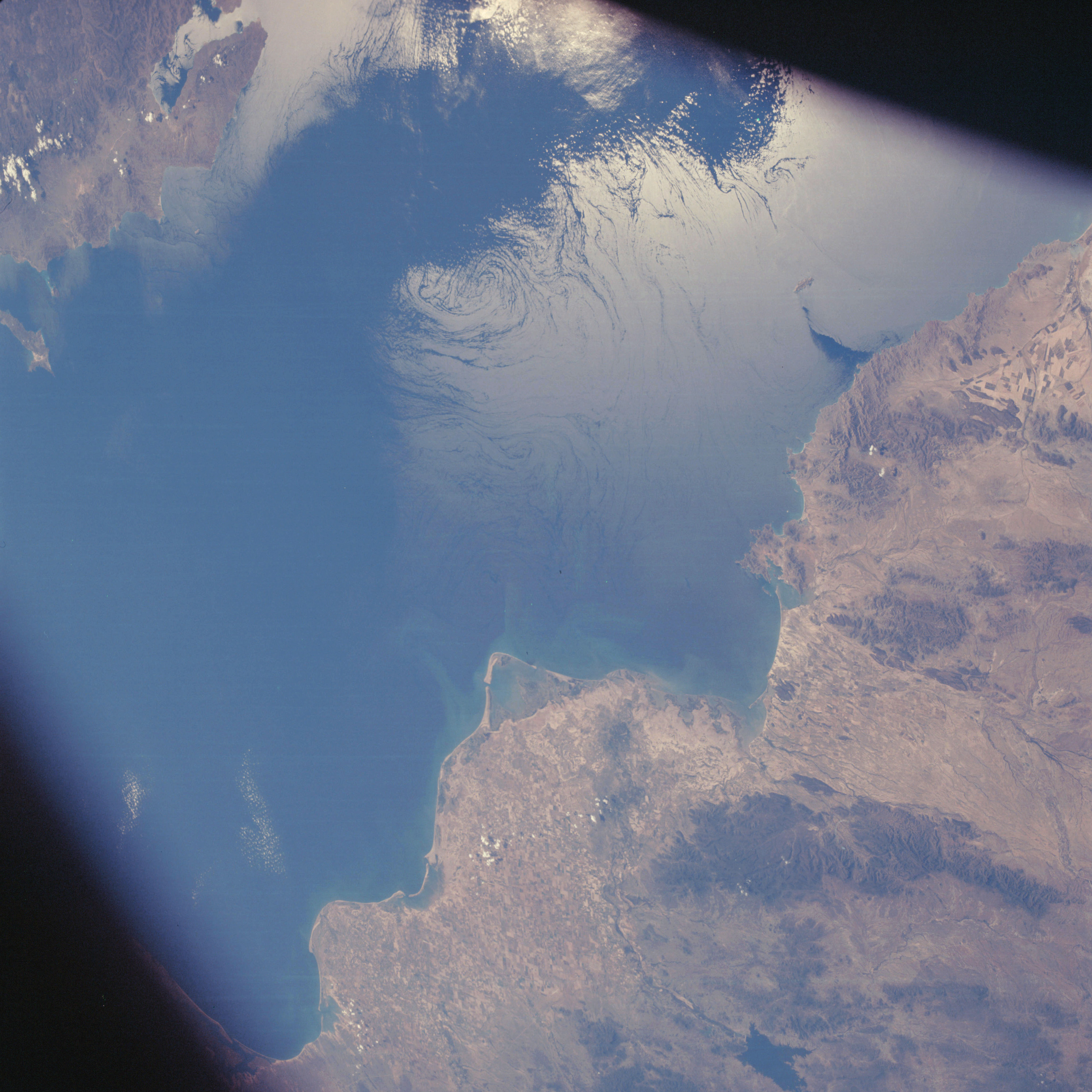 | AS07-05-1632 GEOGRAPHY/CARTOGRAPHY: Western Coast of Mexico, Gulf of California. AGRICULTURE: Extensive cultivation along coast, prominent field patterns. GEOLOGY/HYDROLOGY: Deltaic coastal plains and complex hills and mountains. FORESTRY: Scattered desert shrubform, with evergreens at higher elevations. OCEANOGRAPHY: Prominent sun glint revealing surface current patterns. Image credit: Image Science and Analysis Laboratory, NASA-Johnson Space Center. |
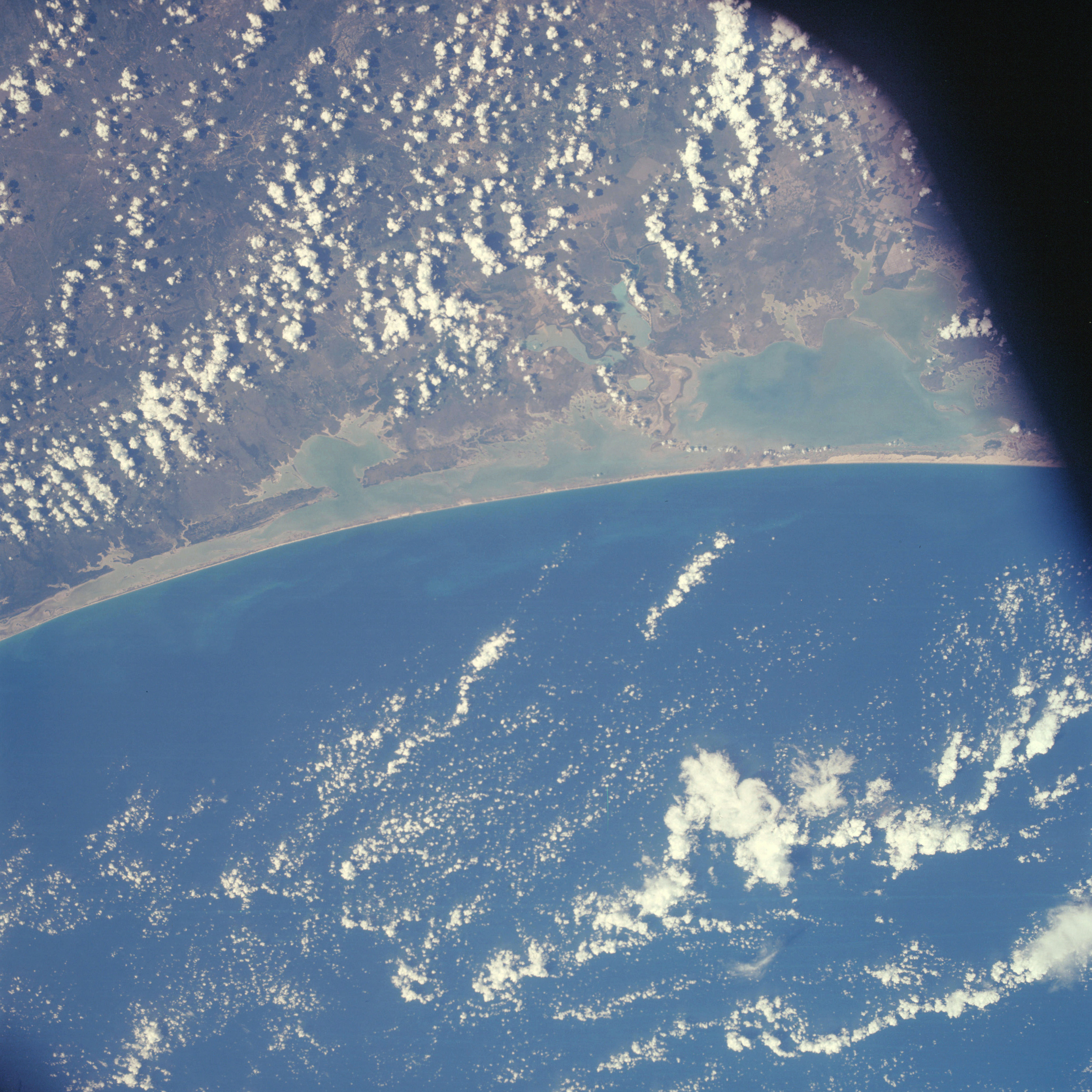 | AS07-05-1633 GEOGRAPHY/CARTOGRAPHY: Mexico, Lower Texas Gulf Coast, Laguna Madre, Gulf of Mexico, San Fernando. AGRICULTURE: Extensive cultivation along northern coast. GEOLOGY/HYDROLOGY : Shoreline of emergence with an offshore bar and lagoon. FORESTRY: Scattered to dense shrubform, coastal grasses. METEOROLOGY: Cumulus, towering cumulus. OCEANOGRAPHY: Well developed beaches, inner coastal lagoon depths evident by color contrast. Some offshore current patterns apparent. Image credit: Image Science and Analysis Laboratory, NASA-Johnson Space Center. |
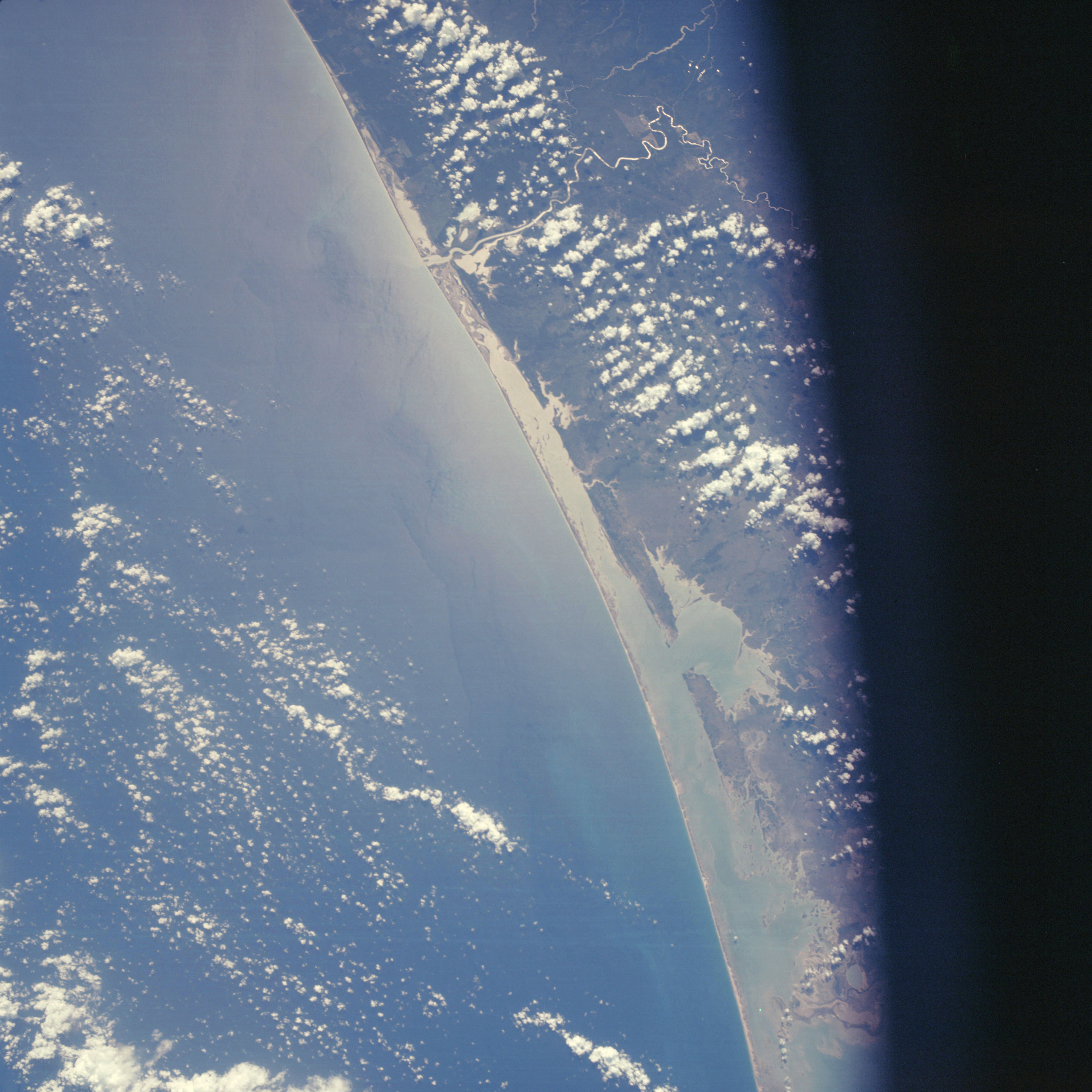 | AS07-05-1634 GEOGRAPHY/CARTOGRAPHY: Mexico, Laguna Madre, Laguna de Morales, Soto la Marina River, Gulf Coast. AGRICULTURE: Isolated field patterns primarily along Soto River and coast. GEOLOGY/HYDROLOGY : Shoreline of emergence with an offshore bar and lagoon. FORESTRY: Coastal grasses with scattered shrubform. METEOROLOGY: Cumulus. OCEANOGRAPHY: Well developed beaches, sun glint exposing surface wave and current patterns. Image credit: Image Science and Analysis Laboratory, NASA-Johnson Space Center. |
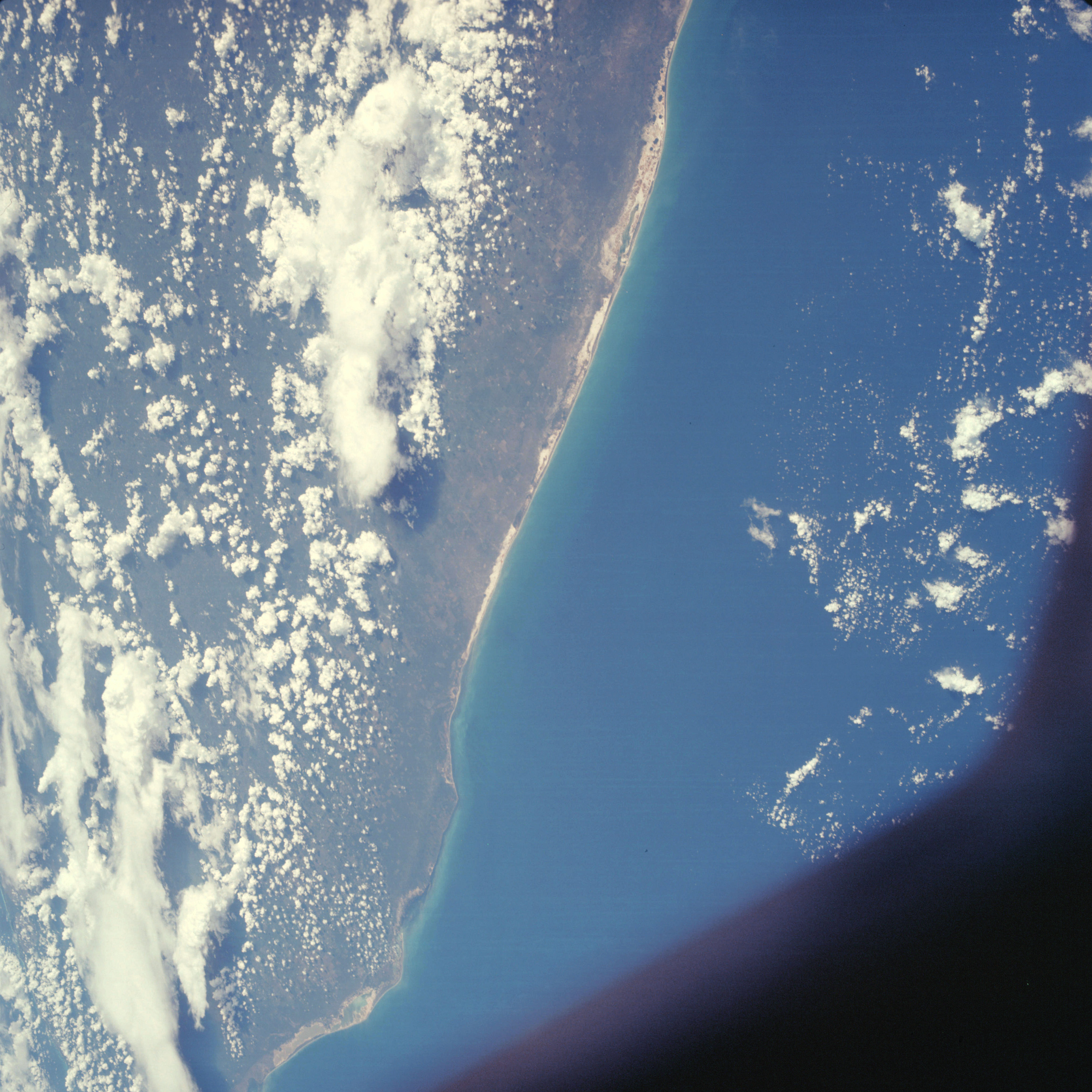 | AS07-05-1635 GEOGRAPHY/CARTOGRAPHY: Mexico, northern coast of Yucatan, Merida, Gulf of Mexico, Progreso. AGRICULTURE: Extensive cultivation patterns along coast at Progreso and inland to Merida. GEOLOGY/HYDROLOGY: Emerged coastline and coastal plain deposits. FORESTRY: Grasses with scattered shrubform. METEOROLOGY: Cumulus, alto-cumulus. OCEANOGRAPHY: Some surface current activity apparent along coast. Image credit: Image Science and Analysis Laboratory, NASA-Johnson Space Center. |
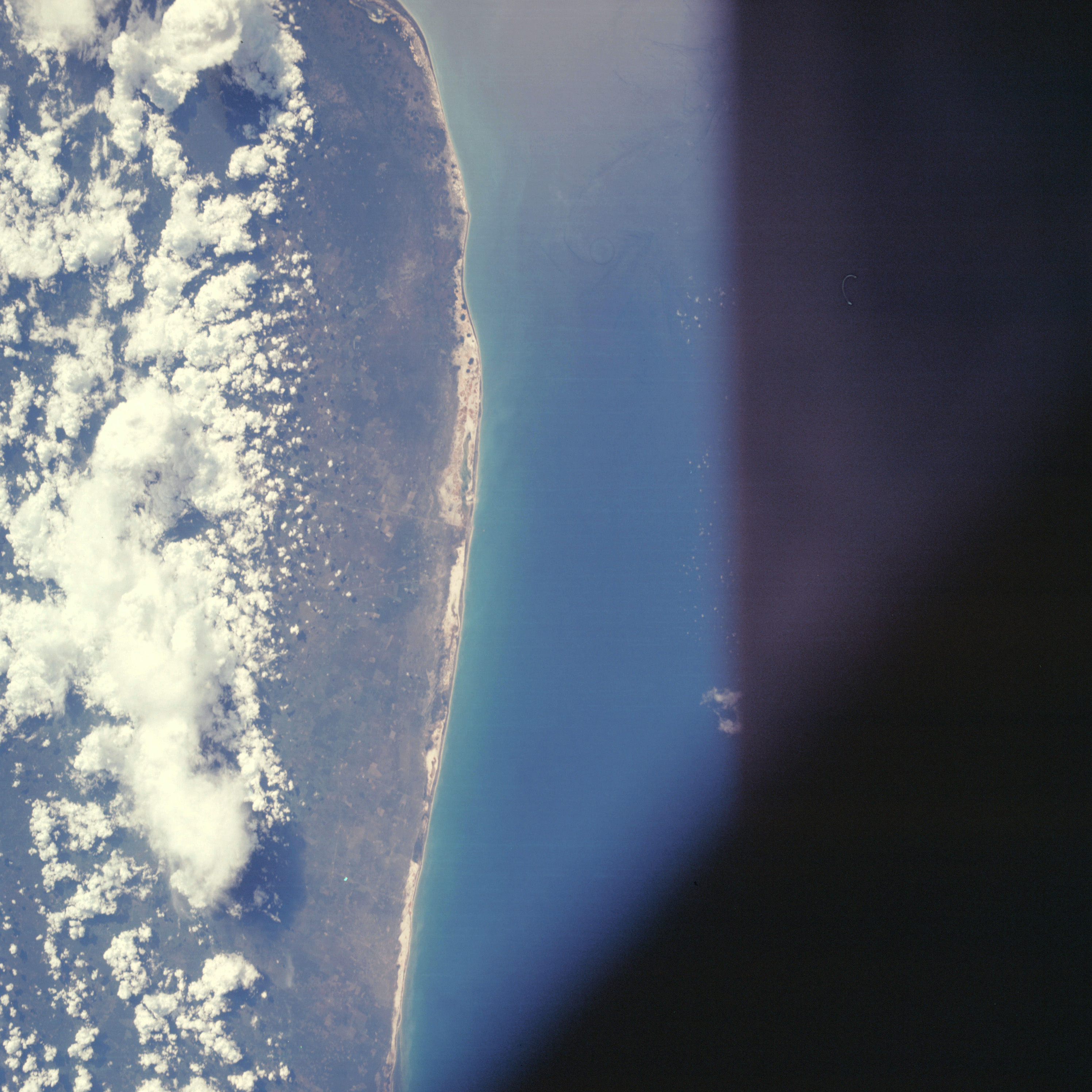 | AS07-05-1636 GEOGRAPHY/CARTOGRAPHY: Mexico, northern coast of Yucatan, Merida, Gulf of Mexico. AGRICULTURE: Extensive field pattern development along coast. GEOLOGY/HYDROLOGY: Emerged coastline and coastal plain deposits. FORESTRY: Grasses and low shrubform. METEOROLOGY: Cumulus, cumulo-nimbus. OCEANOGRAPHY: Partial sun glint revealing offshore wave or current activity. Image credit: Image Science and Analysis Laboratory, NASA-Johnson Space Center. |
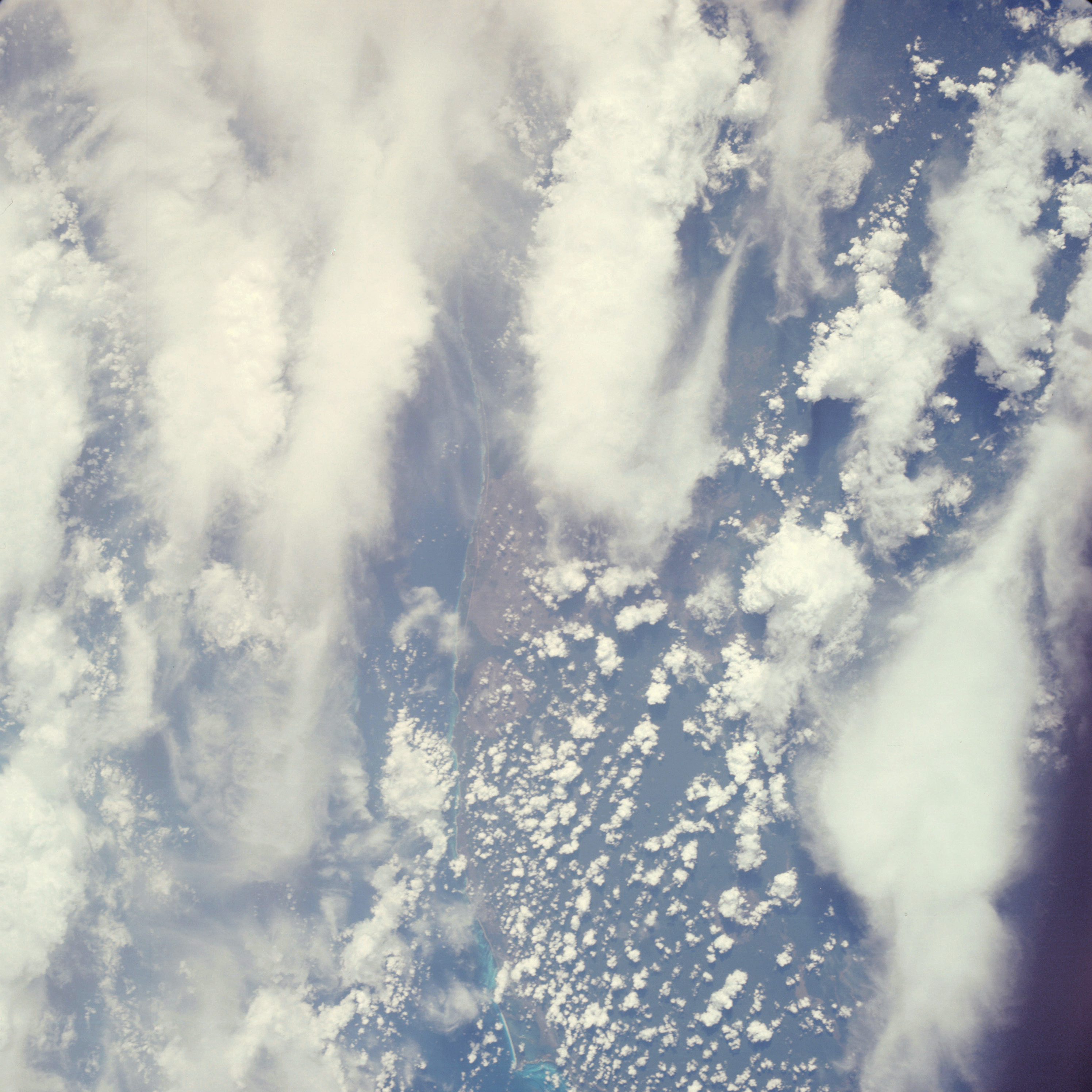 | AS07-05-1637 GEOGRAPHY/CARTOGRAPHY: Mexico, northeastern tip of Yucatan, Puerto Juarez. GEOLOGY/HYDROLOGY: Emerged coastline and coastal plain. FORESTRY: Dense shrubform with large open areas near coast. METEOROLOGY: Cumulus, towering cumulus, cirrus. Image credit: Image Science and Analysis Laboratory, NASA-Johnson Space Center. |
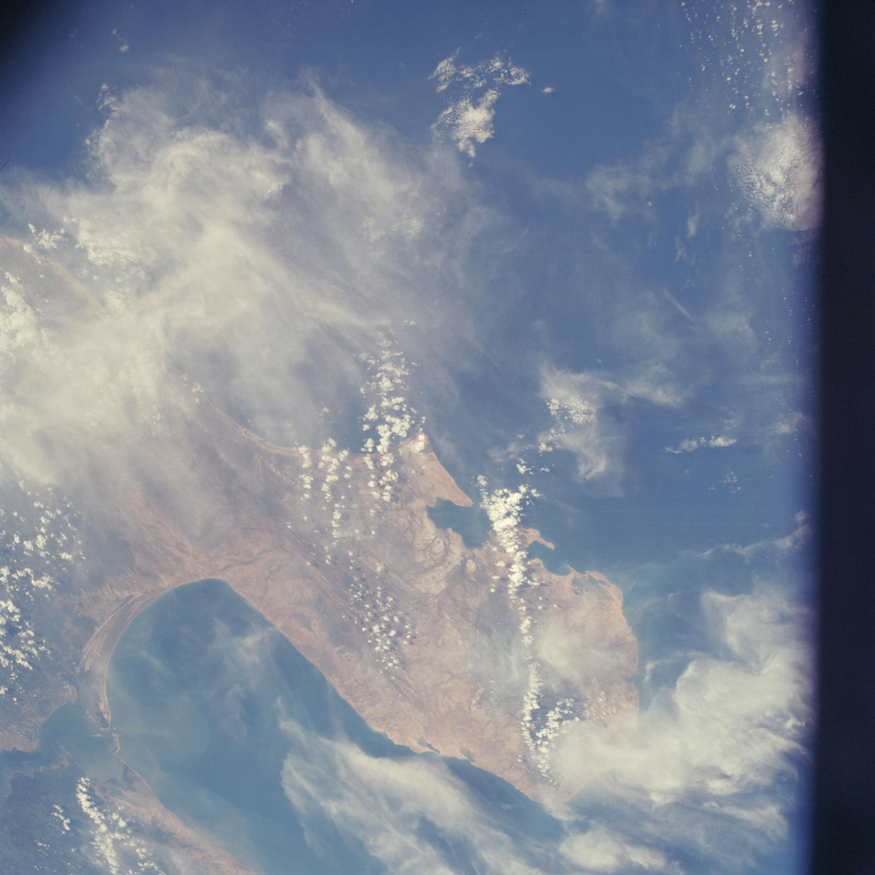 | AS07-05-1638 GEOGRAPHY/CARTOGRAPHY: Columbia, Venezuela, Peninsula de Guajira, Gulf of Venezuela, Maracaibo. GEOLOGY/HYDROLOGY: Sedimentary coastal plain with complex and folded hills. FORESTRY: Dense tropical forests inland. METEOROLOGY: Cumulus, cirrus. OCEANOGRAPHY: Some sediment patterns in Gulf of Venezuela. Image credit: Image Science and Analysis Laboratory, NASA-Johnson Space Center. |
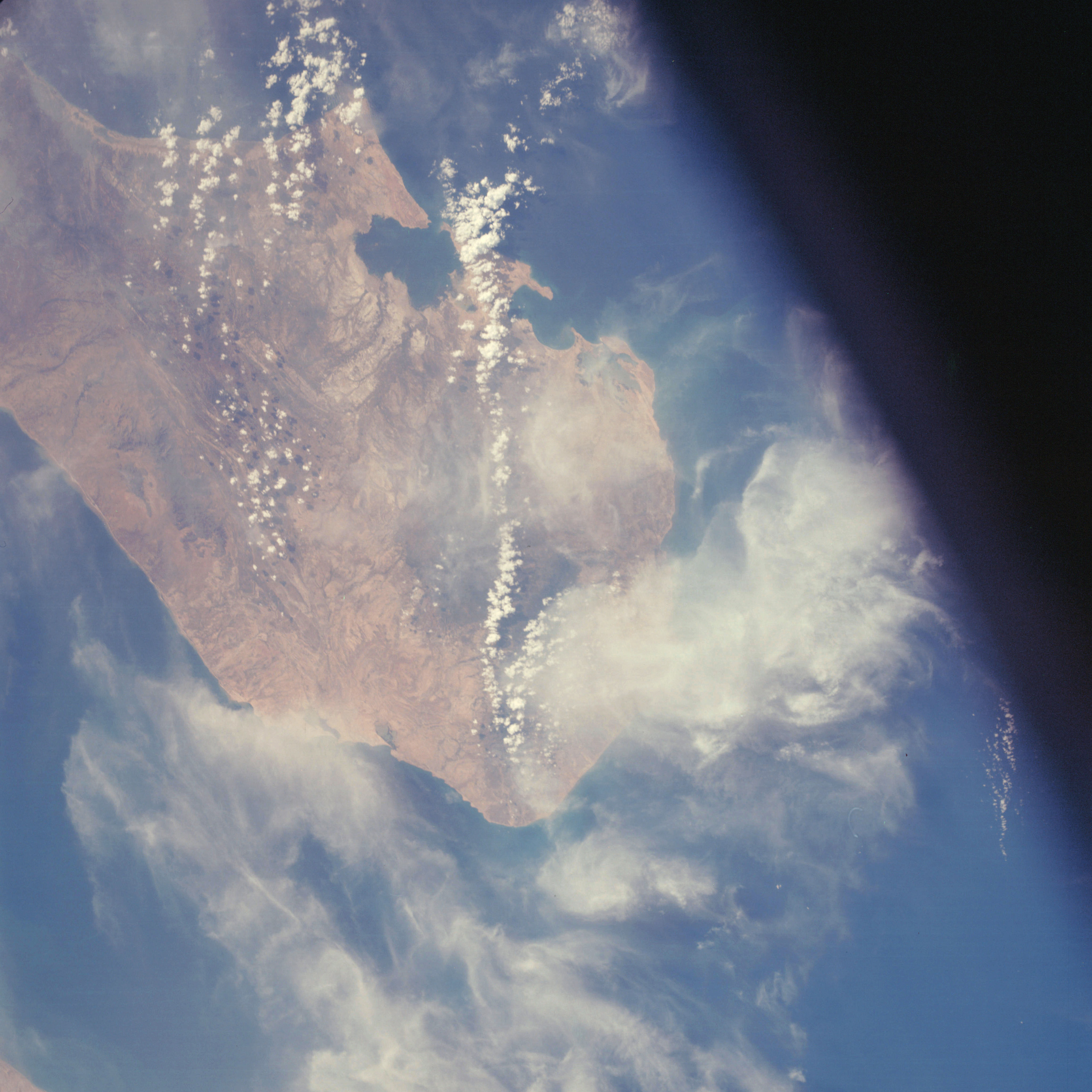 | AS07-05-1639 GEOGRAPHY/CARTOGRAPHY: Columbia, Venezuela, Peninsula de Guajira. GEOLOGY/HYDROLOGY: Sedimentary coastal plain with complex and folded hills. METEOROLOGY: Cumulus, cirrus. OCEANOGRAPHY: Some color change. Image credit: Image Science and Analysis Laboratory, NASA-Johnson Space Center. |
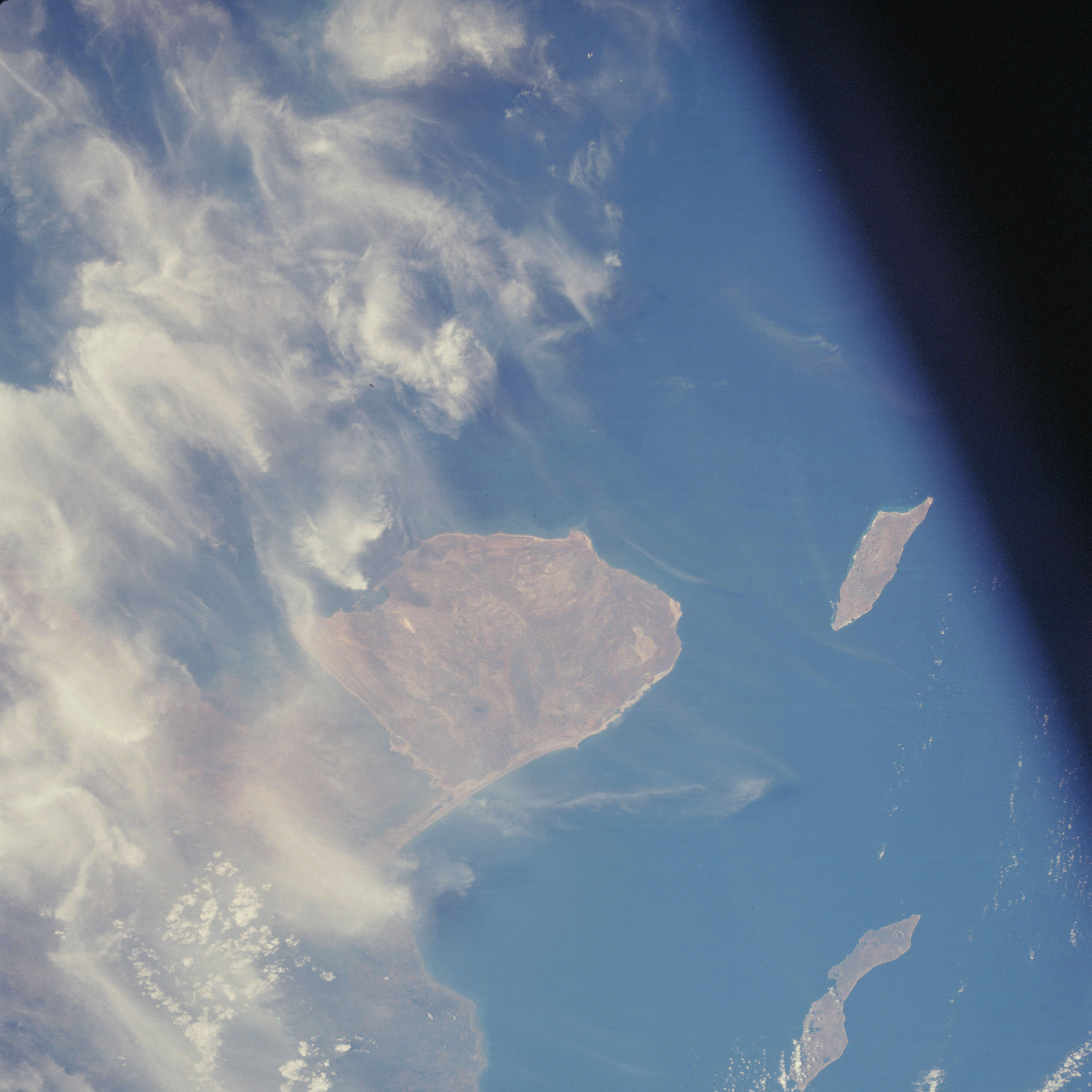 | AS07-05-1640 GEOGRAPHY/CARTOGRAPHY: Venezuela, Peninsula de Paraguana, Islands of Aruba and Curacao. GEOLOGY/HYDROLOGY: Coastal plain region. FORESTRY: Dense to semi-dense stands on mainland. METEOROLOGY: Cumulus, cirrus. OCEANOGRAPHY: Some wave activity along beaches. Image credit: Image Science and Analysis Laboratory, NASA-Johnson Space Center. |
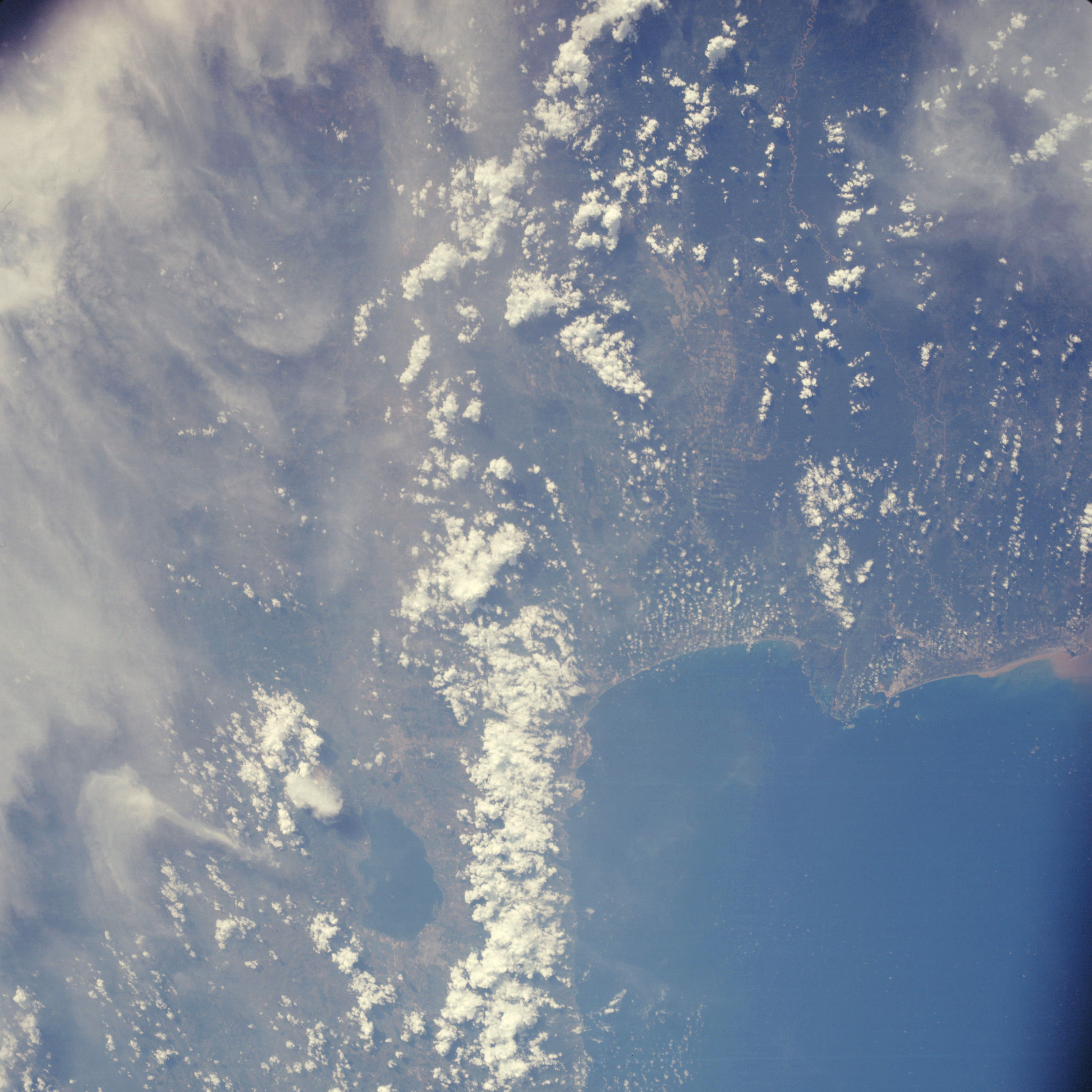 | AS07-05-1641 GEOGRAPHY/CARTOGRAPHY: Venezuela coastline, Gulf of Triste, Valencia. AGRICULTURE: Field patterns evident in lowlands of interior. GEOLOGY/HYDROLOGY: Coastal plain and complex mountain region. FORESTRY: Dense tropical forests in upper peninsula. METEOROLOGY: Cumulus, cirrus. OCEANOGRAPHY: Sediment. terns alone interface. Image credit: Image Science and Analysis Laboratory, NASA-Johnson Space Center. |
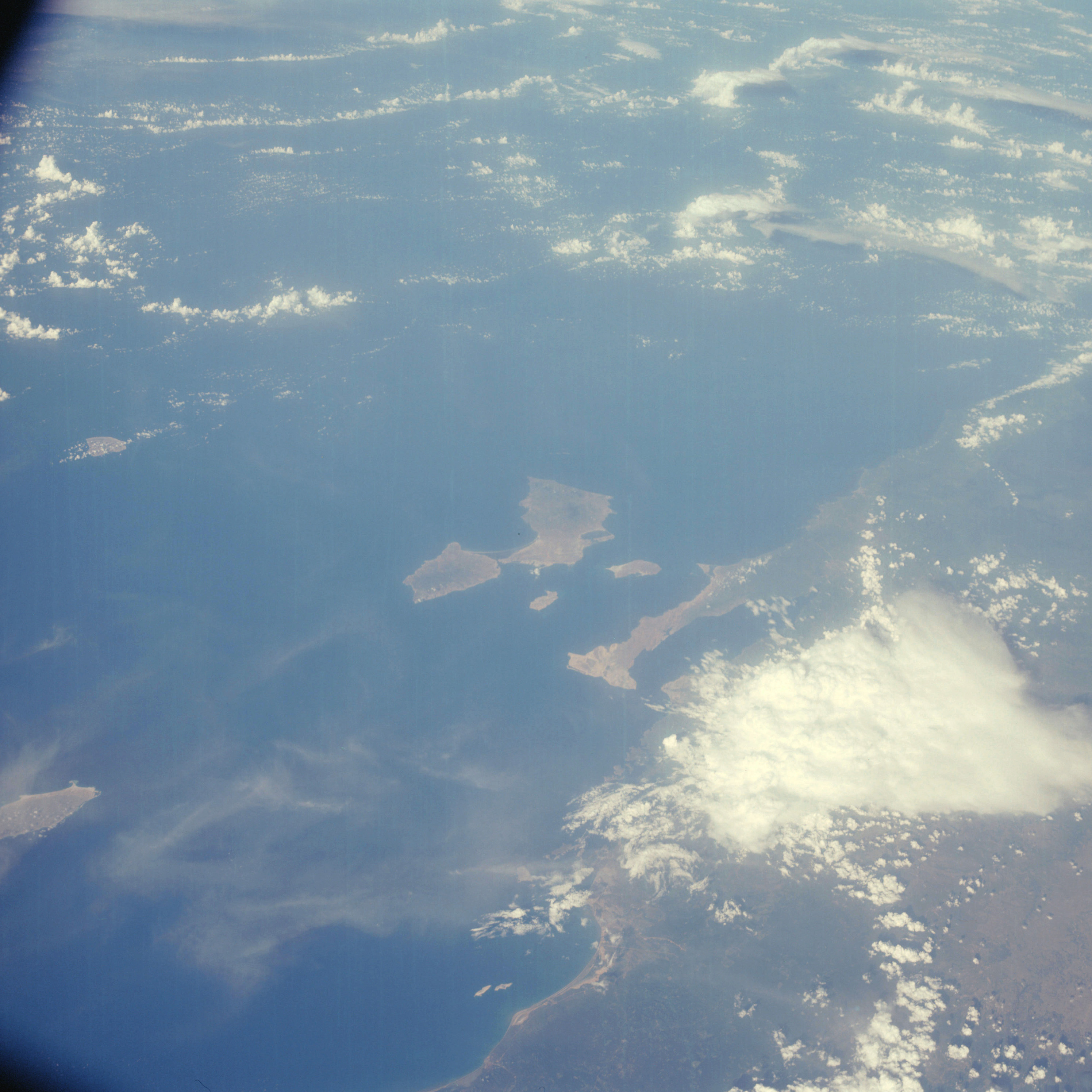 | AS07-05-1642 GEOGRAPHY/CARTOGRAPHY: Venezuela coast, Peninsula de Avaya, Barcelona, De Margarita Island. GEOLOGY/HYDROLOGY: Submerged coastline and coastal plain. FORESTRY: Dense tropical rainforest grading to shrubform. METEOROLOGY: Cumulus, alto-cumulus. OCEANOGRAPHY: Some tonal change. Image credit: Image Science and Analysis Laboratory, NASA-Johnson Space Center. |
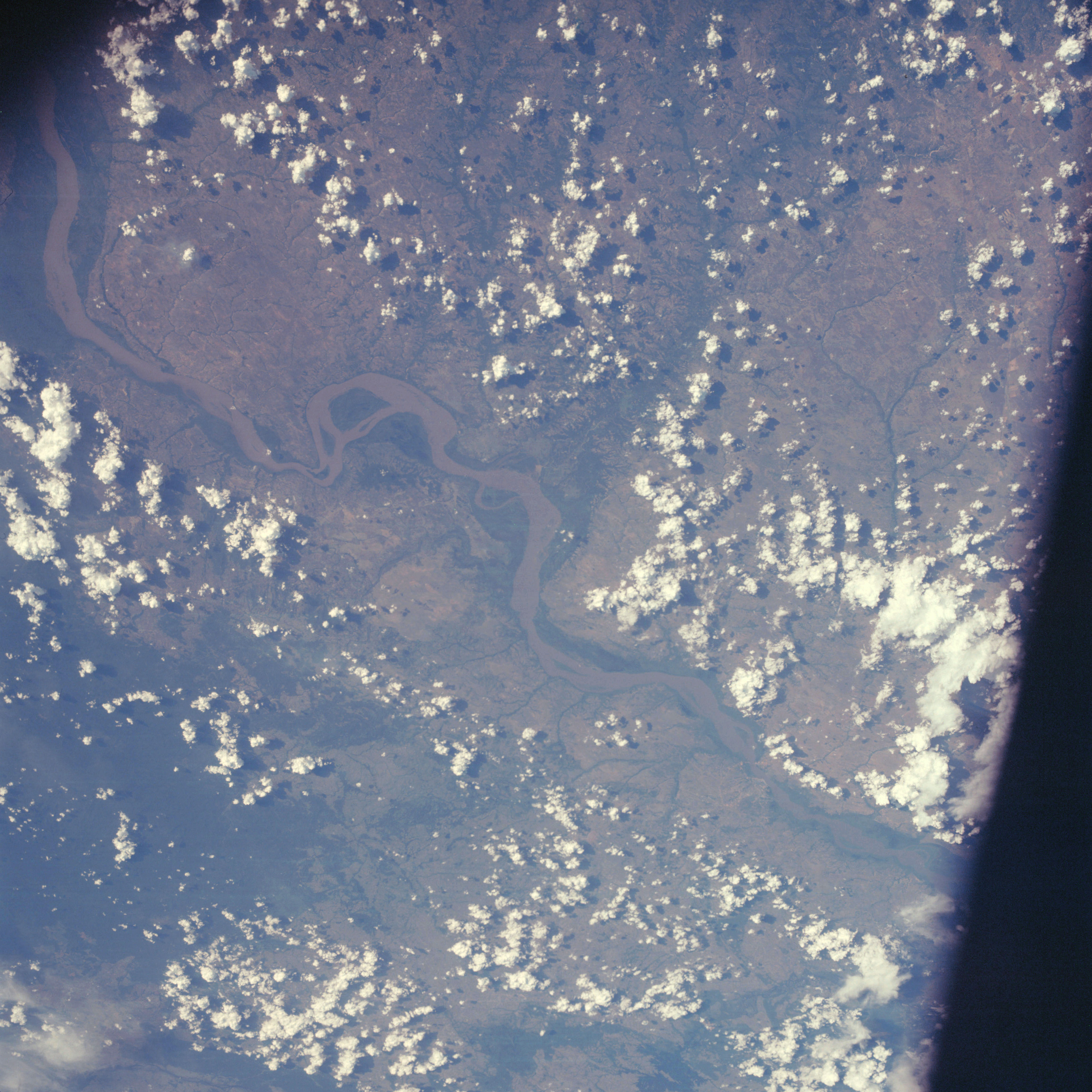 | AS07-05-1643 GEOGRAPHY/CARTOGRAPHY: Venezuela, Orinoco River, Cuidad Bolivar, El Tigre. AGRICULTURE: Isolated field patterns near El Tigre. GEOLOGY/HYDROLOGY : Sedimentary plateau, flood plain and meandering perennial drainage. FORESTRY: Isolated dense forest stands, primarily along Orinoco River and tributaries. METEOROLOGY: Cumulus. Image credit: Image Science and Analysis Laboratory, NASA-Johnson Space Center. |
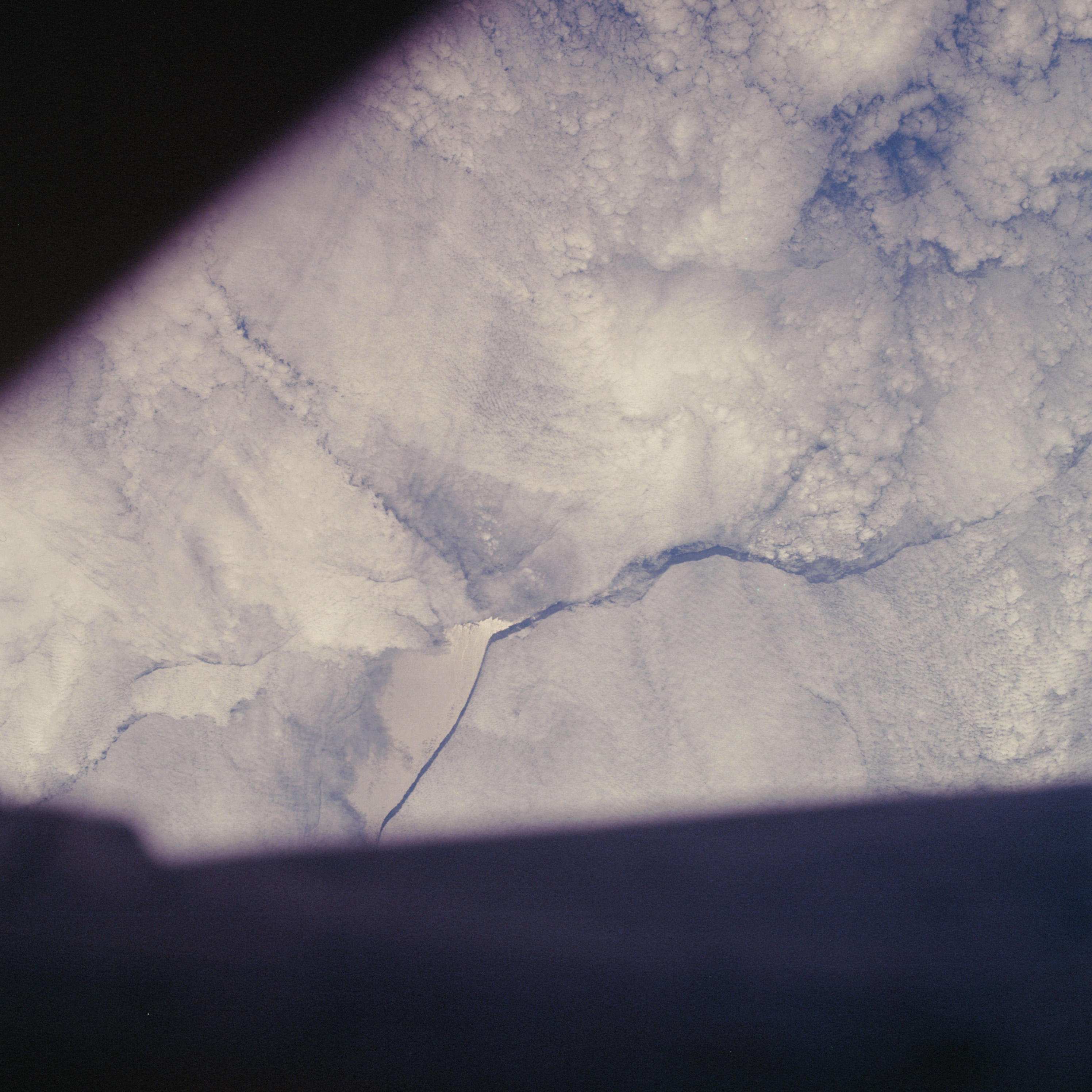 | AS07-05-1644 CLOUDS: Strato-cumulus Image credit: Image Science and Analysis Laboratory, NASA-Johnson Space Center. |
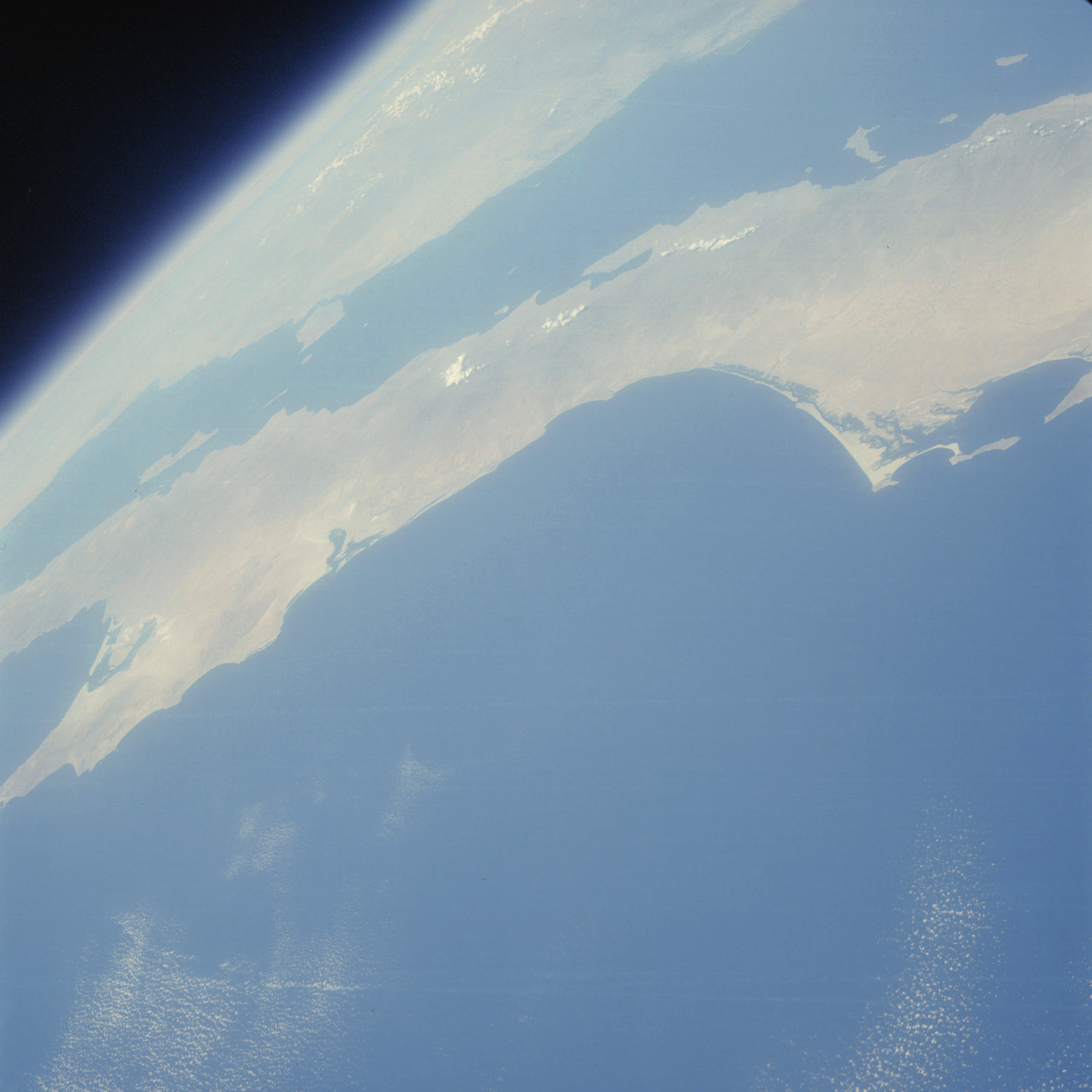 | AS07-05-1645 GEOGRAPHY/CARTOGRAPHY: Baja California. GEOLOGY/HYDROLOGY: Alluvial and low plains. Complex mountains in the foreground. METEOROLOGY: Small-cumulus. Image credit: Image Science and Analysis Laboratory, NASA-Johnson Space Center. |
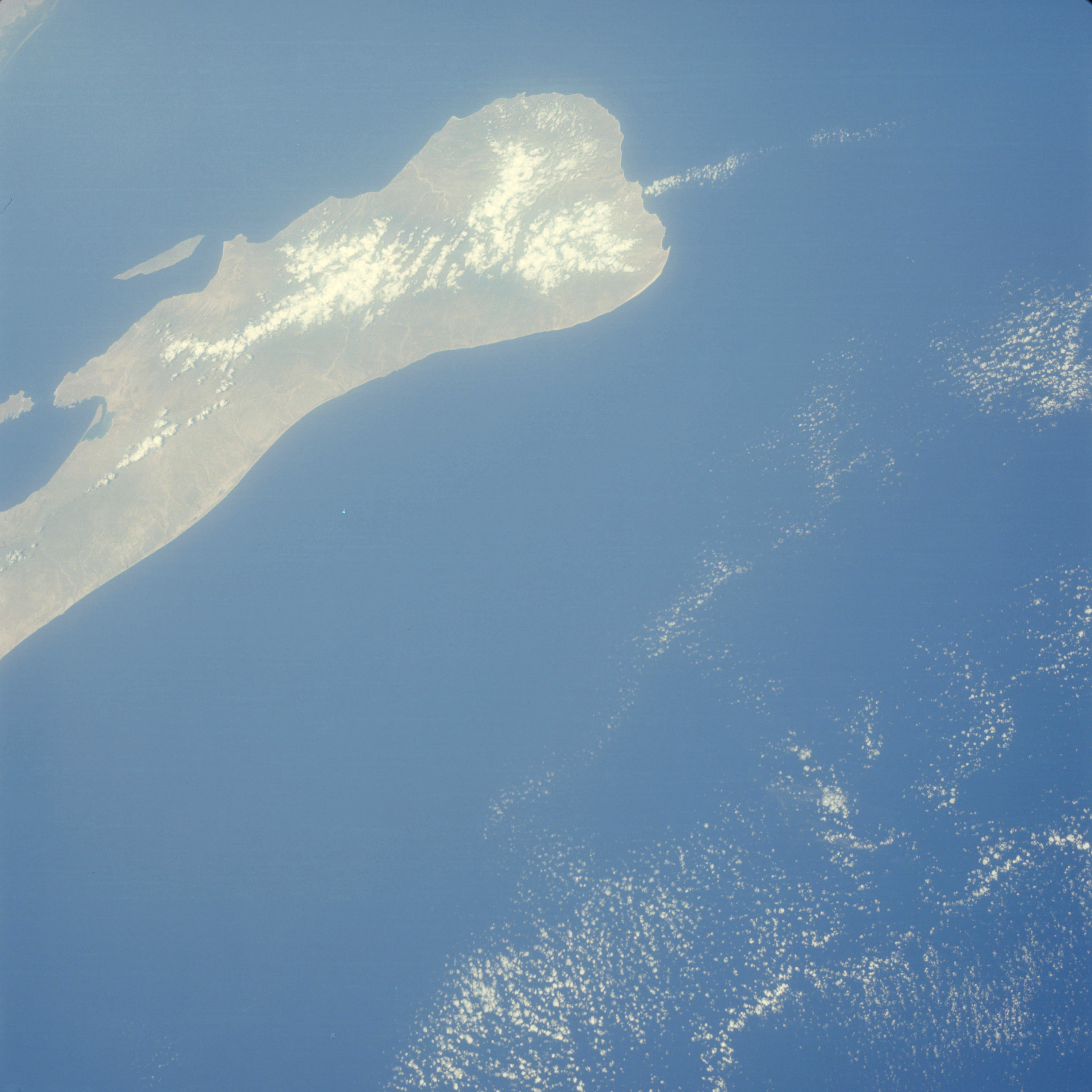 | AS07-05-1646 GEOGRAPHY/CARTOGRAPHY: Baja California. GEOLOGY/HYDROLOGY: Low plains region. METEOROLOGY: Cumulus, alto-cumulus. Image credit: Image Science and Analysis Laboratory, NASA-Johnson Space Center. |
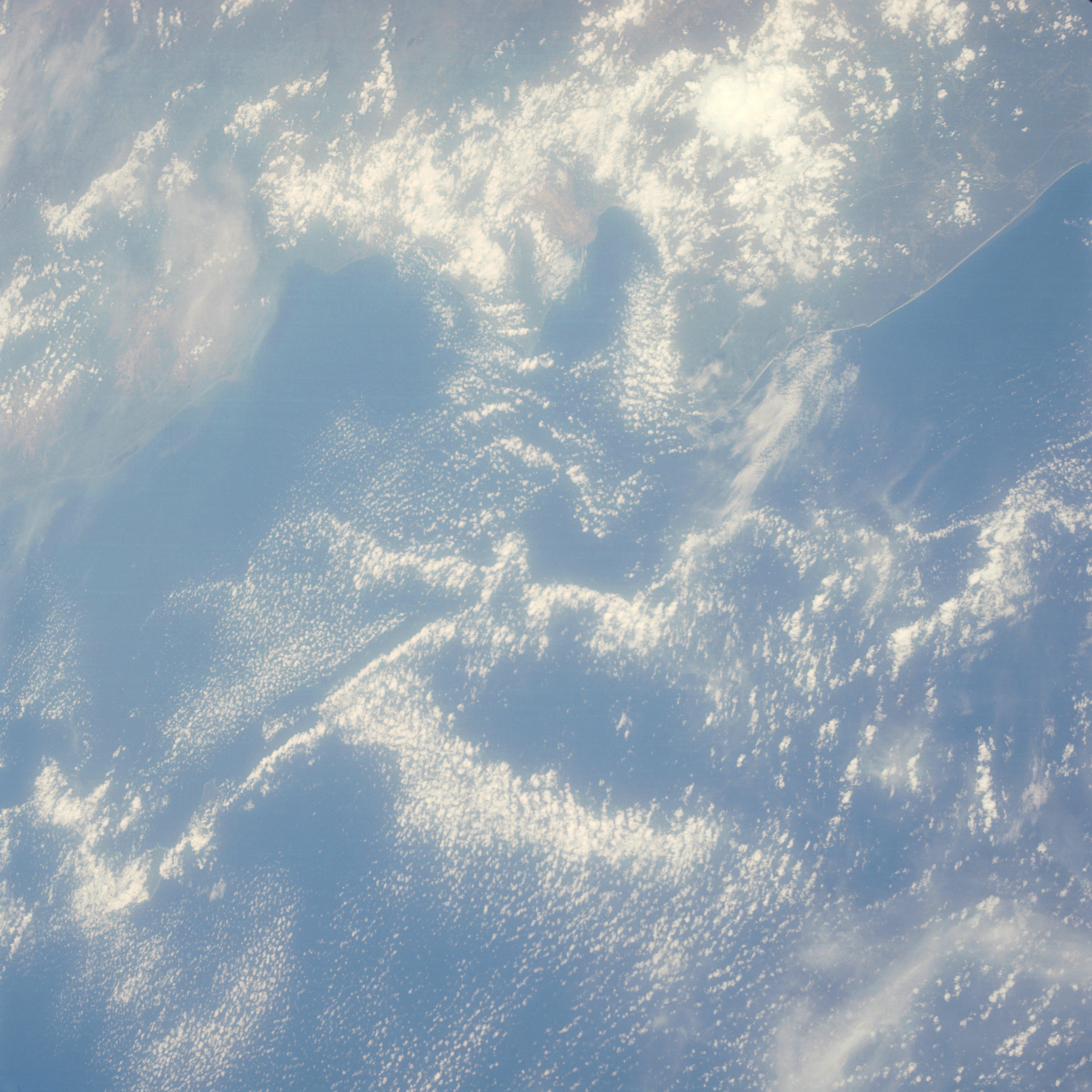 | AS07-05-1647 GEOGRAPHY/CARTOGRAPHY: Mexico, Puerto Vallarta. GEOLOGY/HYDROLOGY: Coastal plain region. FORESTRY: Semi-dense forest stands in the southern boundary grading to isolated shrubform to the north. METEOROLOGY; Cumulus, cirrus. Image credit: Image Science and Analysis Laboratory, NASA-Johnson Space Center. |
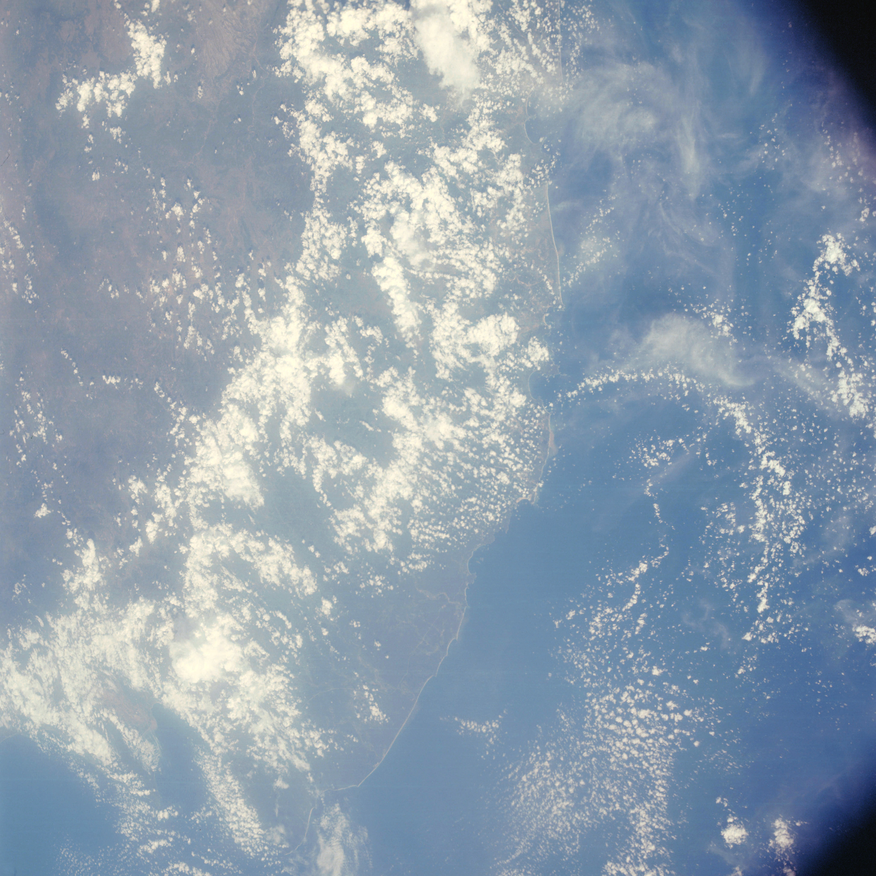 | AS07-05-1648 GEOGRAPHY/CARTOGRAPHY: Mexico, Puerto Vallarta to Manzanille. GEOLOGY/HYDROLOGY: Coastal piain and dissected hills region. FORESTRY: Semi-dense forest stands changing to dense stands along drainage. METEOROLOGY; Cumulus, towering-cumulus, alto-cumulus, cirrus. Image credit: Image Science and Analysis Laboratory, NASA-Johnson Space Center. |
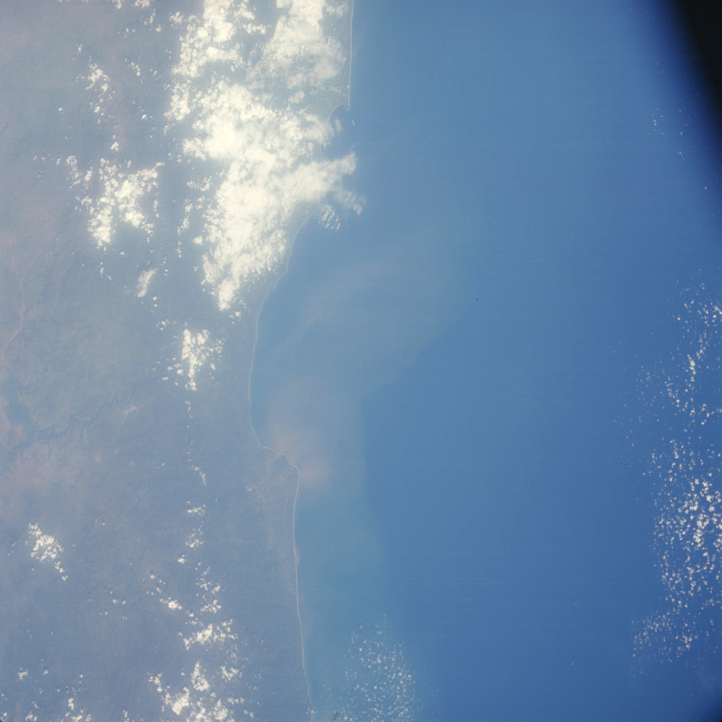 | AS07-05-1649 GEOGRAPHY/CARTOGRAPHY: Mexico, Bahia de Petacalco. GEOLOGY/HYDROLOGY: Basement complex of Sinai Madre and elevated coastal plain. FORESTRY: Semi-dense to open forests with dense vegetation along major drains. METEOROLOGY: Small cumulus, alto-cumulus. OCEANOGRAPHY: Excellent fresh-salt water interface with definite sediment flow patterns. Image credit: Image Science and Analysis Laboratory, NASA-Johnson Space Center. |
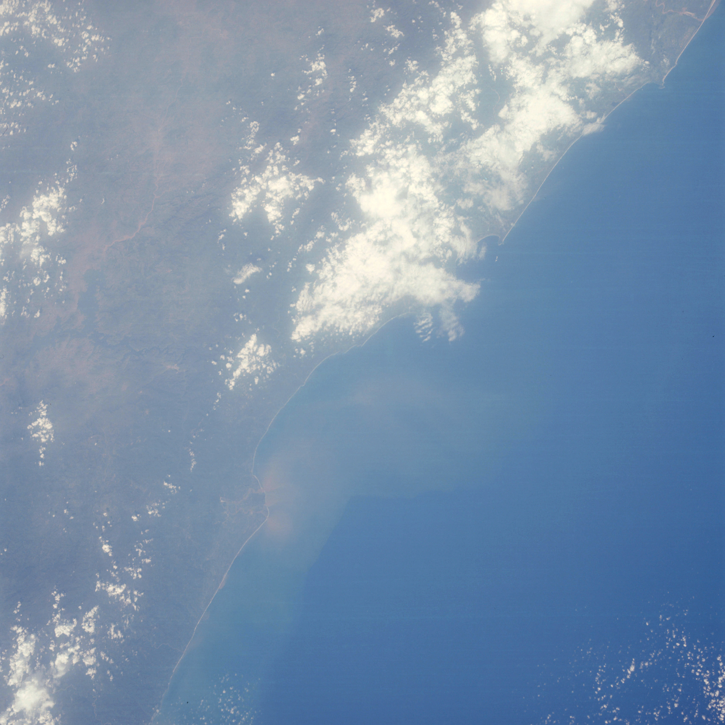 | AS07-05-1650 GEOGRAPHY/CARTOGRAPHY: Mexico, West Coast, Bahia de Petacalco. GEOLOGY/HYDROLOGY: Basement complex of the Sierra Madre Del Sur with intermittent and perennial drainage. FORESTRY: Semi-dense to open forests with dense vegetation along drains. METEOROLOGY: Cumulus, alto-cumulus. OCEANOGRAPHY: Excellent fresh-salt water interface with definite sediment flow patterns. Image credit: Image Science and Analysis Laboratory, NASA-Johnson Space Center. |
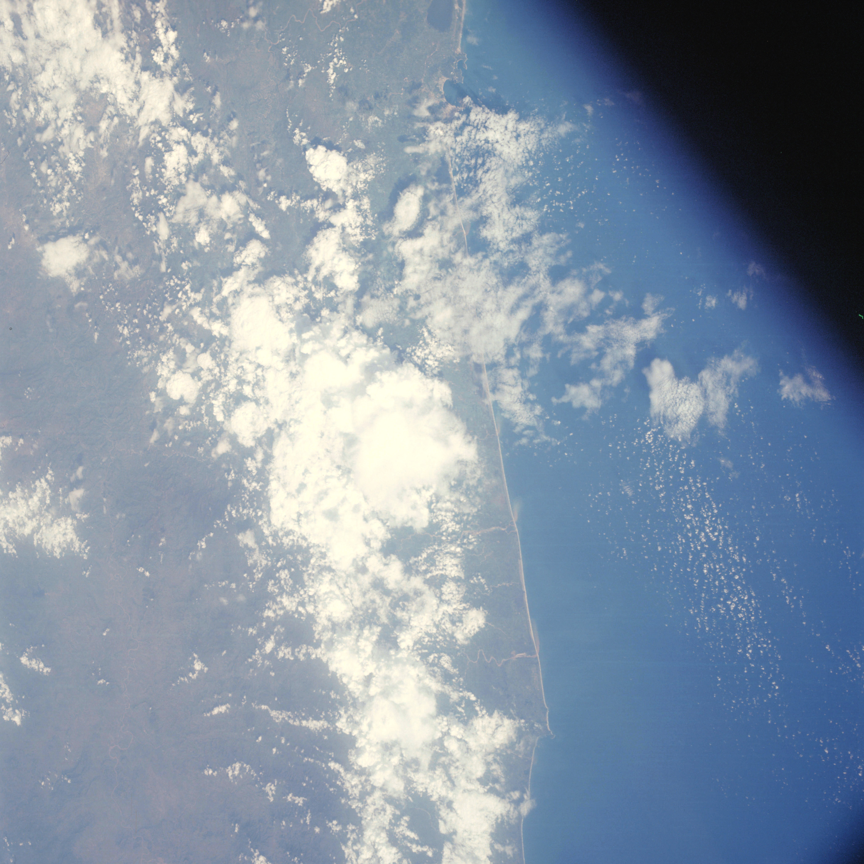 | AS07-05-1651 GEOGRAPHY/CARTOGRAPHY: Mexico, West Coast, Acapulco. GEOLOGY/HYDROLOGY: Complex mountains and perennial drainage flowing toward the Coastal Plain region. FORESTRY: Scattered low shrubform. METEOROLOGY: Cumulus, alto-cumulus. OCEANOGRAPHY: Sediment flows showing offshore currents. Image credit: Image Science and Analysis Laboratory, NASA-Johnson Space Center. |
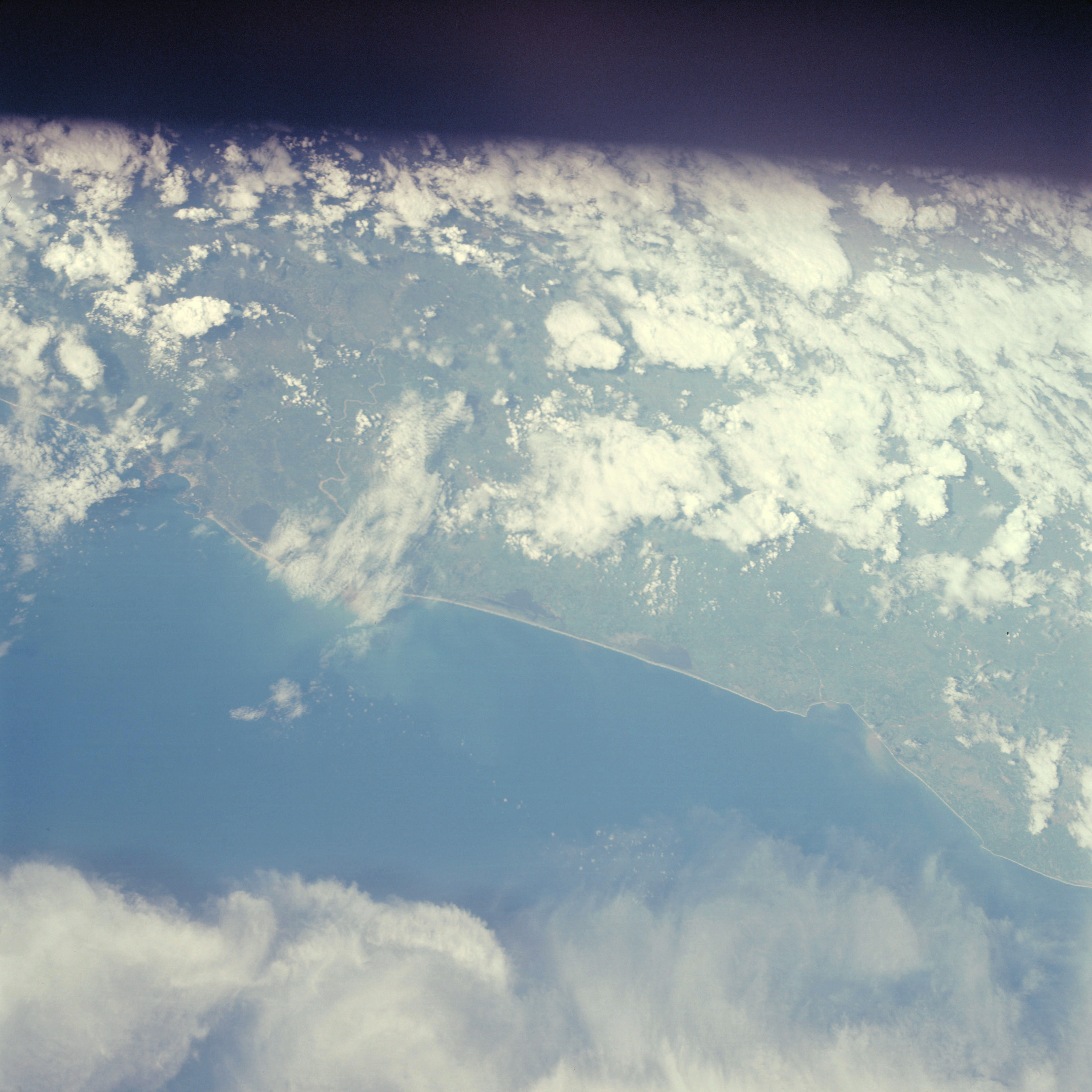 | AS07-05-1652 GEOGRAPHY/CARTOGRAPHY: Mexico, West Coast, Acapulco to Tecuanapa. GEOLOGY/HYDROLOGY: Coastal Plain region with adjacent complex and dissected hills. FORESTRY: Scattered low shrubform with intermittent forest stands. METEOROLOGY: Cumulus, alto-cumulus, cirrus. OCEANOGRAPHY: Fresh-salt water interface showing sediment flows. Image credit: Image Science and Analysis Laboratory, NASA-Johnson Space Center. |
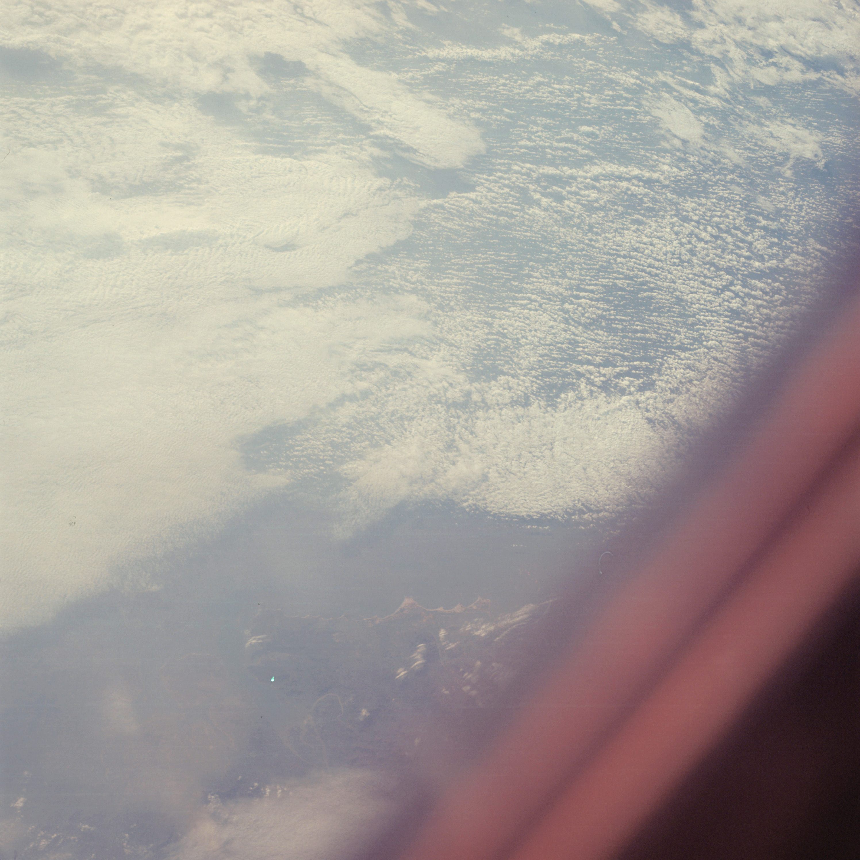 | AS07-05-1654 GEOGRAPHY/CARTOGRAPHY: China Coast near Quemoy Island. (Dark) GEOLOGY/HYDROLOGY: Shoreline of submergence with coastal sedimentation. METEOROLOGY; Cumulus, cirrus. OCEANOGRAPHY: Some sediment transports. Image credit: Image Science and Analysis Laboratory, NASA-Johnson Space Center. |
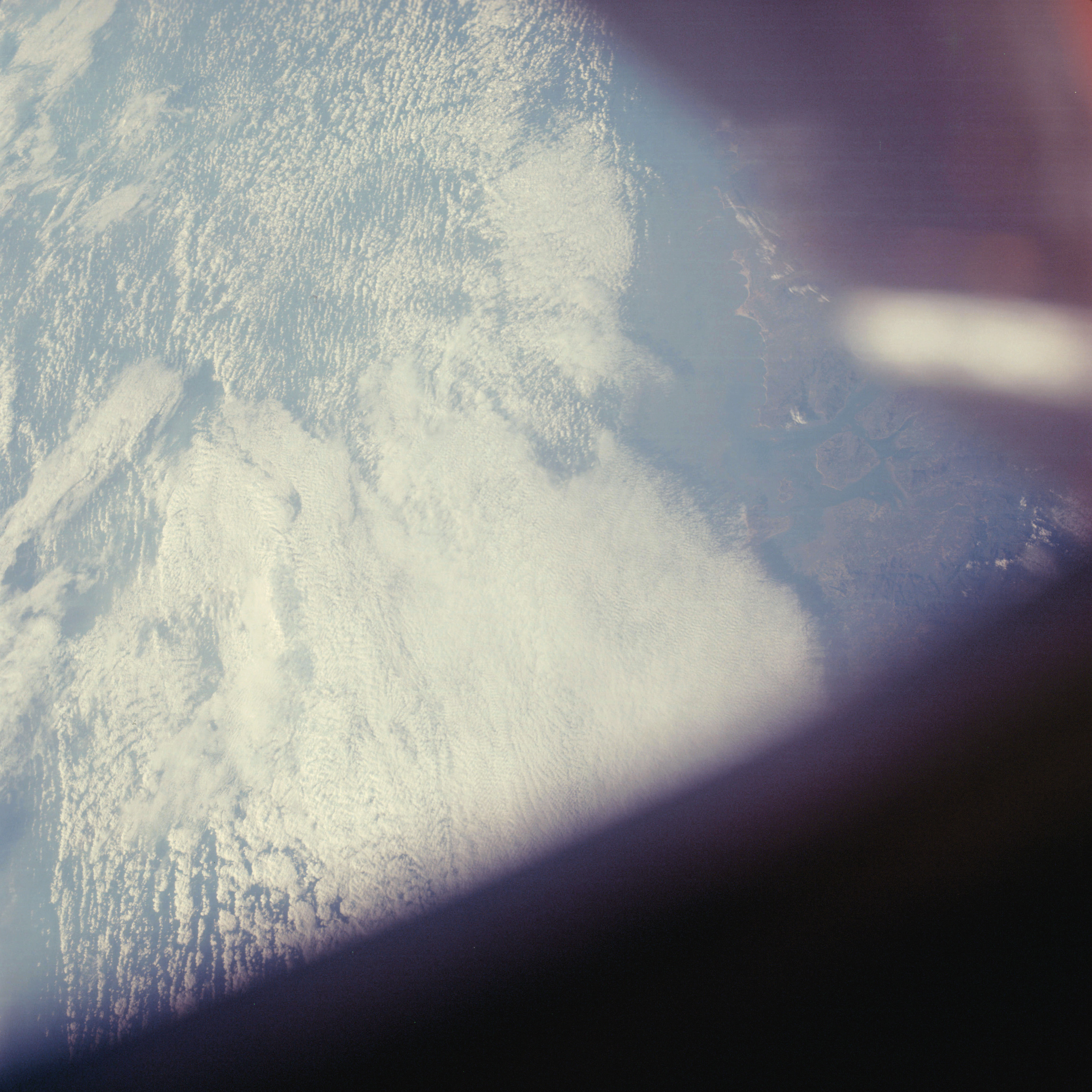 | AS07-05-1655 GEOGRAPHY/CARTOGRAPHY: China Coast near Quemoy Island. (Dark) GEOLOGY/HYDROLOGY: Shoreline of submergence. METEOROLOGY: Cumulus, alto-cumulus, cirrus. OCEANOGRAPHY: Some sediment transports. Image credit: Image Science and Analysis Laboratory, NASA-Johnson Space Center. |
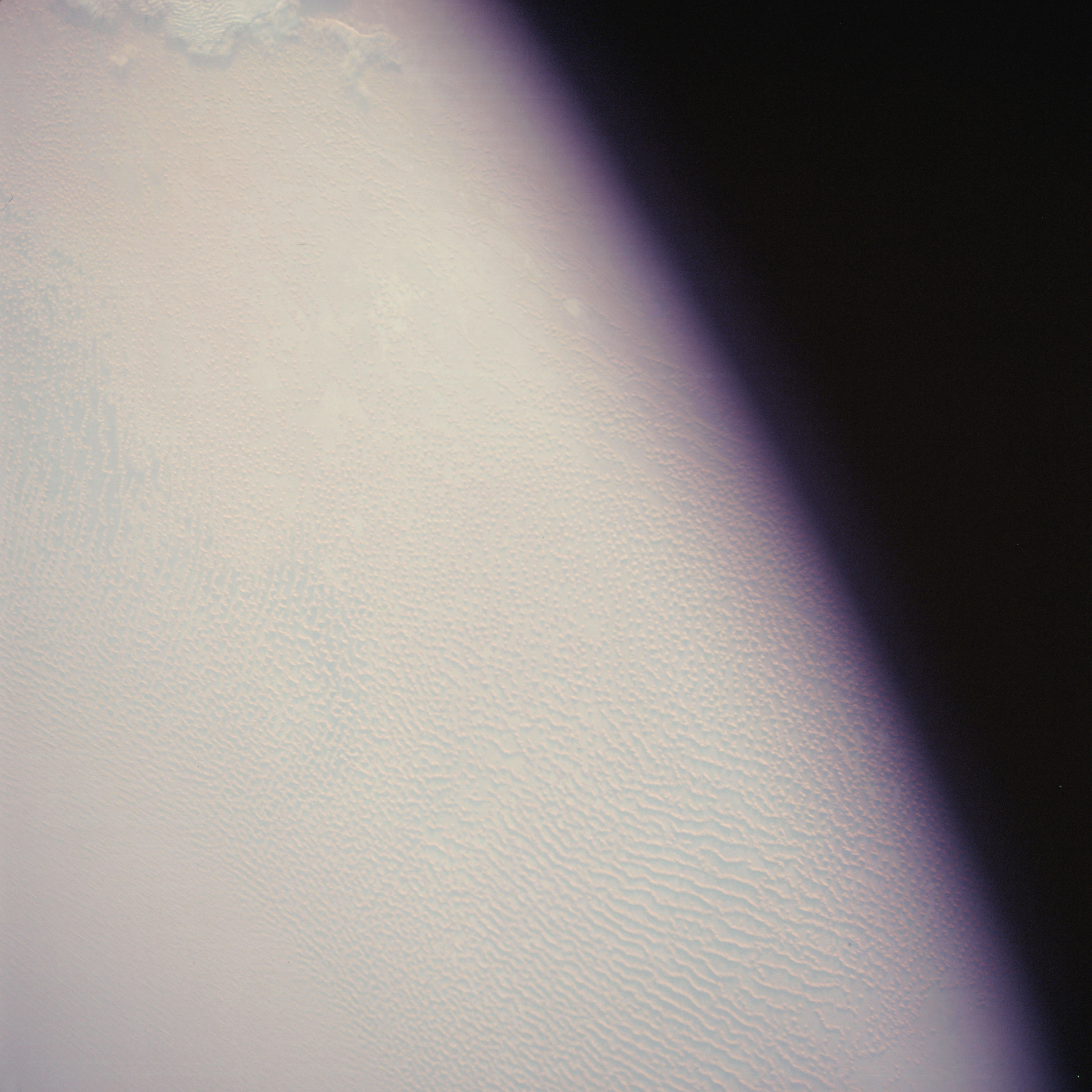 | AS07-05-1656 GEOGRAPHY/CARTOGRAPHY: Saudi Arabia, Empty Quarter sand dunes. (Light) Image credit: Image Science and Analysis Laboratory, NASA-Johnson Space Center. |
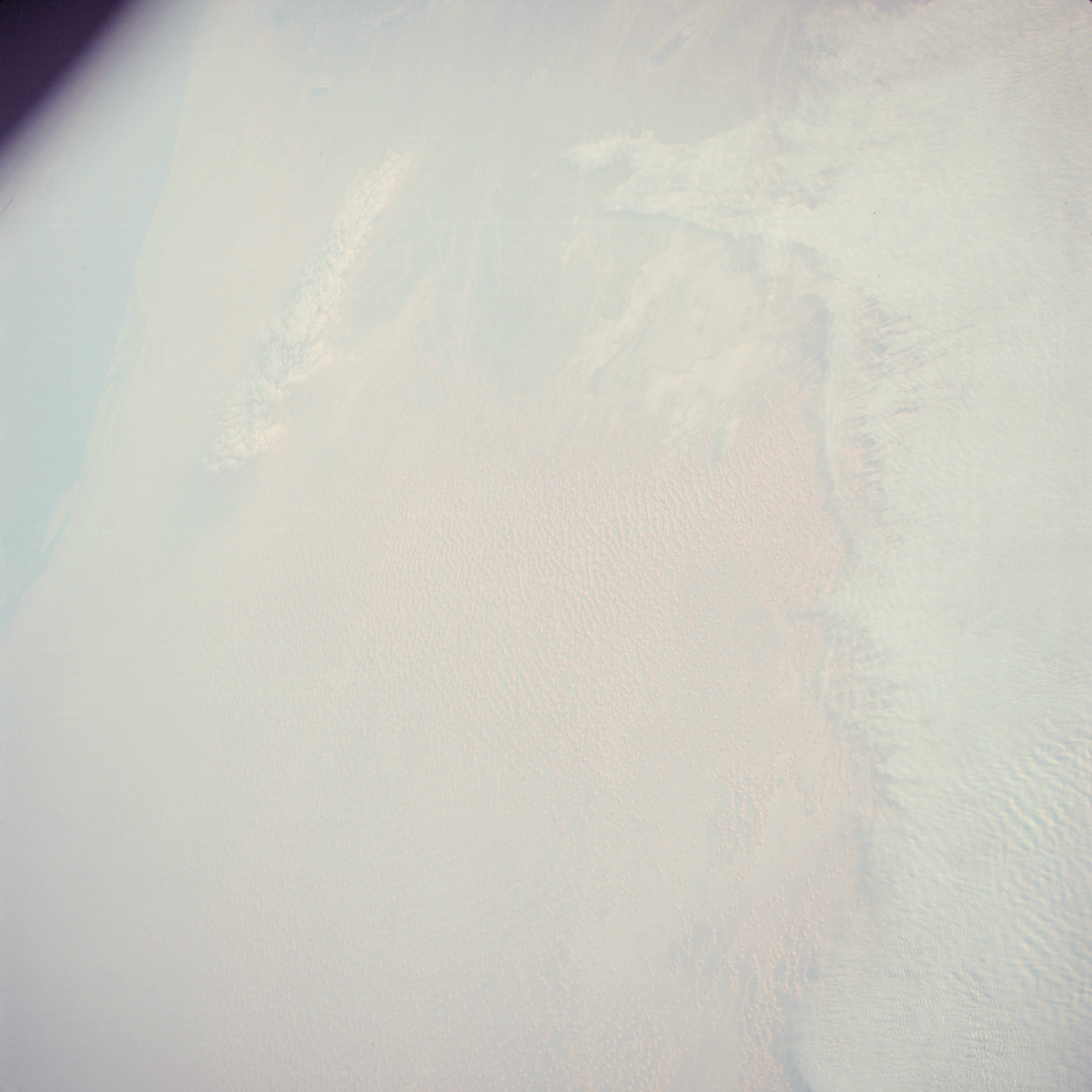 | AS07-05-1657 GEOGRAPHY/CARTOGRAPHY: Saudi Arabia, Trucial States, Coast of Abu Dhabi. (Light) GEOLOGY/HYDROLOGY: Erg plains of seif dunes. Image credit: Image Science and Analysis Laboratory, NASA-Johnson Space Center. |
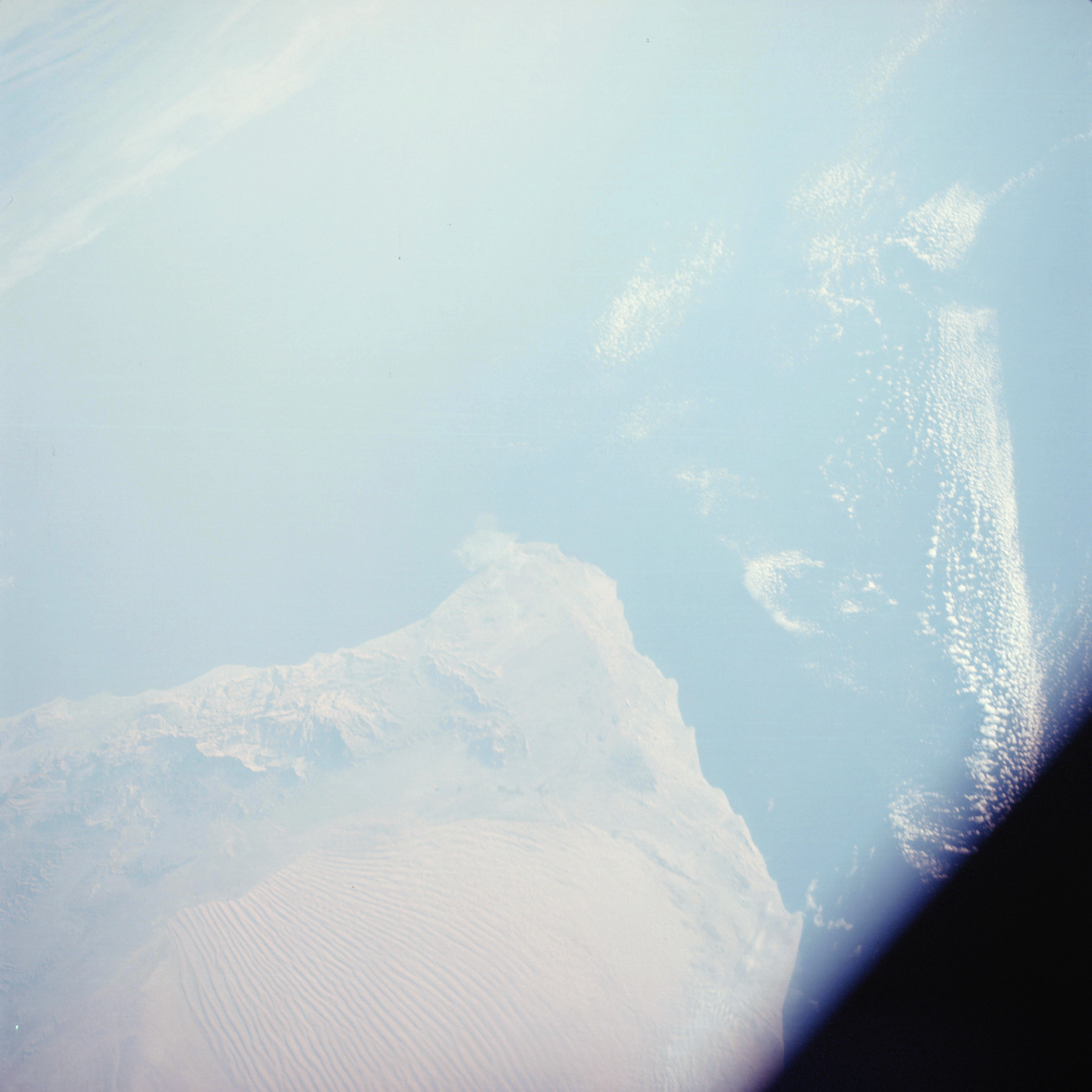 | AS07-05-1658 GEOGRAPHY/CARTOGRAPHY: Muscat and Oman, Oman Ranges. ( Light) GEOLOGY/HYDROLOGY: Coastal mountain complex and interior desert plains of seif dunes. METEOROLOGY: Cumulus. Image credit: Image Science and Analysis Laboratory, NASA-Johnson Space Center. |
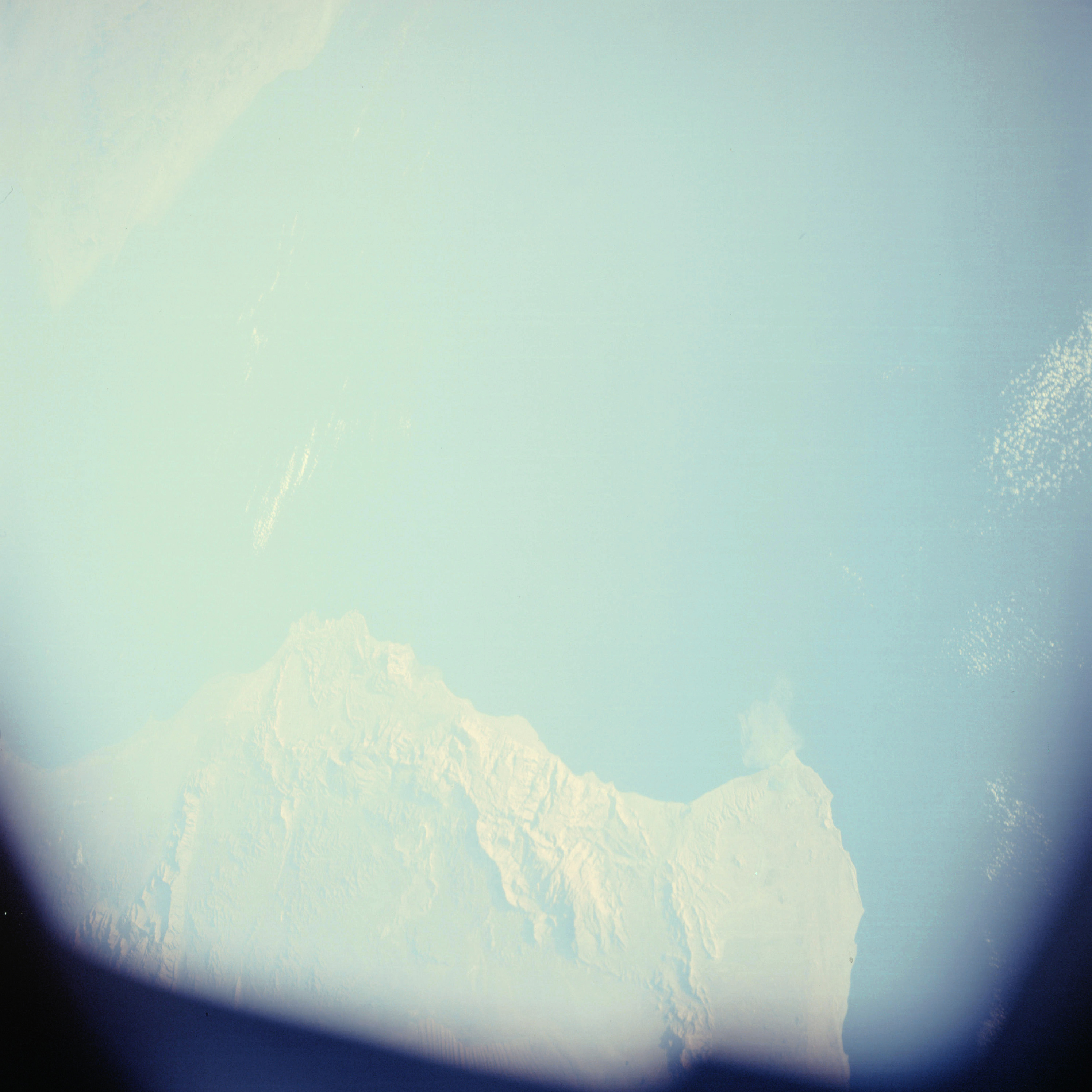 | AS07-05-1659 GEOGRAPHY/CARTOGRAPHY: Muscat and Oman, Oman Ranges, Coast of Iran. (Light) GEOLOGY/HYDROLOGY: Coastal mountain complex. METEOROLOGY: Cumulus. Image credit: Image Science and Analysis Laboratory, NASA-Johnson Space Center. |
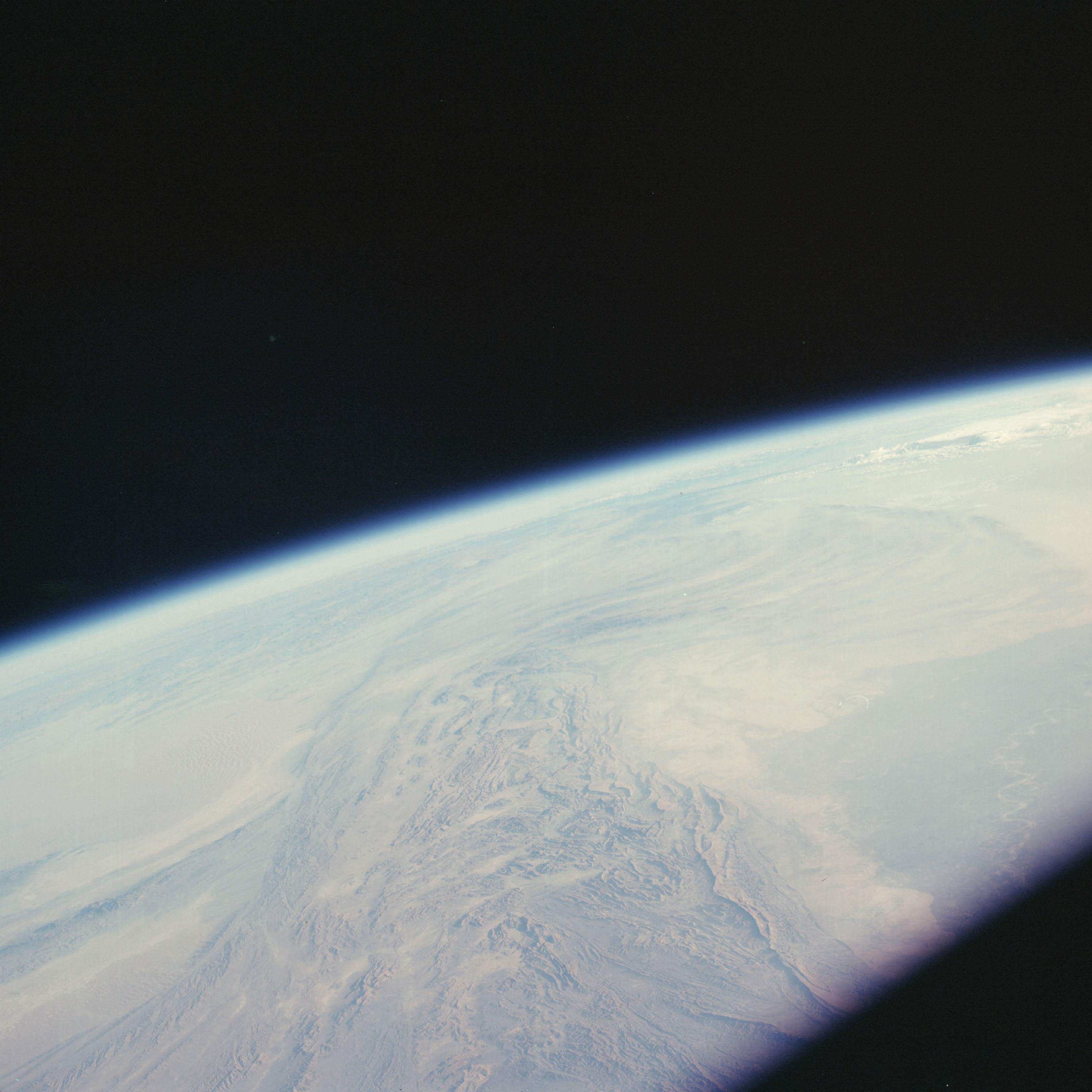 | AS07-05-1660 GEOGRAPHY/CARTOGRAPHY: Pakistan, Rirther and Makran Ranges, Indus River. GEOLOGY/HYDROLOGY: Complex anticlinorium folding. Image credit: Image Science and Analysis Laboratory, NASA-Johnson Space Center. |
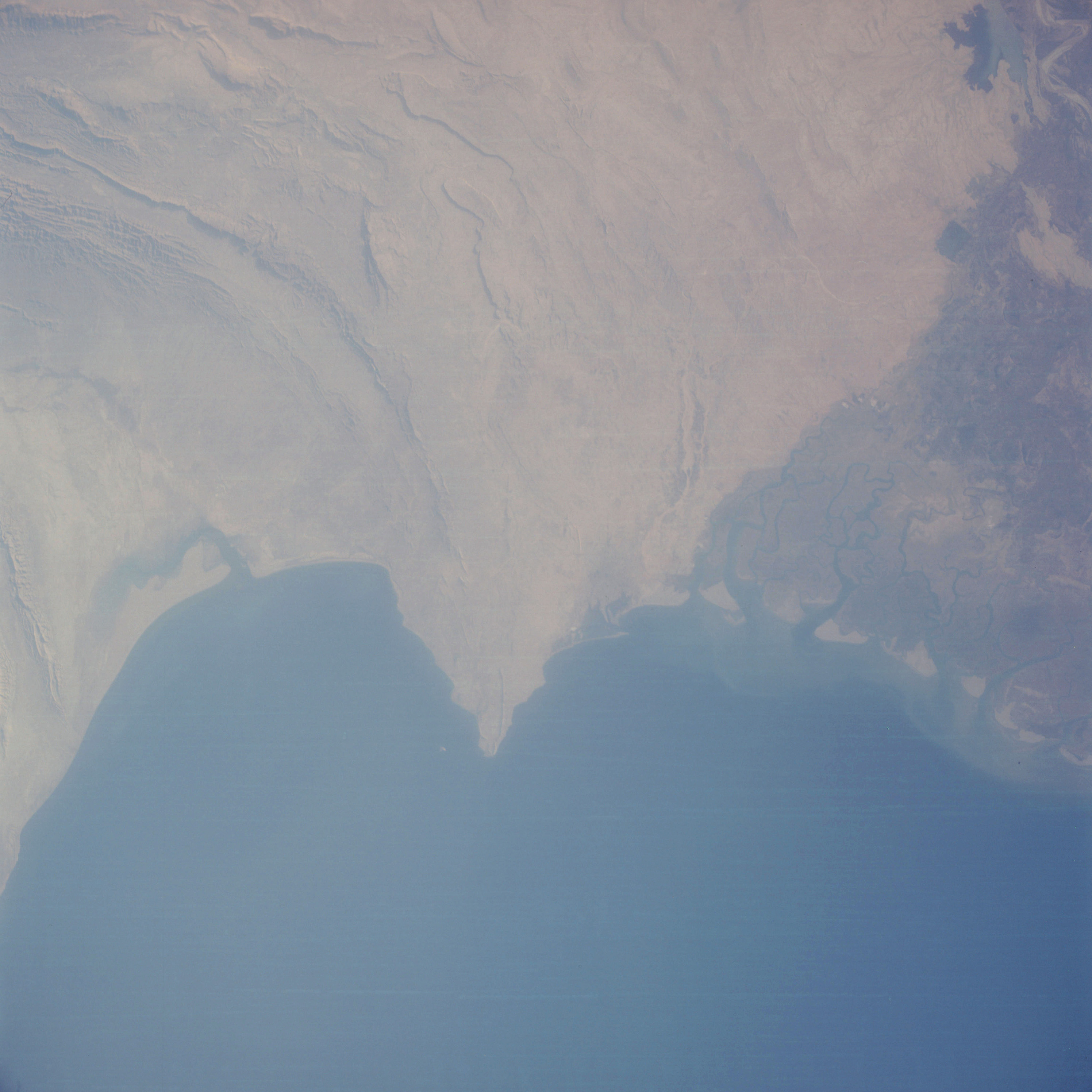 | AS07-05-1661 GEOGRAPHY/CARTOGRAPHY: Pakistan, Karachi and Indus River. (Light) GEOLOGY/HYDROLOGY: Perennial deltaic flood plain and sedimentary folded and horizontal beds. FORESTRY: Scattered shrubform changing to dense vegetation in delta. OCEANOGRAPHY: Fresh-salt water interface with sediment patterns showing current directions. Image credit: Image Science and Analysis Laboratory, NASA-Johnson Space Center. |
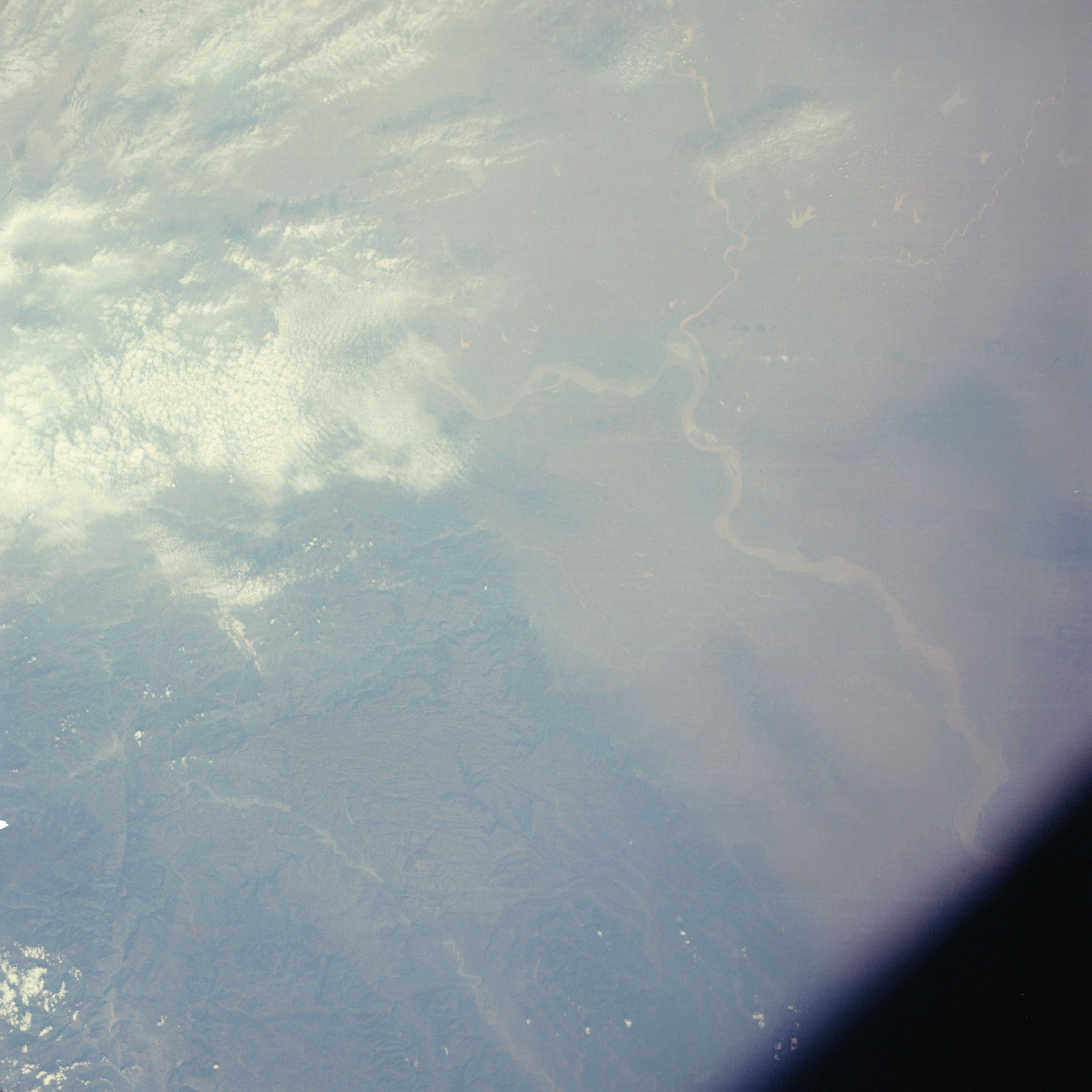 | AS07-05-1662 GEOGRAPHY/CARTOGRAPHY: China, Han River Area. Fanch Eng. GEOLOGY/HYDROLOGY: Alluvial flood plain, and sedimentary and complex mountain structure. FORESTRY: Isolated shrubform. METEOROLOGY: Cirrus, cumulus. Image credit: Image Science and Analysis Laboratory, NASA-Johnson Space Center. |
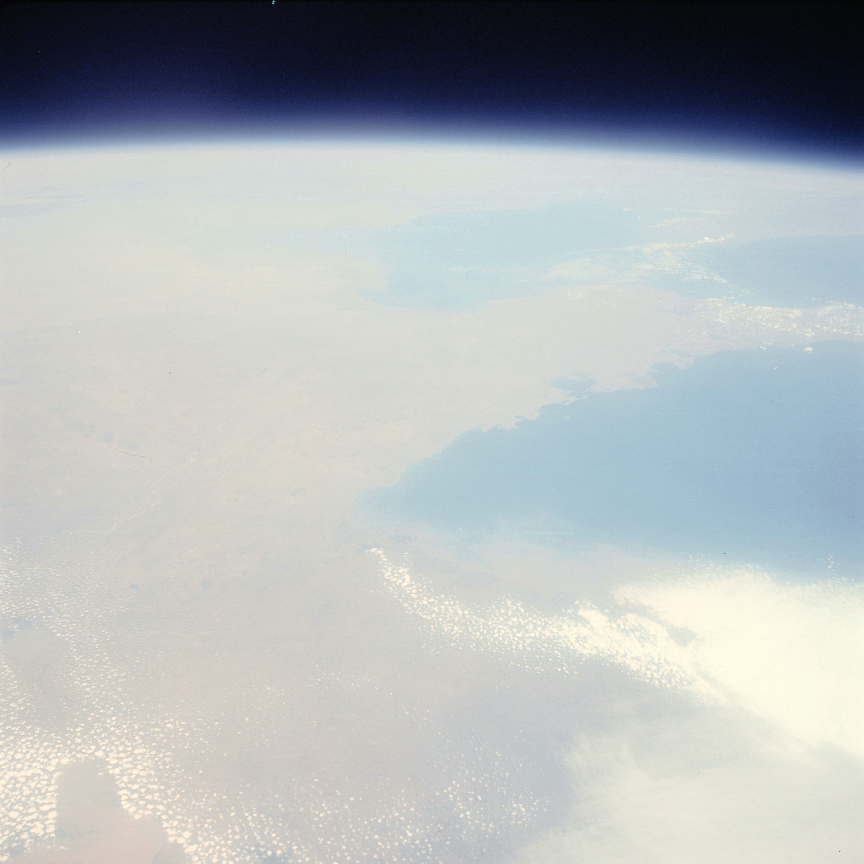 | AS07-05-1663 GEOGRAPHY/CARTOGRAPHY: China, Shantung Peninsula, Yellow Sea, Korea Bay. (Light) METEOROLOGY: Cirrus, cumulus. Image credit: Image Science and Analysis Laboratory, NASA-Johnson Space Center. |
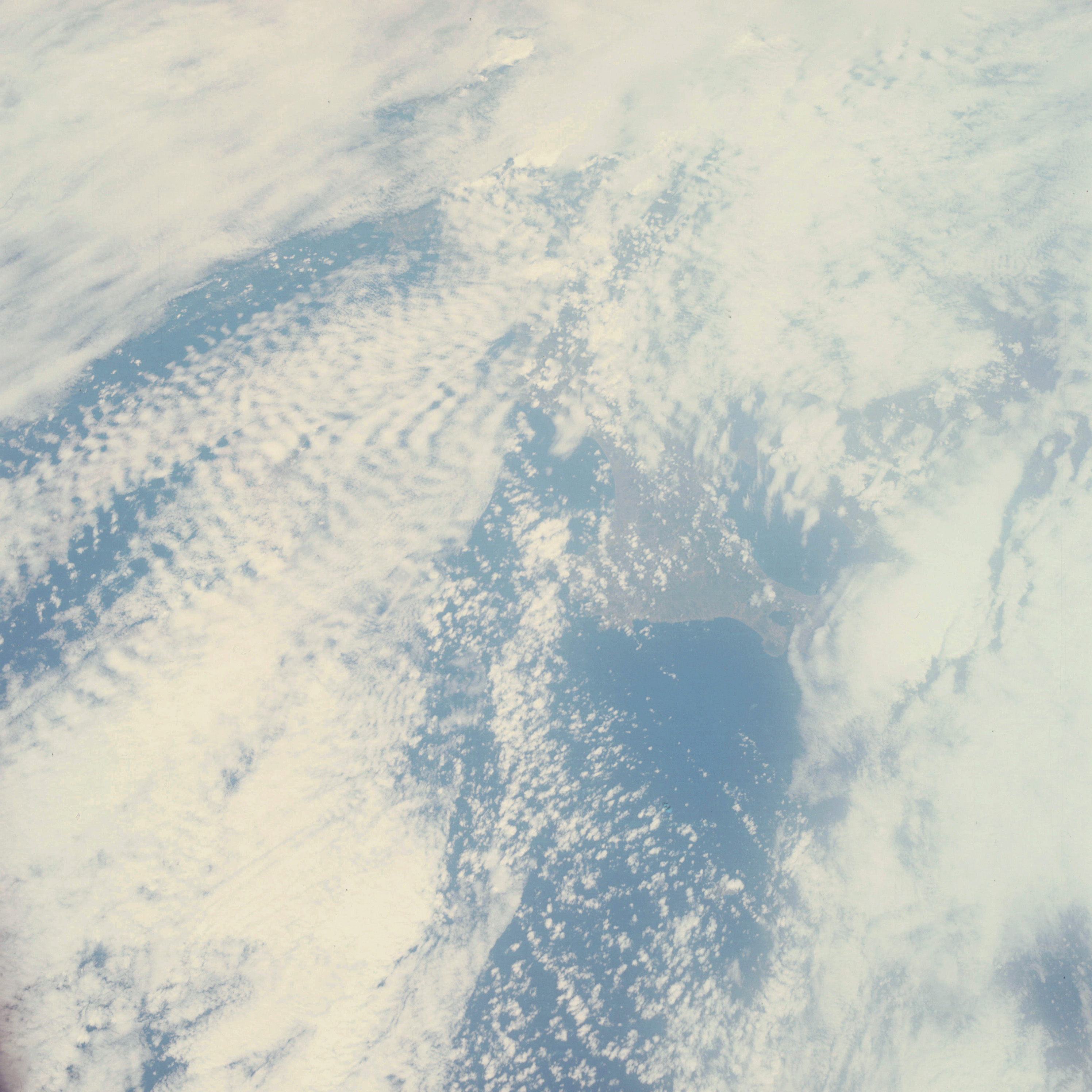 | AS07-05-1664 GEOGRAPHY/CARTOGRAPHY: Southern tip of Japan. (Light) METEOROLOGY: Cirrus, alto-cumulus, cumulus. Image credit: Image Science and Analysis Laboratory, NASA-Johnson Space Center. |
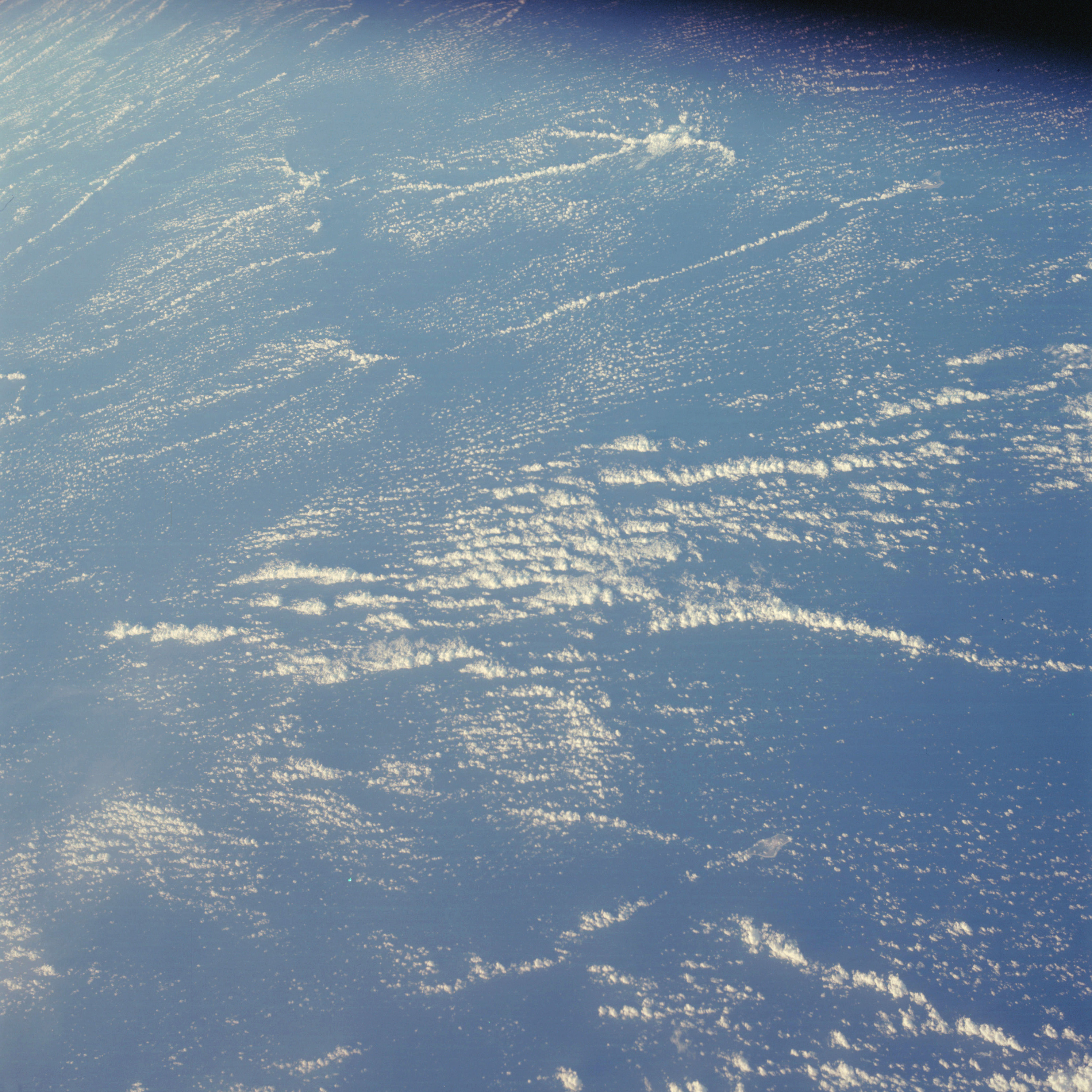 | AS07-05-1665 GEOGRAPHY/CARTOGRAPHY: Two small islands. (Light) METEOROLOGY: Cumulus. Image credit: Image Science and Analysis Laboratory, NASA-Johnson Space Center. |
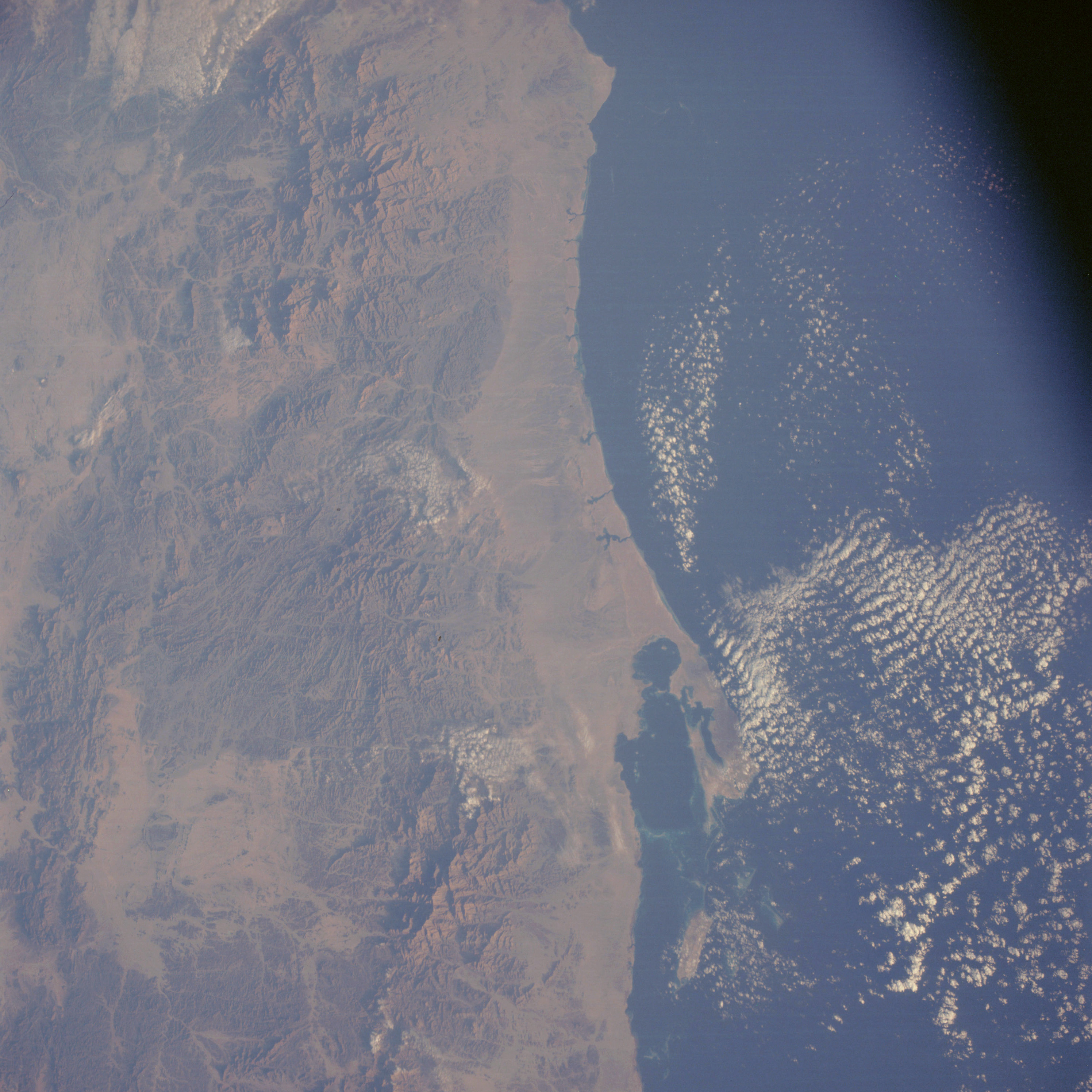 | AS07-05-1666 GEOGRAPHY/CARTOGRAPHY: Sudan, Red Sea, Coast at Ras Abu Shajarah. (Light) GEOLOGY/HYDROLOGY: Highly fractured sedimentary and igneous mountain complex, coastal plain and intermittent drainage. FORESTRY: Shrubform and grasses. METEOROLOGY: Cumulus. OCEANOGRAPHY: Offshore, subsurface topography visible. Image credit: Image Science and Analysis Laboratory, NASA-Johnson Space Center. |
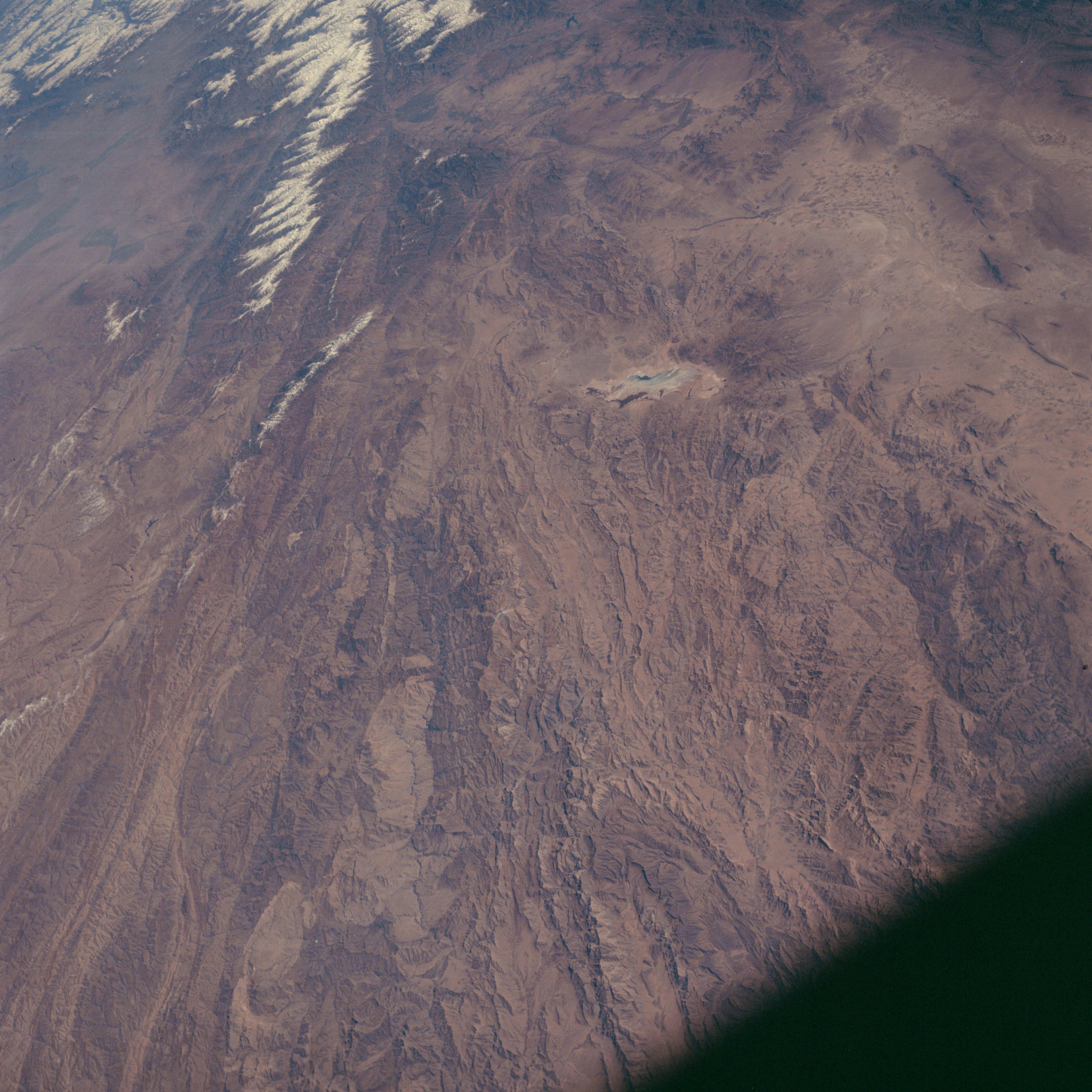 | AS07-05-1667 GEOGRAPHY/CARTOGRAPHY: Afghanistan, Kabul, Panjahir River, Kah-I-Baba Mountains. GEOLOGY/HYDROLOGY: Folded mountain complex and intermittent drainage. Image credit: Image Science and Analysis Laboratory, NASA-Johnson Space Center. |
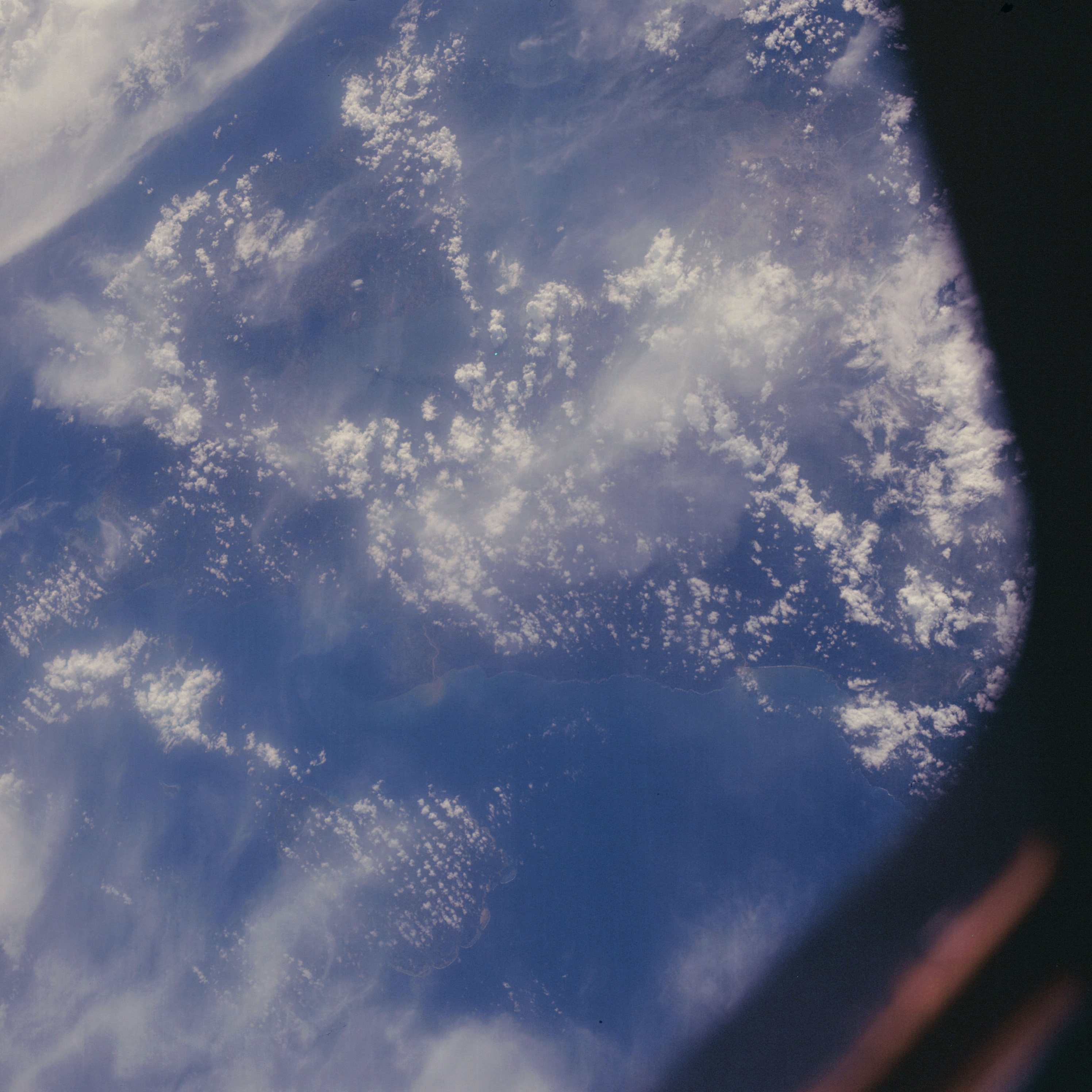 | AS07-05-1668 GEOGRAPHY/CARTOGRAPHY: Philippine Islands, Manila. (Dark) METEOROLOGY: Cumulus, towering cumulus, cirrus. Image credit: Image Science and Analysis Laboratory, NASA-Johnson Space Center. |
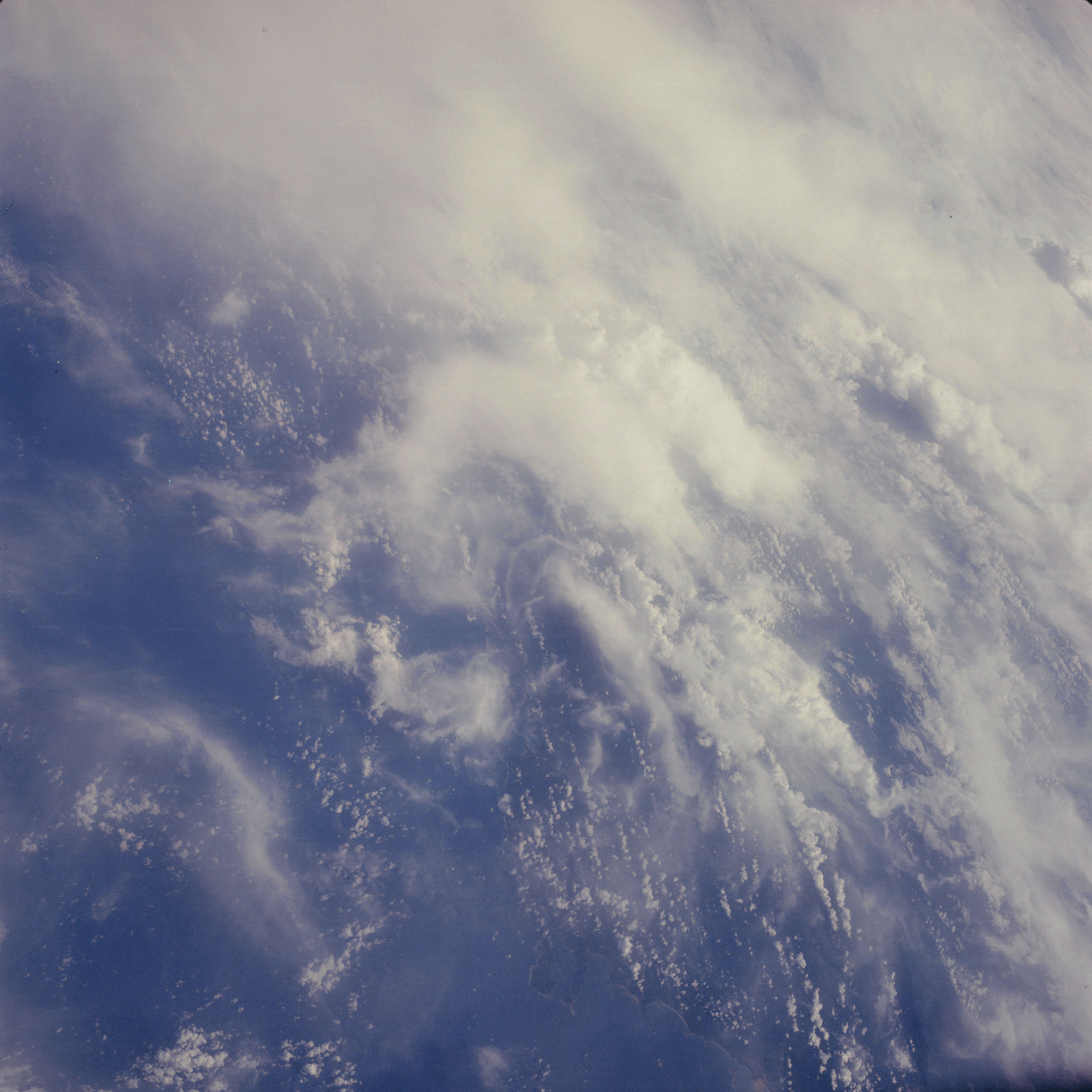 | AS07-05-1669 GEOGRAPHY/CARTOGRAPHY: Philippine Islands, northern coast of Samar. (Dark) METEOROLOGY: Cumulus, cirrus. Image credit: Image Science and Analysis Laboratory, NASA-Johnson Space Center. |
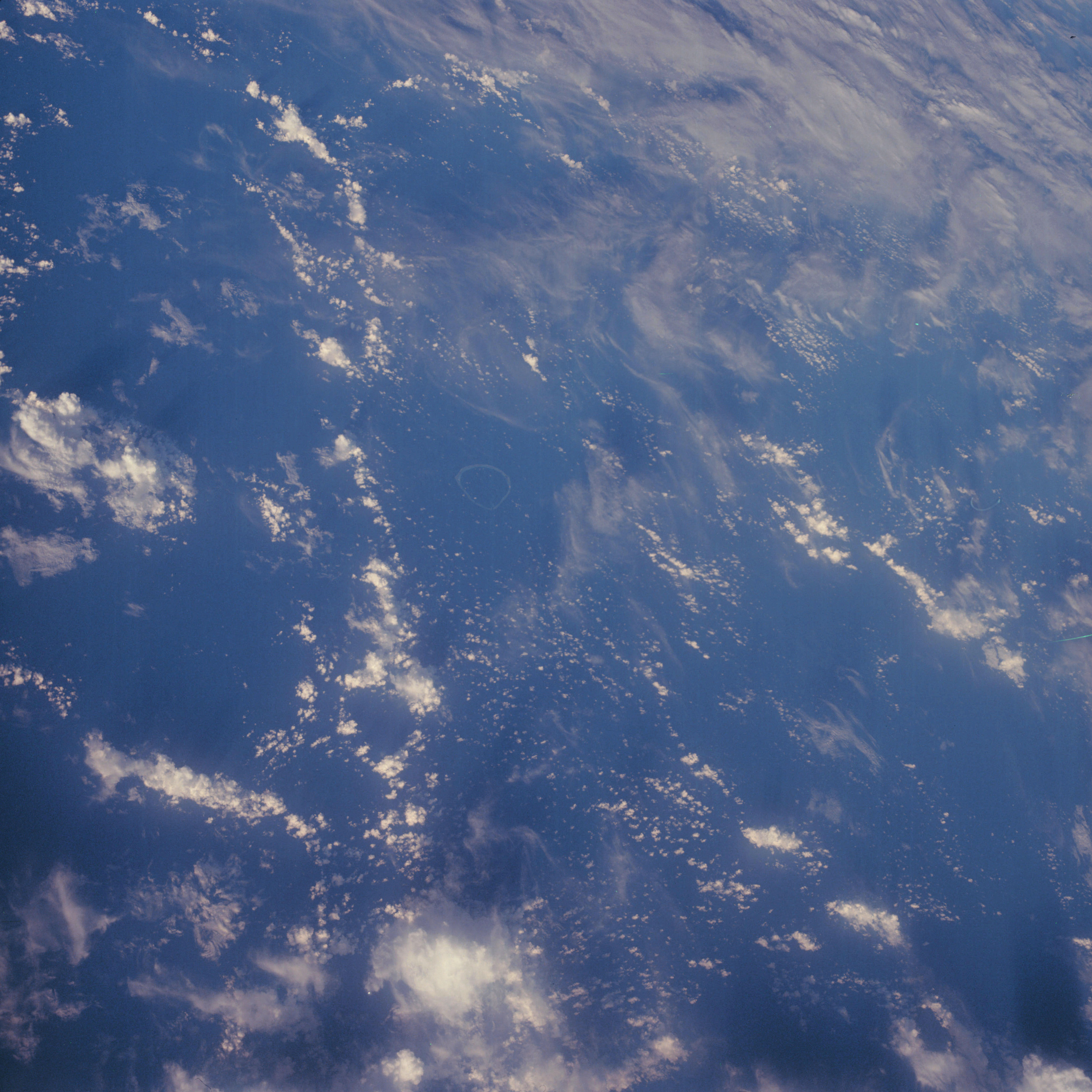 | AS07-05-1670 GEOGRAPHY/CARTOGRAPHY: North of Solomon Islands. (Dark) METEOROLOGY: Cumulus, cirrus. OCEANOGRAPHY: Circular reefs. Image credit: Image Science and Analysis Laboratory, NASA-Johnson Space Center. |
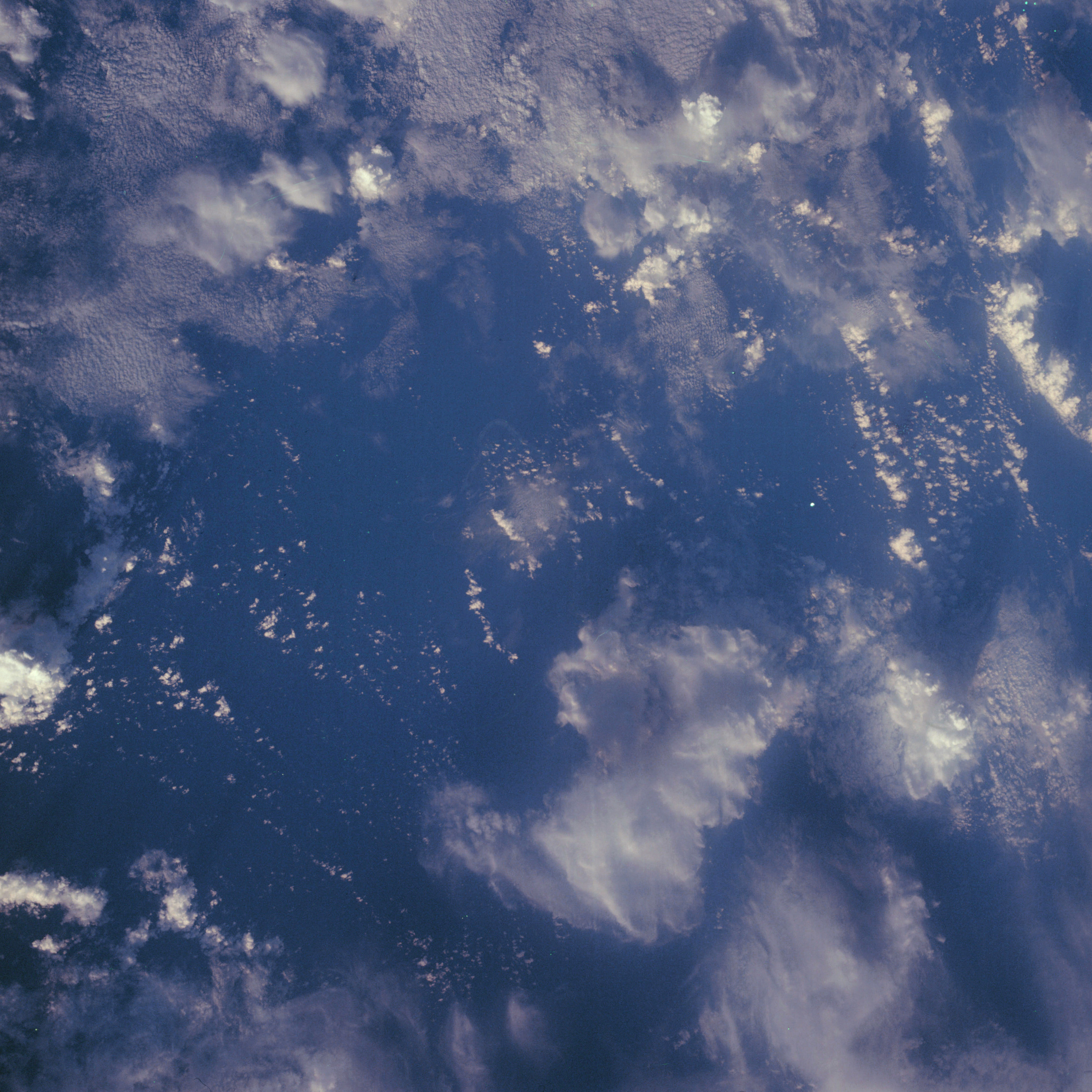 | AS07-05-1671 CLOUDS: Cumulus, towering cumulus, cirrus. Image credit: Image Science and Analysis Laboratory, NASA-Johnson Space Center. |
|
|
|
| 70-mm magazine N - AS07-04-1558 to 1612 |
Photography Index | 70-mm magazine O - AS07-06-1672 to 1737 |